
Maui History Series · Haleakalā
Haleakalā Highway History: The Road to the Summit
The 1935 highway transformed automobile access to Haleakalā, but it did not discover the mountain. It entered a storied, sacred Hawaiian landscape already crossed, named, remembered, and cared for across generations.
Follow the ascent through timePhoto: National Park Service source (opens in a new tab) · public domain U.S. federal work rights status (opens in a new tab) · cropped and resized
A road within a much older story
Haleakalā was a destination before the switchbacks
For kānaka maoli, Haleakalā is a wahi pana—a storied place—and part of wao akua. National Park Service history describes pilgrimage, ceremony, star study and navigation, travel, and basalt adze making within the summit landscape. Native trails linked the summit depression with East Maui long before automobiles.
The name Haleakalā is commonly translated as “House of the Sun.” One well-known moʻolelo connects the mountain with Māui slowing the sun so his mother Hina had enough daylight to dry kapa. It should be approached as living cultural knowledge, not reduced to a decorative tourist legend.
Wahi pana, trail, ranch, and park
From foot and horseback travel to a mountain road
The automobile highway came after centuries of Hawaiian relationship with the summit and decades of visitor travel by trail and horse.

A sacred mountain and a network of trails
Native Hawaiian routes crossed the summit depression and connected high-elevation places with communities and resources in East Maui. The landscape supported travel, ceremony, observation of the sky, and quarrying of fine basalt for adzes. Calling the mountain “inaccessible” before the highway erases that knowledge and movement.
By the 1890s, guided horseback trips brought visitors to the summit, and a rest house at Kalahaku was built in 1894. There was no automobile road, but Haleakalā was neither unknown nor empty.
A federal park is layered onto the mountain
Haleakalā became part of Hawaiʻi National Park in 1916. In 1928, Haleakala Ranch transferred and exchanged summit lands with the federal government, helping establish the modern park land base. Those administrative changes altered ownership and management; they did not create the mountain’s cultural importance.
The full corridor is not one road built by one agency
The roughly 37-mile drive from Kahului to the summit uses a chain of roads and jurisdictions. The territorial approach from Kula toward the park was completed and opened to drivers in April 1933. The separate 10.677-mile National Park Service segment was built from 1933 to 1935.
This distinction matters: the familiar phrase “Haleakalā Highway” describes a complete journey, while historic engineering records often describe only the park road or one approach section. On the territorial road below the park—now designated State Route 378—superelevated, or banked, curves helped carry cars through the ascent.
-
Before roads
Trails cross the summit landscape
Kānaka maoli travel, observe, work, remember, and maintain relationships with Haleakalā.
-
1890s
Horseback tourism grows
Guided summit travel becomes established before automobile access.
-
1916
A national park is created
Haleakalā joins Kīlauea and Mauna Loa within Hawaiʻi National Park.
-
1928
Summit land transfers
A ranch-federal exchange helps define the modern Summit District.
-
1931–33
The territorial approach opens
Road work from Kula creates the automobile approach to the park boundary.
Design, labor, celebration, and debate
Building the park road, 1933–1935
Engineers designed the ascent to reveal the summit gradually. Opening the mountain to cars also brought disagreement about what access would change.
A road designed as an experience
National Park Service and Bureau of Public Roads designers used switchbacks and staged views so the summit depression remained largely hidden during the climb. The principal reveal came after travelers left their cars near the rim.
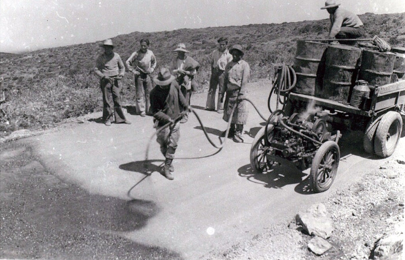
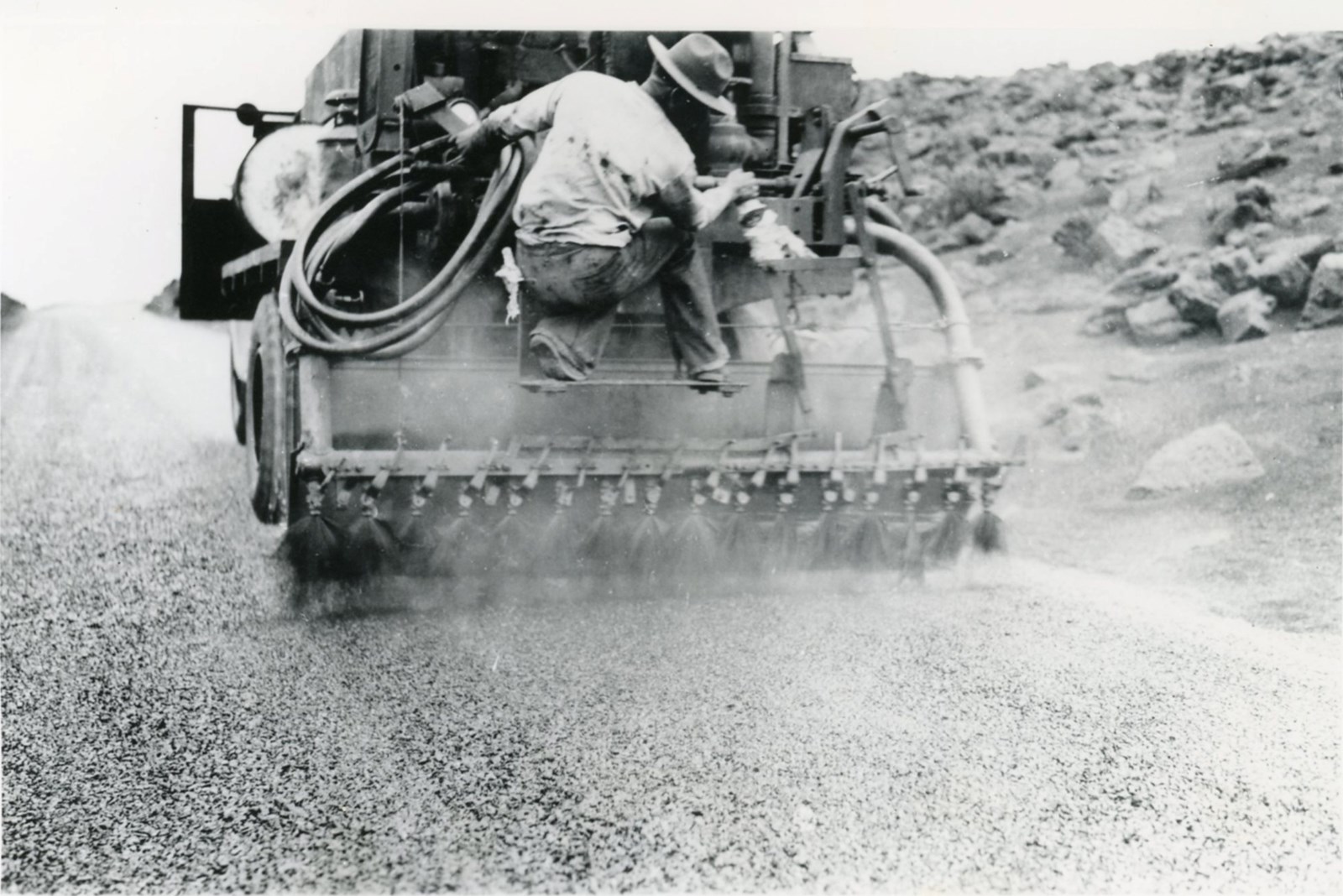
Construction was confined to a narrow 14-foot corridor because separate access roads were prohibited. Crews shaped culverts, gutters, and a bridge with lava-rock masonry so essential engineering sat low in the volcanic landscape.
Opening day brought access and opposition
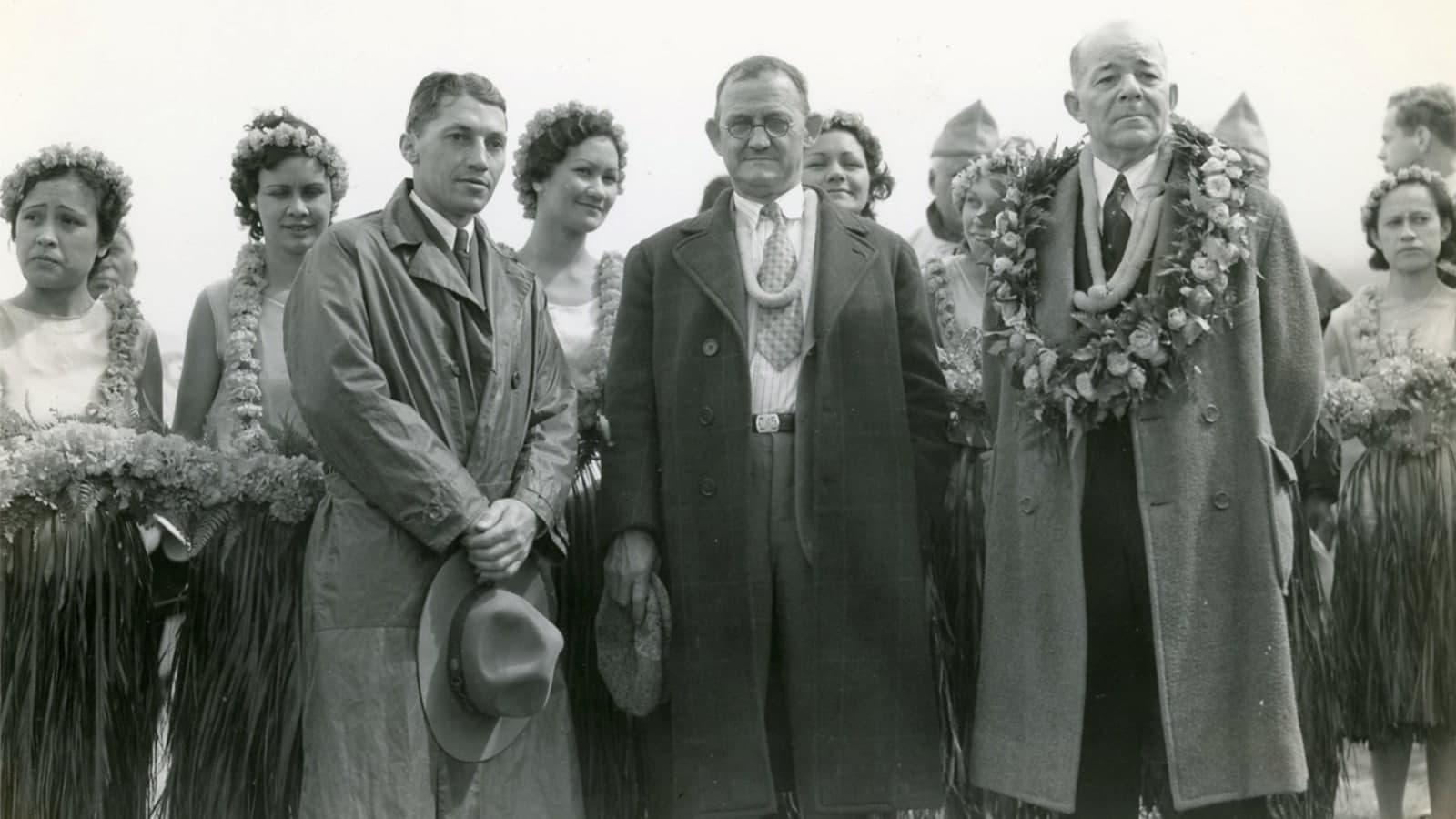
The 10.677-mile park road cost $369,758 and employed 255 men. Its February 23, 1935 dedication drew 1,639 people and 320 cars for hula, music, speeches, a lūʻau, and a national radio broadcast. Maui business leaders promoted the road as a way to bring more visitors to the island.
The celebration was not the whole story. National Park Service history records Native Hawaiian opposition to placing an automobile road across sacred Haleakalā, while other critics believed car access changed the experience of the mountain. By the end of 1935, park visitation had increased 455 percent.
The CCC era surrounded—but did not build—the highway
Civilian Conservation Corps camps operated at Haleakalā from 1934 to 1941. Enrollees built trails and frontcountry structures, controlled invasive plants and feral animals, and hauled materials and supplies for crater cabins and trails. Available records do not support saying the CCC built Haleakalā Highway itself.
Later wartime use, Mission 66 improvements, ecological restoration, and changing visitor systems continued altering how people reached and understood the summit. Haleakalā became a separate national park in 1961.
-
1933–35
The park road climbs upward
Workers shape a restrained alignment, drainage structures, and lava-rock masonry within the 10.677-mile park segment.
-
Feb. 23, 1935
The highway opens
A large dedication celebrates automobile access while opposition and concern remain part of the record.
-
1934–41
CCC park work expands
Enrollees build trails and frontcountry structures, support conservation, and haul supplies for crater work—not construction of the highway itself.
-
1936–37
Visitor center and cabins follow
New summit facilities and backcountry shelters add to the visitor landscape.
-
1956–66
Mission 66 changes access
Postwar visitor improvements alter overlooks and facilities along the historic road.
-
1961
Haleakalā becomes a separate park
The Maui unit formally separates from Hawaiʻi Volcanoes National Park.
Driving with kuleana
Notice the design while caring for the mountain
The route’s historical logic is visible from the public roadway and designated overlooks. Stewardship begins with staying inside those boundaries.
- The delayed revealThe summit depression remains mostly hidden during the climb because the 1930s alignment saves the principal view for the rim.
- Lava-rock masonryLow-profile culverts, walls, gutters, and bridge work reflect a landscape-design effort to reduce visual intrusion.
- Living cultural meaningTreat Hawaiian names, moʻolelo, ceremony, and sacred places as living relationships rather than visitor decoration.
- Fragile summit lifeSlow for wildlife, remain on established surfaces, never stack rocks, and leave plants, cinders, and artifacts untouched.
Related Maui history & tours
Follow the connections
Continue with the places and experiences that share this chapter’s roads, water, communities, or working landscapes.
Continue the mountain story
See how the highway fits the wider landscape
The national park and Upcountry working lands reveal what existed before the road and what changed around it afterward.
Research notes
Sources & further reading
This chapter prioritizes National Park Service history and cultural-landscape research, Historic American Engineering Record documentation, and Hawaiʻi transportation records. It distinguishes the full Kahului-to-summit corridor from the 10.677-mile park road and the CCC era from highway construction.
- National Park Service: history of the Haleakalā Highway (opens in a new tab)
- National Park Service: Haleakalā Highway cultural landscape (opens in a new tab)
- Library of Congress: Haleakalā National Park Roads, HAER report (PDF) (opens in a new tab)
- Library of Congress: Haleakalā Highway, HAER HI-119 (PDF) (opens in a new tab)
- National Park Service: summit-area cultural history (opens in a new tab)
- National Park Service: Haleakalā moʻolelo and deities (opens in a new tab)
- National Park Service: Civilian Conservation Corps at Haleakalā (opens in a new tab)
- National Park Service: archaeology and respectful stewardship (opens in a new tab)
- Hawaiʻi DOT: Maui state roads and highways (opens in a new tab)