
Maui History Series · East Maui
Hāna Highway History: The Road Through East Maui
Before it became one of Maui’s best-known drives, this corridor crossed a living Hawaiian landscape. Trails, farms, streams, landings, labor, and decades of bridge building all belong to the road’s story.
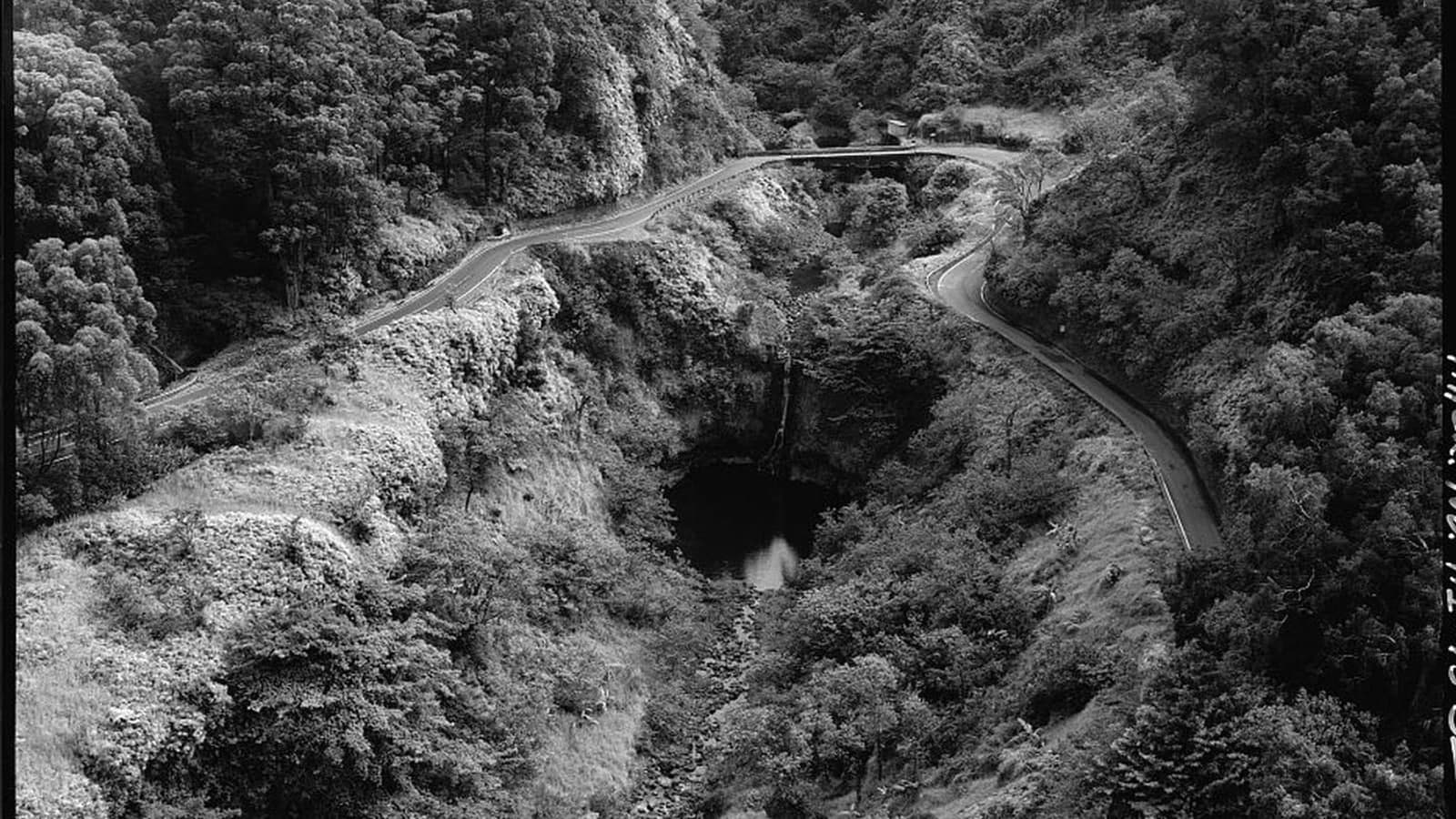
Follow the road through timePhoto: Jet Lowe / Historic American Engineering Record, Library of Congress source (opens in a new tab) · public domain U.S. federal work license (opens in a new tab) · film border removed; cropped, resized and converted
Pathways before pavement
The highway did not begin the story of East Maui
Long before surveyors drew an automobile road, kānaka maoli lived within and traveled through a connected system of moku and ahupuaʻa. Coastal and upland communities moved among loʻi kalo, forests, fishing grounds, streams, homes, and neighboring districts by canoe and established trails.
The ala loa associated with Piʻilani linked Maui districts centuries before the modern highway. Later roads sometimes followed, crossed, widened, or erased pieces of older routes, but today’s Hāna Highway should not be described as one continuous “ancient road.” It is a newer layer across a much older cultural landscape.
Trails, water, farms, and wagon roads
A modern road takes shape within an inhabited landscape
Nineteenth-century irrigation and plantation projects changed overland access, but they entered communities already joined by travel, cultivation, exchange, and genealogy.
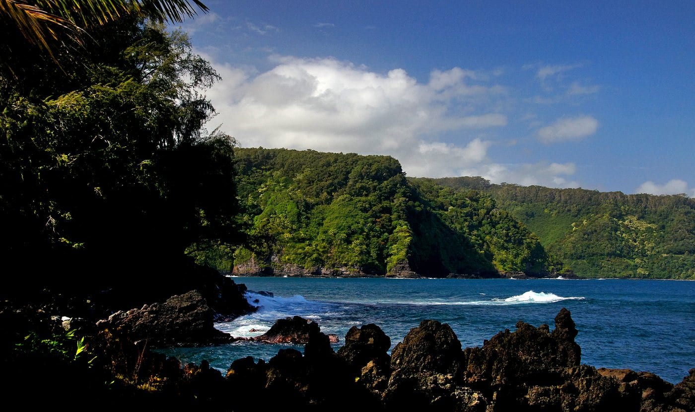

Ala loa and community movement came first
Later historical accounts associate a fitted-basalt trail from Wailuku toward Hāna with Piʻilani and describe Kihapiʻilani—also rendered Kiha-a-Piʻilani—extending the network beyond Hāna through Kaupō and toward Haleakalā. The route is generally described as four to six feet wide.
These routes supported movement across political districts and within ahupuaʻa. They belonged to systems of food production, freshwater use, fishing, ceremony, communication, and family life that cannot be reduced to a precursor of a tourist drive.
Ditches and plantations push roads east
Access toward Kailua expanded during East Maui ditch construction beginning in the 1870s. Plantation and rubber interests extended other sections during the 1890s. In 1900, the footpath between Keʻanae and Nāhiku was widened to about 16 feet and surfaced with cinders for wagon traffic.
Work between Kailua and Keʻanae followed in 1904. Rain, torrents, unstable slopes, and landslides repeatedly damaged construction, while streams and deep gulches demanded more bridges than an ordinary rural road.
Concrete begins spanning the water
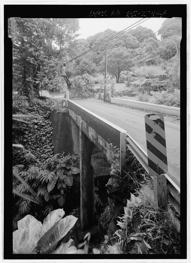
Concrete bridges appeared near Nāhiku between 1905 and 1908. A territorial loan program supported broader bridge work beginning in 1911, but gaps remained and East Maui still depended on coastal landings, steamers, trails, and incomplete road sections into the 1920s.
-
Traditional accounts
Ala loa connects districts
A Hawaiian transportation network associated with the Piʻilani era links communities around Maui long before automobile travel.
-
1870s
Irrigation access expands
Road construction toward Kailua supports ditch work and plantation development.
-
1900
Keʻanae–Nāhiku path widens
Part of the footpath is widened into a roughly 16-foot cinder-surfaced wagon road.
-
1905–11
Concrete bridge work begins
New structures start spanning the wettest and most difficult sections.
The decisive construction campaign
Crews, bridges, and a belt road across the rainforest
The December 1926 opening was a major milestone—not the moment when every bridge, surface, and slope became finished forever.
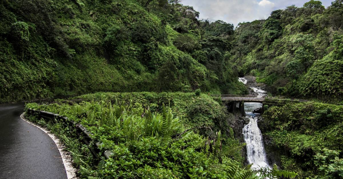
A narrow bench cut into difficult slopes
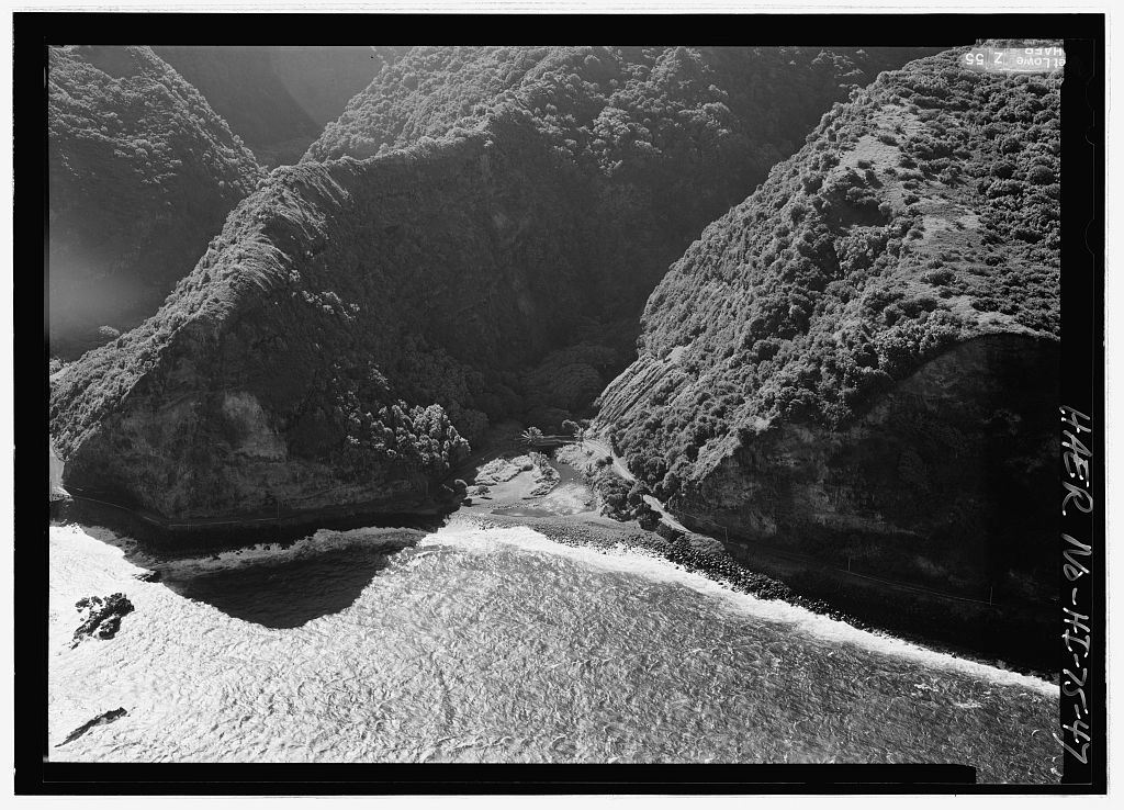
Major construction resumed in 1923. County engineers generally fitted a 12-foot macadam roadway to a narrow bench cut into the mountain. Steam shovels, drilling, blasting, masonry, hand excavation, hired crews, county workers, and prison labor all contributed to the project.
Incarcerated labor is part of the road’s history and should be named plainly, not folded into a romantic account of heroic construction. Washouts, cave-ins, floods, and a roughly 30-acre landslide in July 1926 show how unstable the work remained.
Opening day connected—but did not complete—the road
The Hāna Belt Road officially opened to public traffic on December 18, 1926. Automobile access changed how residents, goods, government services, and visitors moved across East Maui, while coastal shipping and older forms of connection did not simply disappear overnight.
Bridge construction, stabilization, and surfacing continued through the 1930s and 1940s. A state program begun in 1962 widened, paved, and restored the route, with the work completed in 1964.
The engineering record is part of the view
Reinforced-concrete arches, girders, flat slabs, masonry arches, basalt abutments, retaining walls, and culverts form a working archive along the road. The contour-following alignment and limited shoulder are historical evidence as well as modern driving constraints.
The Hāna Belt Road Historic District was listed in the National Register of Historic Places in 2001. Preservation recognizes the route’s transportation and engineering history; it does not turn the communities beside it into a museum.
-
1923
Major construction resumes
Crews cut, blast, drain, retain, and bridge the remaining route.
-
July 1926
A major landslide interrupts work
About 30 acres of unstable slope underscore the difficulty of the corridor.
-
Dec. 18, 1926
The belt road opens
A continuous public roadway reaches Hāna, though construction continues afterward.
-
1930s–47
Bridges and surfaces evolve
CCC- and WPA-era work, county projects, and later bridges continue shaping the route.
-
1962–64
The road is modernized
A state program widens, paves, and restores sections of the corridor.
-
2001
The historic district is listed
National Register recognition documents the road’s engineering and transportation significance.
Read the road with respect
What the highway can teach without leaving public space
The best historical clues are visible from designated public viewpoints, legal parking areas, public roads, and places where access is explicitly welcomed.
- One-lane bridgesConcrete arches, rails, and narrow approaches reveal how engineers crossed streams without flattening the whole coast.
- Water and cultivationStreams, ʻauwai, and loʻi are parts of living water systems, not scenery detached from community use.
- Roadside communitiesHomes, farms, churches, schools, and driveways are reminders to slow down, park legally, and yield.
- Named placesHawaiian place names carry knowledge. Learn and pronounce them with care rather than replacing them with generic mile-marker labels.
Related Maui history & tours
Follow the connections
Continue with the places and experiences that share this chapter’s roads, water, communities, or working landscapes.
Continue through East Maui
Meet the communities connected by the road
The highway makes more sense when read alongside the places, water systems, and working landscapes it passes.
Research notes
Sources & further reading
This chapter prioritizes Hawaiʻi transportation records, federal engineering documentation, National Register records, National Park Service cultural history, and community guidance. Historical sources sometimes use variant spellings; editorial text retains Hawaiian diacritics where the official form is established.
- Hawaiʻi DOT: State Historic Bridge Inventory and Evaluation, 2024 Update (PDF) (opens in a new tab)
- Library of Congress: Hāna Belt Road, HAER HI-75 (opens in a new tab)
- Library of Congress: full HAER Hāna Belt Road history and engineering report (PDF) (opens in a new tab)
- National Park Service: Hāna Belt Road Historic District nomination (PDF) (opens in a new tab)
- National Park Service: Kīpahulu Moku (opens in a new tab)
- National Park Service: early Hawaiians and traditional land divisions (opens in a new tab)
- County of Maui: Hāna Community Plan (PDF) (opens in a new tab)
- Hāna Business Council: Drive With Aloha (opens in a new tab)