
Maui History Series · Central Maui
Maui’s Dragstrip: The Runway That Found a Second Life
A territorial airport became a wartime naval training base, then a community raceway—leaving one long strip of pavement to connect Maui’s aviation, sugar, war, and motorsports stories.
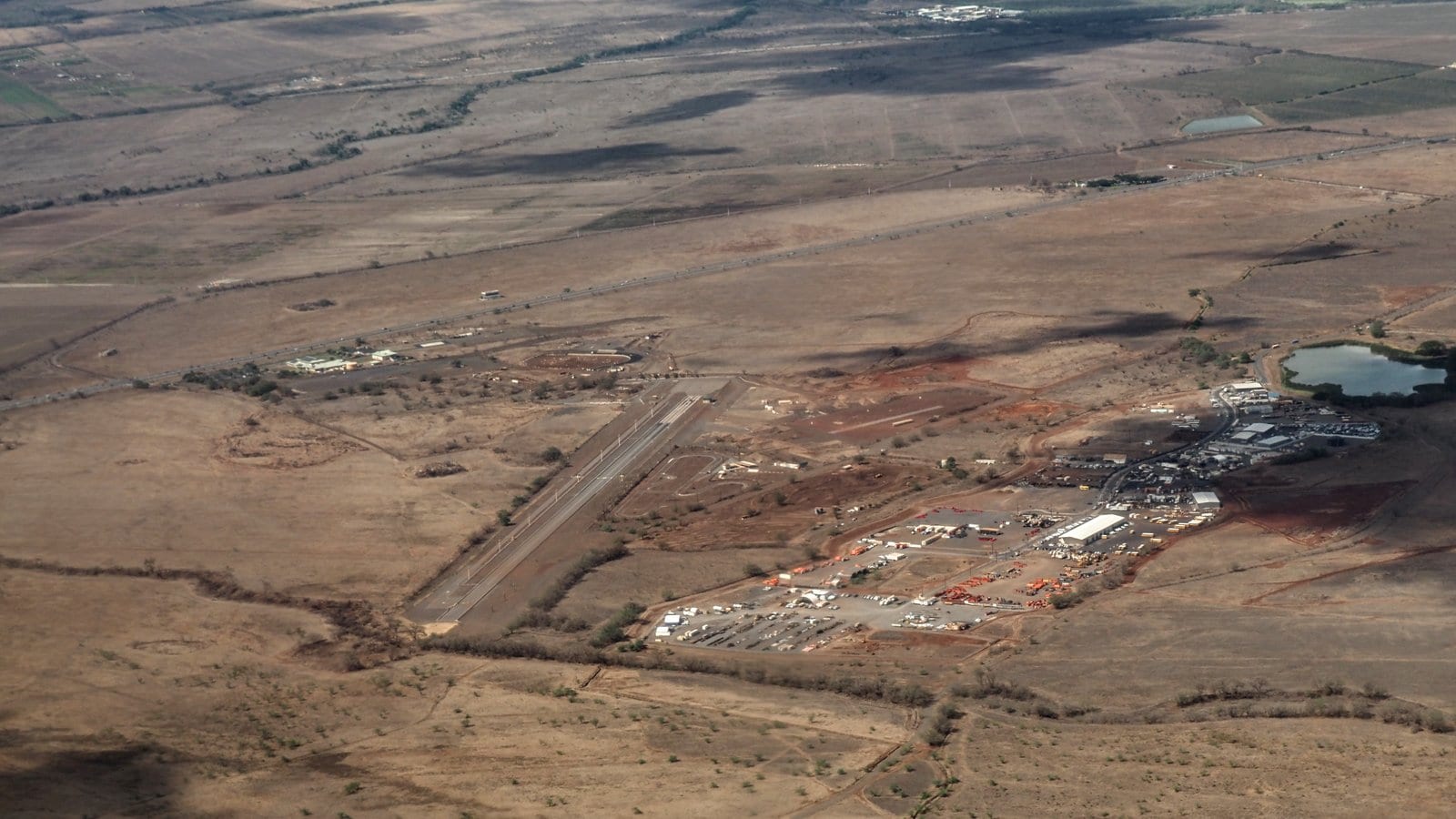
Follow the runway through timePhoto: Dicklyon source (opens in a new tab) · CC BY-SA 4.0 license (opens in a new tab) · cropped and resized; derivative shared under CC BY-SA 4.0
One pavement, several Mauis
The old airport is not an empty ruin
The long paved line beside Mokulele Highway began as Maui Airport in 1939. During World War II it expanded into Naval Air Station Puʻunēnē, a principal carrier-aircraft training field. After commercial flights moved to Kahului, the former runway became a place for timed runs, drag racing, and generations of local motorsports.
The site also belongs to a broader central-Maui landscape. Territorial records placed the airport on land at Pulehunui, while the field took the name of nearby Puʻunēnē—a plantation community built around sugar. Official geographic-name records now spell the historical airport Puʻunēnē Airport, though older government documents often print “Puunene.”
Sugar town to airfield
A runway rises from the central plain
The airport arrived in a landscape already transformed by plantation agriculture and a large, diverse sugar community.

A plantation community before the runway
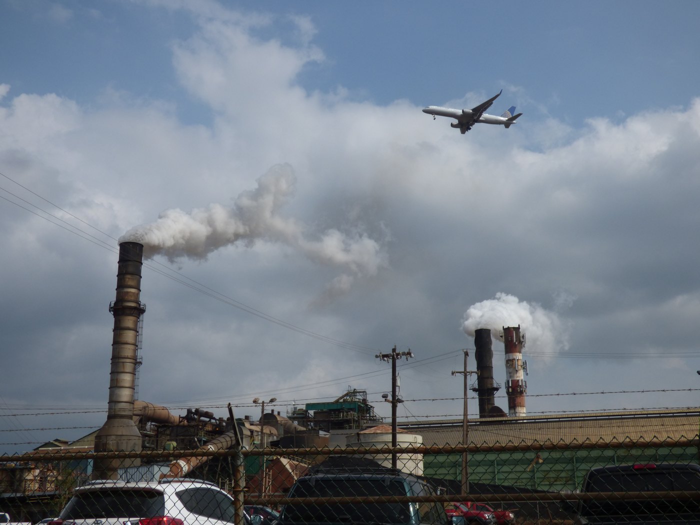
State planning histories describe Puʻunēnē as a major Hawaiian Commercial & Sugar plantation town. By 1930, more than 10,000 people lived in its camps and community—families whose work, languages, schools, stores, and social institutions made the central plain far more than an expanse of cane.
The airport did not create Puʻunēnē. It was inserted into an already occupied and cultivated landscape, using the nearby community’s name while territorial land records identified its initial acreage at Pulehunui.
Maui Airport opens
Governor’s Executive Order 804 set aside 300.71 acres on June 15, 1938. Construction began that summer, and Maui Airport opened June 30, 1939. Inter-Island Airways built a depot while territorial and federal agencies improved runways, a taxiway, communications, weather equipment, and navigation aids.
The field replaced the limited airport at Māʻalaea and quickly became one of the Territory’s important interisland aviation facilities.
The Navy expands the field
When the military took control after December 7, 1941, the field became Naval Air Station Puunene. Runways were extended, utilities and revetments expanded, and the station supported carrier-group aircraft and advanced training for fighter, torpedo-bomber, and dive-bomber crews.
Interisland service continued under military control, so the same field served both wartime training and Maui’s constrained civilian connection to the other islands.
-
1938
Land is set aside
Territorial work begins on a new central-Maui airport.
-
June 30, 1939
Maui Airport opens
Interisland passengers, cargo, and mail gain a modern field at Puʻunēnē.
-
December 1941
Military control
The Army and Navy take over Hawaiʻi’s airfields; Puʻunēnē becomes a naval air station.
-
1943–45
Advanced carrier training
Expanded facilities support fighter, torpedo-bomber, and dive-bomber training and staging.
Postwar second life
From airport runway to Maui raceway
Aviation moved north to Kahului. The pavement remained—and local racers gave it a new purpose.
Civilian flying returns, then moves
The Territory resumed full commercial operation at Puʻunēnē in October 1946. But planners preferred the former naval station at Kahului for Maui’s long-term airport. All scheduled operations transferred there on June 24, 1952.
Puʻunēnē entered caretaker status in 1953 and closed to aeronautical activity on December 31, 1955. That ending created the physical opportunity for a very different use.
The first official green light for racing
In May 1956, the Hawaiʻi Aeronautics Commission approved closing the former runways for drag races and time trials, subject to Civil Aeronautics Administration approval and liability protections. The decision is the clearest official bridge between the airfield and its motorsports era.
Maui Raceway Park’s own history records that Valley Isle Timing Association organized in 1963 after earlier informal racing. That club history should be read as the community’s account; the 1956 commission record independently confirms approved runway racing years earlier.
A living piece of infrastructure
State environmental records now describe a roughly 220-acre Maui Raceway Park and Drag Strip using part of the former airport. Drag racing occupies a runway while kart, motocross, and radio-controlled activities use adjoining areas.
The park was still publishing race results and a 2026 schedule in August 2026. That current activity is why this is not simply an “old airport” story: a piece of wartime-scale pavement continues to support a Maui community use more than seventy years after aviation left.
-
October 1, 1946
Commercial control resumes
The Territory returns Puʻunēnē to full-scale civilian airport operation.
-
June 24, 1952
Flights move to Kahului
All airport operations and facilities transfer north.
-
December 31, 1955
Aeronautical activity closes
The old field formally leaves aviation service.
-
May 1956
Runway racing is approved
The Hawaiʻi Aeronautics Commission authorizes drag races and time trials subject to federal approval and insurance.
-
1963
VITA organizes
Maui Raceway Park’s club history dates Valley Isle Timing Association’s formation to this year.
-
2026
Racing continues
Maui Raceway Park publishes current event schedules and July race results.
What the landscape still says
Read the old airfield without entering it
The story is visible at landscape scale. Observe from lawful public routes or during authorized events; do not cross gates or treat operational land as an abandoned attraction.
- The long straightThe dragstrip follows surviving runway pavement built for aircraft, not a purpose-built neighborhood road.
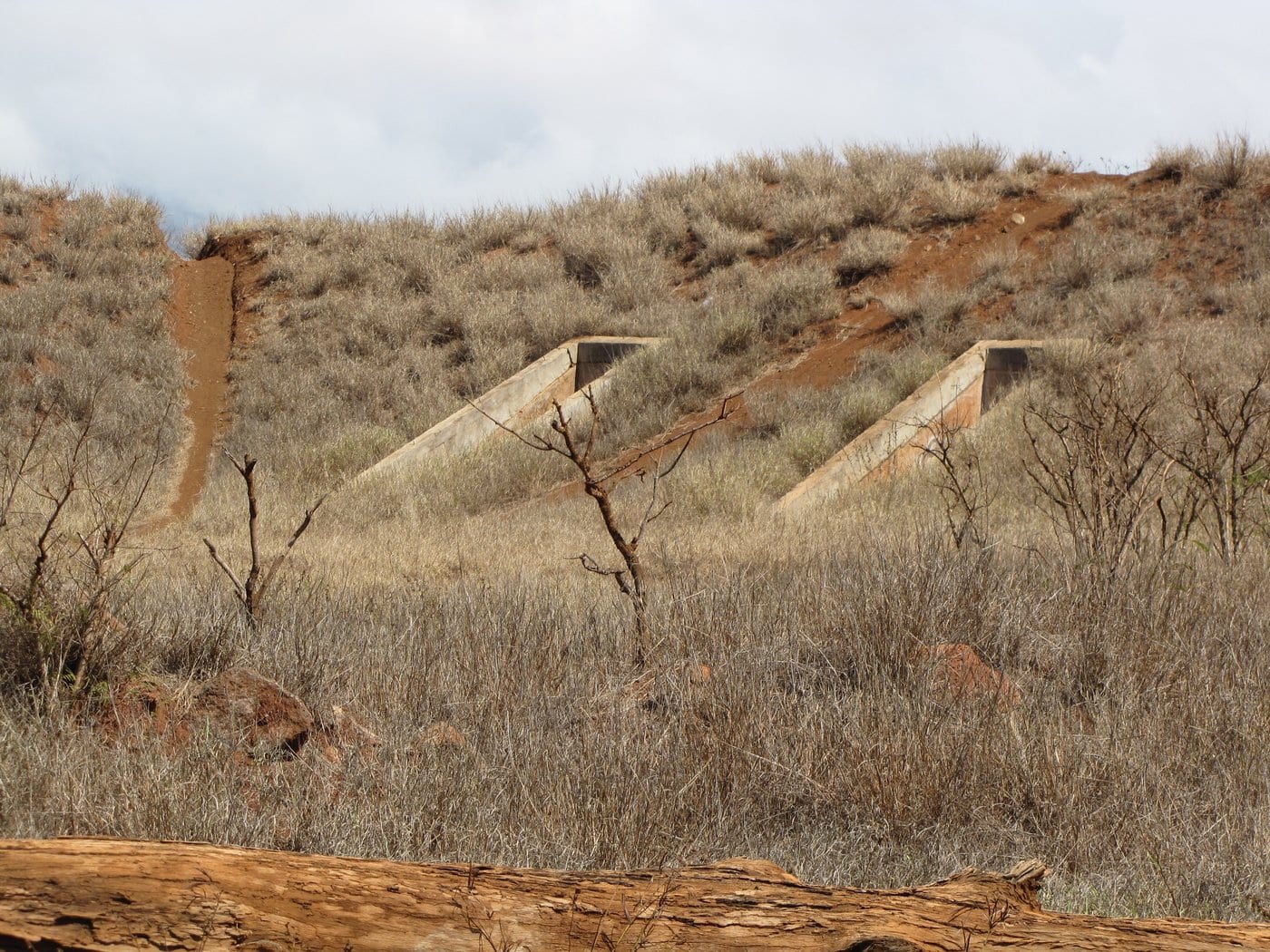
- Concrete pocketsRevetments and hardstand traces reveal the dispersed layout of a wartime air station.
- The sugar plainMill structures, former cane fields, and irrigation-era geometry place the runway inside Puʻunēnē’s plantation landscape.
- Current useTemporary barriers, paddock areas, and race infrastructure show that the runway has an active community life. Check the organizer’s current event information before visiting.
Related Maui history & tours
Follow the connections
Continue with the places and experiences that share this chapter’s roads, water, communities, or working landscapes.
Continue the series
Follow central Maui’s infrastructure stories
The airport’s move to Kahului and the harbor’s growth belong to the same postwar reshaping of central Maui.
Research notes
Sources & further reading
This chapter uses official aviation, military, land-planning, archive, and current raceway records. Historical source titles may omit Hawaiian diacritics; the page follows the Hawaiʻi Board on Geographic Names for Puʻunēnē.
- State of Hawaiʻi Aviation: Maui Airport (Puunene) chronology (opens in a new tab)
- U.S. Navy: Building the Navy’s Bases in World War II—NAS Puunene (opens in a new tab)
- U.S. Navy: Hawaiʻi naval aviation and archaeological-resource history (PDF) (opens in a new tab)
- State of Hawaiʻi: Pulehunui wastewater improvements Final EA (PDF) (opens in a new tab)
- Department of Hawaiian Home Lands: Pulehunui Final EIS, volume I (PDF) (opens in a new tab)
- Library of Congress HABS: Naval Air Station Puunene historic documentation (opens in a new tab)
- Hawaiʻi Board on Geographic Names: official Maui spellings (PDF) (opens in a new tab)
- Hawaiʻi State Archives: Puunene Airport aerial, about 1947–48 (opens in a new tab)
- Maui Raceway Park: Valley Isle Timing Association history (opens in a new tab)
- Maui Raceway Park: current event information and schedule (opens in a new tab)
- Maui Raceway Park: July 18, 2026 race results (opens in a new tab)