
Maui History Series · West Maui
Māla Wharf and Ramp: From Plantation Port to West Maui Lifeline
A 1922 steamer wharf that failed at its intended job later became a fishing landmark, dive site, public launch, and an important piece of West Maui’s post-fire recovery.
Follow the wharf through timePhoto: Dwarfroe source (opens in a new tab) · CC BY-SA 4.0 license (opens in a new tab) · cropped and resized; derivative shared under CC BY-SA 4.0
A separate West Maui facility
Māla is not Lahaina Harbor—and it is not Māʻalaea
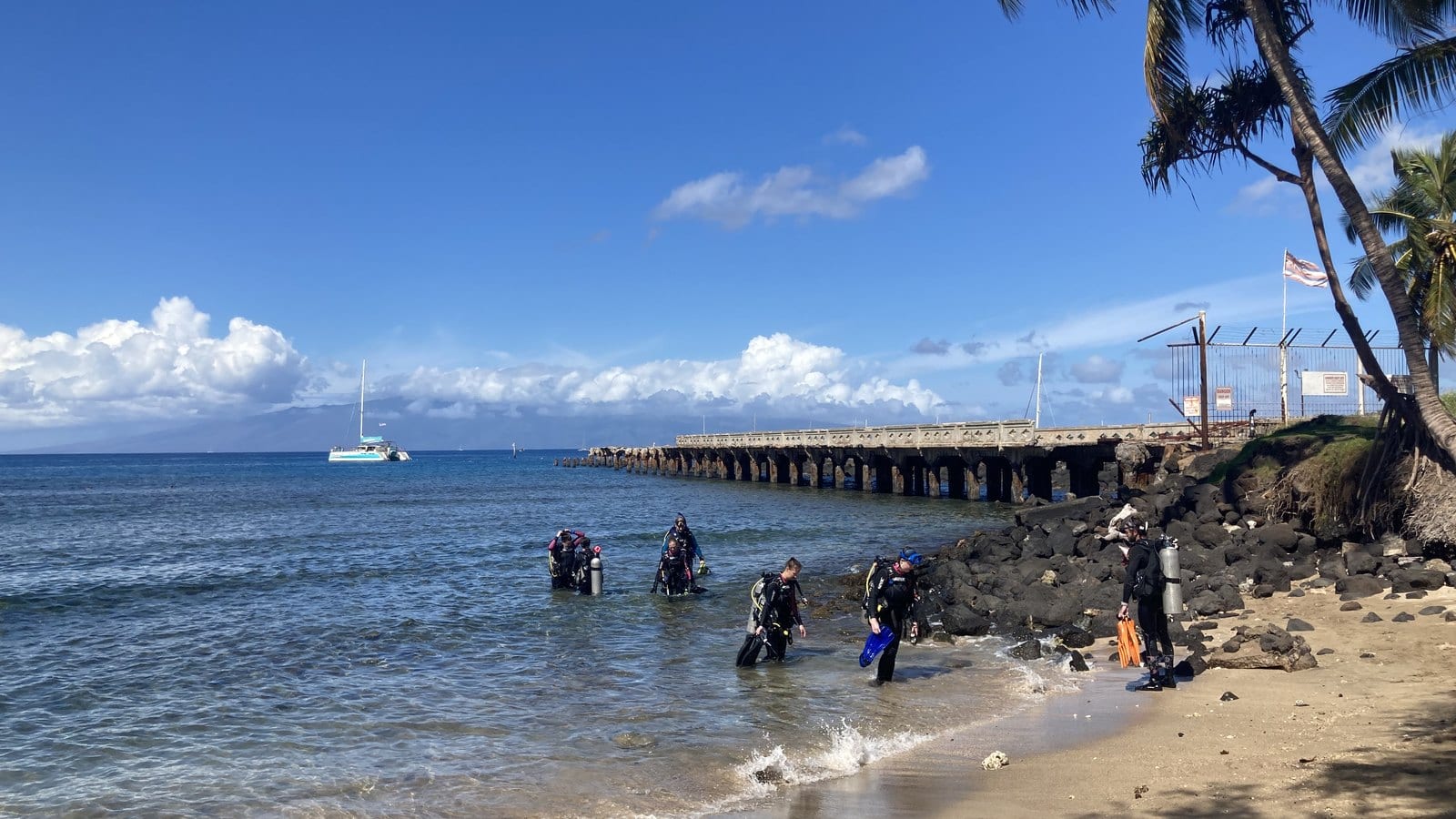
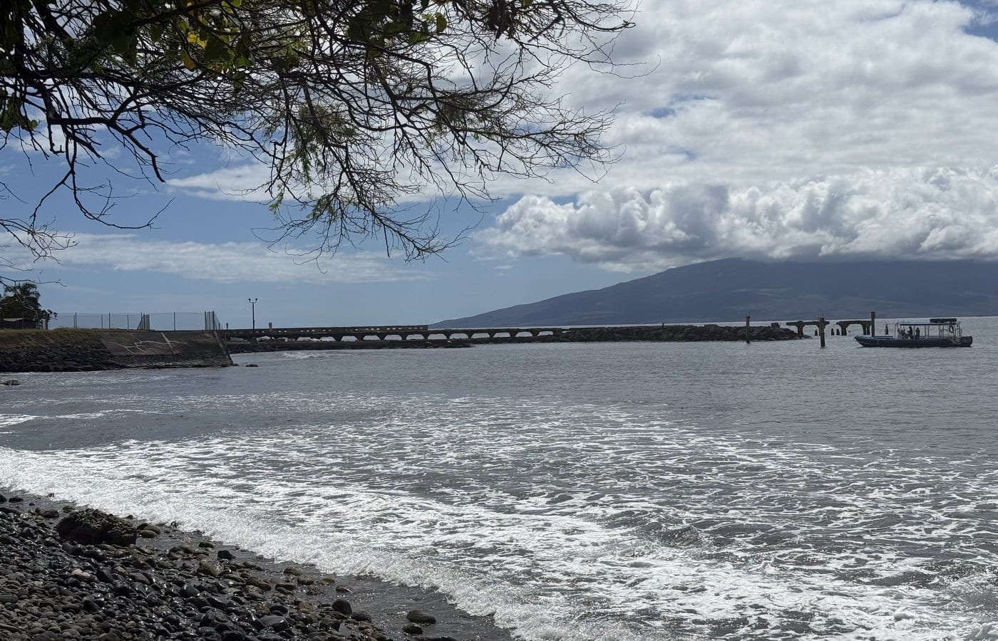
Māla Wharf and Ramp sits north of Lahaina. Its concrete pier was built during the plantation era, while the adjacent public ramp, loading docks, washdown, and offshore moorings belong to a later small-boat facility.
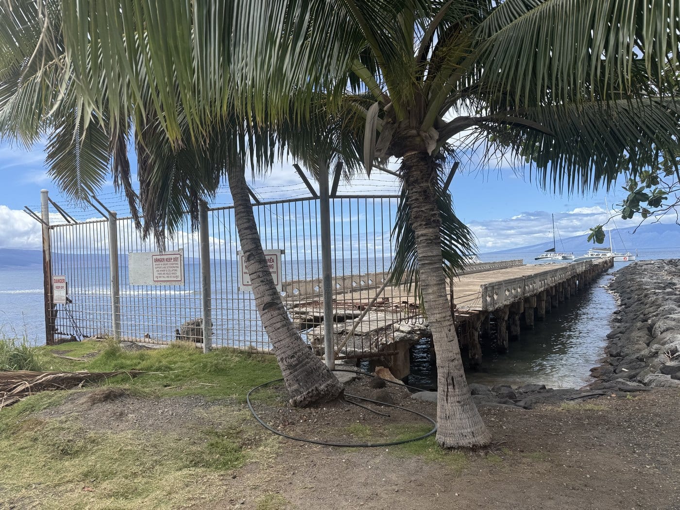
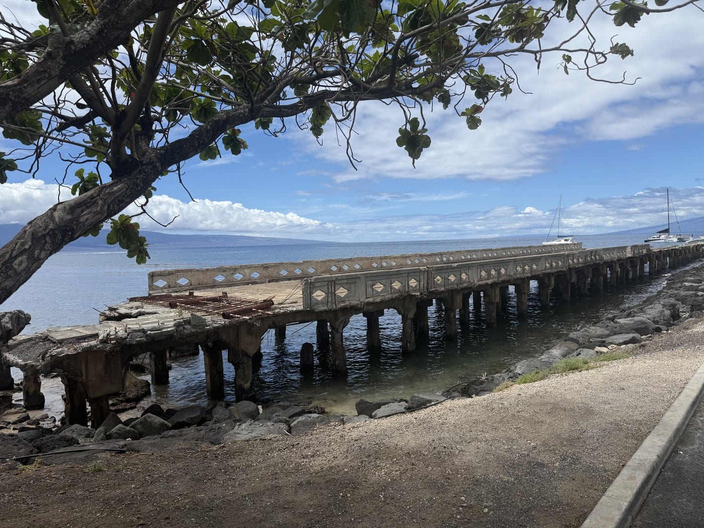
The ruined wharf is now a recognizable shoreline structure, but deterioration, surf, and storm damage make it unsafe. The story should be read from legal public areas: plantation shipping, failed steamer engineering, local boating, marine life, the 2023 fire, and continuing state repair work all meet here.
Before the public ramp
A plantation shoreline reaches for interisland steamers
Māla’s concrete pier was one part of a much larger transformation of West Maui land, labor, transport, and water.
A Hawaiian coastal landscape before plantation infrastructure
The place name māla means a garden or cultivated patch. Long before a concrete pier projected into the sea, Hawaiian communities used West Maui’s coastal and upland lands for settlement, fishing, cultivation, and travel. Modern wharf history must not be written as though this shore began with sugar.
Plantation consolidation later reshaped that landscape. Pioneer Mill organized in the 1860s, a railroad connected cane lands and Lahaina facilities in the 1880s, and a cannery added another industrial layer in the early twentieth century. Māla became part of the transport system serving those enterprises.
A wharf designed for steamers—and defeated by the sea
The concrete wharf was dedicated on April 5, 1922. Its ambition was direct steamer service, allowing larger vessels to take freight and passengers without the transfer through small boats that characterized open-roadstead landings.
Currents, swell, and surf made that plan impractical. The large steamers did not use Māla as intended, but smaller boats continued using the structure until about 1950. The wharf therefore survived as both an engineering failure and a useful local landing.
The ruin acquires another life
As the deck deteriorated, the pilings and broken concrete created habitat and a sheltered underwater environment. Fishing, diving, and small-boat activity gave the site a new identity distinct from its original plantation purpose.
Storms accelerated the decline. Hurricane Iniki damaged the wharf in 1992, and waves, salt, and age continued exposing reinforcement and breaking deck sections. That physical history explains the site’s visual power and its danger.
-
1860s
Pioneer Mill takes shape
Sugar production expands across West Maui and reorganizes land and transport.
-
1883
Plantation rail links the district
Rail infrastructure helps move cane, freight, and supplies through the Lahaina area.
-
Early 1920s
Industry intensifies
Cannery and plantation operations add pressure for improved shipping facilities.
-
April 5, 1922
Māla Wharf is dedicated
A concrete pier is opened with the hope of direct interisland steamer service.
-
Through 1950
Smaller boats keep using it
The wharf remains useful even after its large-vessel purpose proves unworkable.
Public launch and recovery
A local ramp becomes part of West Maui’s lifeline
The later boating facility serves a different purpose from the old pier and became especially important after the 2023 Lahaina fire.
A small-boat facility beside the ruin
The state developed a public launch facility beside the historic wharf, eventually providing two ramps, two loading docks, washdown, restrooms, showers, and offshore moorings. Modern improvements, including work in 2013, support launching and retrieval rather than plantation freight.
This shared shoreline can be confusing in photographs. The concrete ruin is the 1922 wharf. The ramps and loading docks are later boating infrastructure. Their dates, safety conditions, and permitted uses should never be merged.
Fire, reopening, and phased repair
After the August 8, 2023 Lahaina fire, the state closed Māla while officials assessed access and safety. The ramp reopened on October 14, 2023, first under restrictions. Commercial-use restrictions were lifted in April 2024 as West Maui boating operations adapted to the loss and closure of other facilities.
Dredging began in March 2025 to address accumulated material near the ramp. In January 2026, DLNR described preliminary design work for broader improvements. Those plans remain a current project rather than completed history, so this page does not promise future layouts, completion dates, or unchanged access.
-
1992
Hurricane Iniki damages the wharf
Storm impacts add to decades of structural deterioration.
-
2013
The launch facility is modernized
State work improves the active small-boat side of the site.
-
August–October 2023
Fire closure and reopening
Māla is assessed after the Lahaina fire and reopens October 14 under restrictions.
-
April 2024
Commercial restrictions lift
The state expands operating access as West Maui boating adapts.
-
March 2025
Ramp dredging begins
Work addresses accumulated material affecting the launch area.
-
January 2026
Renewal remains in design
DLNR presents preliminary improvement concepts, not a completed project.
What guests can notice
Read the shoreline without entering the ruin
From legal public areas, the contrast between the long failed wharf and compact working launch makes the transportation history unusually visible.
- The long concrete lineThe ruined pier shows the scale of the 1922 steamer ambition. Look from outside barriers only.
- Ramp geometryTwo sloped lanes and loading docks identify the later small-boat facility.
- Broken deck and exposed steelCorrosion, waves, and storms are visible in the wharf’s fragmented structure.
- A living recovery landscapeBoats, trailers, work zones, and changing access show that this is active infrastructure, not an abandoned attraction.
Related Maui history & tours
Follow the connections
Continue with the places and experiences that share this chapter’s roads, water, communities, or working landscapes.
Continue the series
Place Māla in the larger West Maui story
Lahaina Harbor and Māʻalaea show how different shoreline facilities answered different needs.
Research notes
Sources & further reading
This chapter distinguishes Māla Wharf, Lahaina Small Boat Harbor, and Māʻalaea Small Boat Harbor. Current facility conditions are dated August 20, 2026 and must be rechecked before travel.
- DLNR Division of Boating and Ocean Recreation: Māla Wharf and Ramp facility listing (opens in a new tab)
- Wehewehe Wikiwiki: māla place-name and wharf chronology (opens in a new tab)
- DLNR: 2026 preliminary Māla ramp improvement planning (opens in a new tab)
- DLNR: 2025 Māla ramp dredging notice (opens in a new tab)
- DLNR: 2024 commercial-use restrictions lifted (opens in a new tab)
- DLNR: 2023 Māla Wharf reopening after Lahaina fire (opens in a new tab)
- State of Hawaiʻi: 1994 Māla Wharf comfort-station Final EA (PDF) (opens in a new tab)
- State of Hawaiʻi: 2008 Lahaina harbor DEIS with Māla wharf history (PDF) (opens in a new tab)
- State of Hawaiʻi: West Maui plantation and cannery historical context (PDF) (opens in a new tab)
- Library of Congress Chronicling America: 1920 West Maui cannery context (opens in a new tab)
- The Maui News: Hurricane Iniki and long-term deterioration at Māla Wharf (opens in a new tab)