
Maui History Series · Weather & recovery
Maui Hurricanes: Wind, Rain and Recovery Across Generations
On Maui, “no landfall” has never meant “no impact.” Island terrain, rain bands, surf, and wind can turn a distant storm into a local emergency.
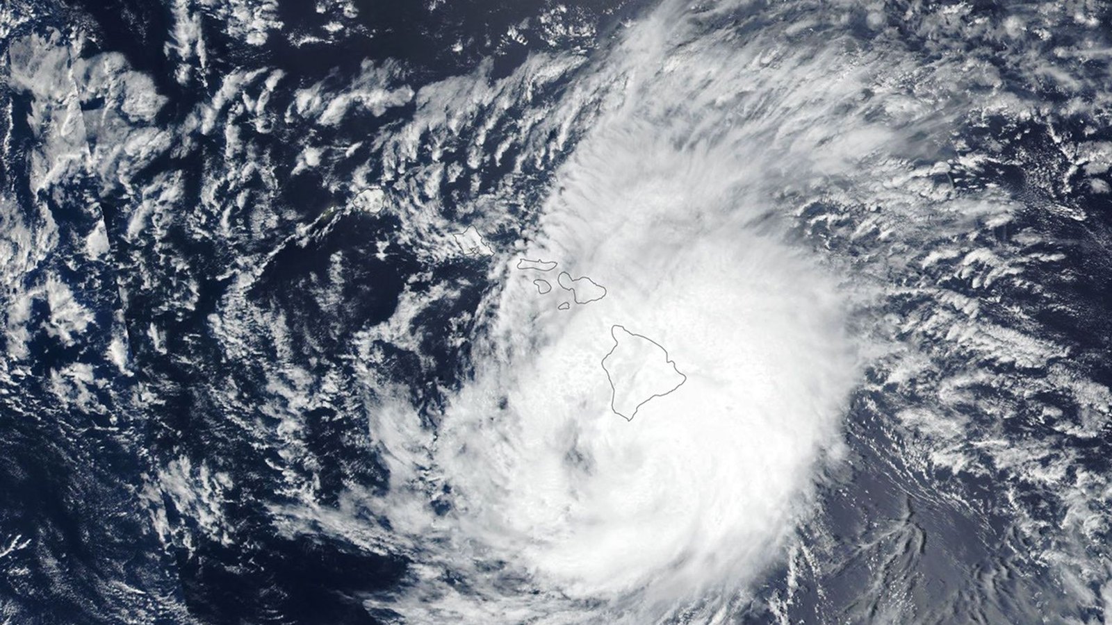
Follow Maui’s storm recordPhoto: NASA Earth Observatory / Lauren Dauphin source (opens in a new tab) · NASA imagery use guidelines license (opens in a new tab) · cropped and resized
Beyond the landfall line
The storm center is only one part of Maui’s risk
Tropical cyclones can drive deep moisture into windward valleys, accelerate winds across exposed ridges and channels, raise surf, and close roads far from the eye. Maui’s steep terrain then concentrates rainfall into streams, gulches, and narrow coastal crossings.
From Hawaiian-language accounts of the 1871 hurricane to Hurricanes Lane, Dora, Hone, Lala, and Lowell, the island’s record is a history of observation, preparation, infrastructure, and recovery—not simply category numbers.
Memory, measurement and terrain
Maui’s storm history predates the modern forecast cone
Newspapers, rain gauges, satellites, radar, and survivor accounts describe different parts of the same hazard.
The 1871 hurricane survives in Hawaiian-language reporting
On August 9, 1871, a major hurricane crossed parts of Hawaiʻi Island and Maui. Researchers using Hawaiian-language newspapers and other observations reconstructed it at roughly Category 3 intensity. Reports from Hāna described damaged houses, trees, and property.
That record matters because it reaches beyond the shorter modern satellite era. It also reminds readers that Hawaiian-language newspapers are primary historical evidence—not decorative anecdotes added after an English-language narrative.
Mountains change rain and wind; they do not form a shield
Haleakalā and the West Maui Mountains can redirect flow, intensify rain on windward slopes, and produce sharply different conditions over short distances. Channels between islands can accelerate wind. Narrow coastal roads and stream crossings can fail even when the storm center remains far away.
The useful question is not only “Did it make landfall?” It is also: where did the moisture, wind, and surf meet Maui’s terrain, and what infrastructure was exposed?
-
August 9, 1871
A major hurricane crosses Maui
Hawaiian-language reports preserve damage observations later used in a scientific reconstruction.
-
August 21–25, 2018
Lane drenches windward Maui
The hurricane remains offshore while West Wailuaiki records 25.58 inches of rain.
-
September 12, 2018
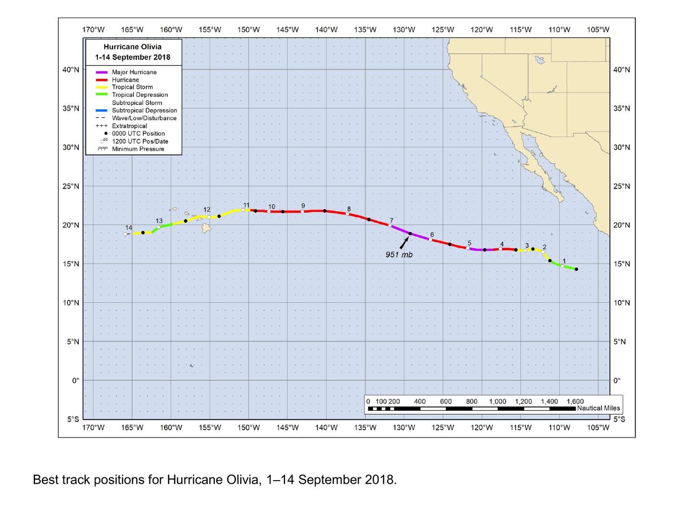
Olivia crosses Maui and Lānaʻi
The tropical storm makes landfall northwest of Kahului, then crosses Lānaʻi.
Recent reminders
Dora, Hone, Lala and Lowell: different storms, different impacts
Recent storms affected Hawaiʻi in different ways. Accurate history separates direct damage, indirect weather influence, and still-provisional reports.
Dora did not ignite Lahaina
Hurricane Dora stayed hundreds of miles south in August 2023. NOAA’s updated report says Dora caused no direct tropical-cyclone damage in Hawaiʻi, while its circulation contributed indirectly to a critical fire-weather pattern interacting with other atmospheric systems.
That does not make Dora a single cause of the Lahaina fire. Official investigations describe a complex interaction of weather, fuels, infrastructure, emergency conditions, and human systems. Storm history should not compress that complexity into a slogan.
Hone reinforces the offshore-impact lesson
Hurricane Hone passed south of Hawaiʻi Island in August 2024. NOAA documented gradient-wind effects reaching Maui and Oʻahu. Again, the center’s path did not define the full area of concern.
Each storm interacts with a different background pattern. Similar tracks do not guarantee similar rain, wind, surf, or road impacts.
Hurricane Lala: August 2026 rain, wind and recovery
During its August 15–16, 2026 passage near the main Hawaiian Islands, Lala brought damaging wind and extreme rainfall without making landfall. NASA describes its passage near Hawaiʻi Island at Category 1 strength. Its subsequent weakening did not undo flooding or restore access immediately.
For Maui visitors, the lesson is to distinguish the storm track from conditions on an individual road, shoreline, or trail. This account does not assign an unverified damage photograph to Lala or treat an old closure notice as a current access report. The NASA account and NOAA advisory archive below document the event; local agencies determine present access.
Hurricane Lowell: September 2026 and hazards beyond the center
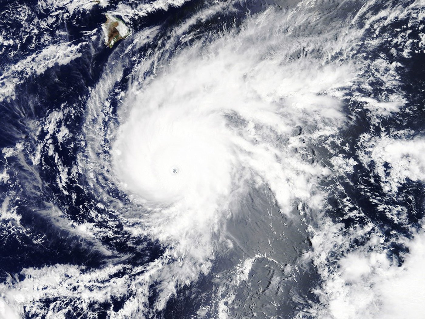
Lowell reached Category 5 strength over the Pacific before weakening as it approached the western Hawaiian Islands. That peak category describes the hurricane over the ocean, not winds experienced on Maui.
In Advisory 51, issued at 11 a.m. HST on September 8, 2026, NOAA placed Lowell about 230 miles north-northwest of Līhuʻe with maximum sustained winds of 75 mph. Although no coastal watches or warnings remained in that advisory, NOAA continued to highlight flooding and dangerous surf. For Oʻahu and Maui counties, it forecast an additional 1–3 inches of rain, with isolated storm totals of 8 inches possible. These were forecasts at that time, not measured rainfall totals or a forecast for the day you read this.
A departing or weakening hurricane is not an all-clear. Check current official alerts and closures rather than using this historical snapshot to decide whether to drive, hike, swim, or visit a shoreline. This chapter does not claim a Lowell landfall on Maui or a final damage total.
-
August 7–9, 2023
Dora passes well south
NOAA later describes an indirect role in the fire-weather pattern, not direct cyclone damage or ignition.
-
August 22–September 1, 2024
Hone affects islands beyond its track
Gradient winds extend the offshore storm’s influence to Maui and Oʻahu.
-
August 15–16, 2026
Lala passes without landfall
The event remains recent; final scientific and site-specific damage records are still developing.
What guests can understand
Read storm history without entering damaged places
The most useful evidence is often visible from safe public routes: terrain, drainage, repaired infrastructure, and official warning systems.
- Windward valleysDeep valleys can focus runoff from slopes far above the coast.
- One-lane bridgesA small crossing may become a regional bottleneck when debris or floodwater blocks it.
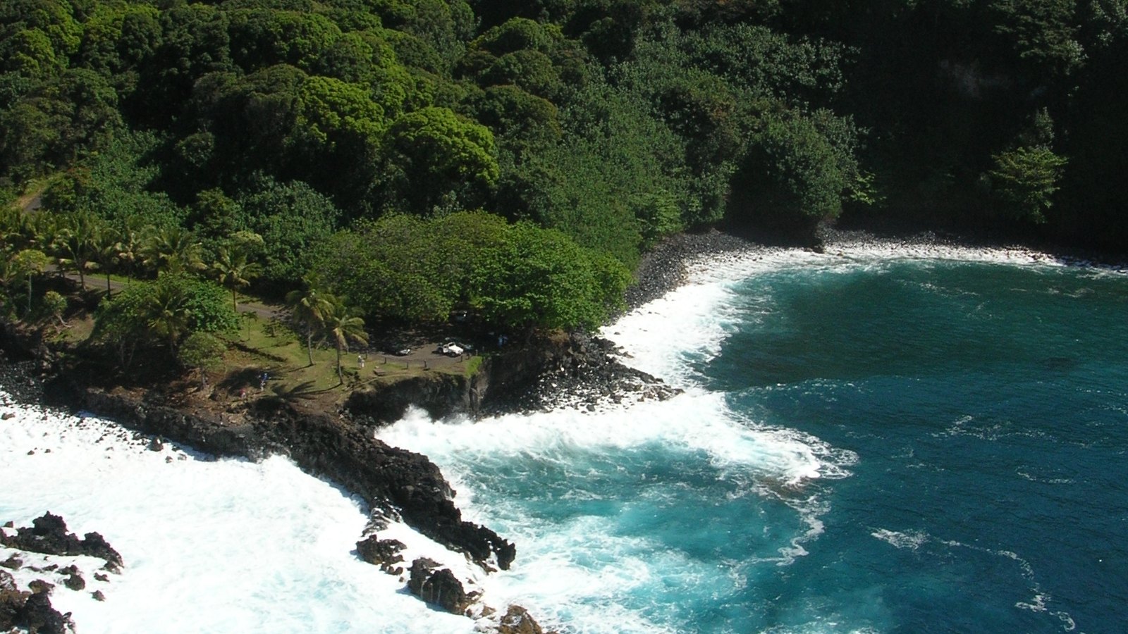
- Rocky landingsExposed shoreline structures can face surf, storm surge, and wave damage even when inland rain is modest.
- Repaired roadsNew pavement, walls, drainage, and temporary work can mark a recovery chapter; never enter work zones for a closer view.
- Local knowledgeResident and agency guidance adds site detail that a statewide storm track cannot supply.
Continue the series
Follow weather into East Maui’s places
Nāhiku Landing and Hāna Harbor show how exposed shorelines, transportation, and community history meet the weather record.
Research notes
Sources & further reading
Reviewed September 8, 2026. Historical claims use NOAA reports and Hawaiian-language research. The 2026 accounts use NASA reporting and dated NOAA advisories, not final damage assessments. Forecast amounts are labeled as forecasts. Consult live official sources for present conditions.
- LIVE: National Weather Service Honolulu forecasts and alerts (opens in a new tab)
- LIVE: NOAA tropical cyclone advisories (opens in a new tab)
- NOAA: Lowell Advisory 51, September 8, 2026, 11 a.m. HST (historical snapshot) (opens in a new tab)
- NOAA: Lowell Discussion 36, September 4, 2026 (Category 5 over the Pacific) (opens in a new tab)
- NOAA: Lala 2026 advisory archive (opens in a new tab)
- NOAA repository: A major Hawaiian hurricane in 1871 (opens in a new tab)
- University of Hawaiʻi: translated 1871 Hāna newspaper account (opens in a new tab)
- NOAA: Hurricane Lane Tropical Cyclone Report (PDF) (opens in a new tab)
- NOAA: Hurricane Olivia Tropical Cyclone Report (PDF) (opens in a new tab)
- NOAA: Hurricane Dora Tropical Cyclone Report, updated January 2026 (PDF) (opens in a new tab)
- NOAA: Hurricane Hone Tropical Cyclone Report (PDF) (opens in a new tab)
- NOAA National Hurricane Center: 2026 advisory archive (opens in a new tab)
- NASA Earth Observatory: Lala Batters Hawaii, August 18, 2026 (opens in a new tab)
- County of Maui: emergency road notices (opens in a new tab)
- Hawaiʻi DOT: Maui lane closures and roadwork (opens in a new tab)