
Maui History Series · East Maui
Hāna Airport: Hāmoa Airstrip to HNM
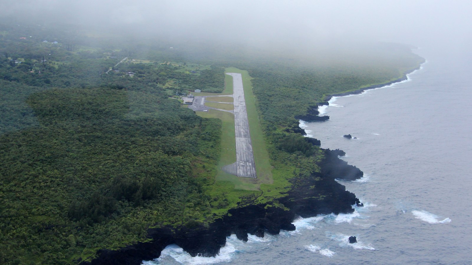
Hāna’s first grass field opened south of town in 1935. Today’s runway occupies a different coastal site northwest of town—built after wartime delays and opened in 1950.
Trace Hāna aviationPhoto: Eric Prado source (opens in a new tab) · CC BY-SA 4.0 license (opens in a new tab) · cropped and resized; derivative shared under CC BY-SA 4.0
Two fields, one remote district
Hāmoa Airport and Hāna Airport are not the same place
The first scheduled airplanes serving Hāna used a grass strip at Hāmoa, south of town. Territorial records set that land aside in 1935, but the short, wet field quickly proved too limited for growing interisland aviation.
The present Hāna Airport—identifier HNM—was built years later on the coast northwest of town. A plan for the new airport took shape before World War II, construction finally began in 1948, and the field opened in 1950. Treating the two sites separately keeps an emergency wartime strip from being mistaken for a military air base and explains why today’s runway lies away from the old Hāmoa location.
The first air connection
A grass field shortens the trip to Hāna
Aviation offered speed that neither the exposed wharf nor the winding belt road could match, but East Maui weather and terrain made the first site difficult.
Interisland service reaches Hāmoa
Scheduled aviation service began at the Hāmoa field in May 1935. Governor’s Executive Order 646 formally set aside the land that June. The grass strip brought mail, passengers, and urgent travel within a short flight of central Maui, but its location south of town, limited dimensions, rain, and soft ground constrained operations.
By 1937, territorial aviation officials were already seeking a better site. Hāna’s experience echoed its maritime history: the district needed outside connections, but the physical conditions that made East Maui distinctive also complicated permanent infrastructure.
A new airport is planned, then war intervenes
Territorial officials submitted a federal grant application for a replacement airport in December 1940, but World War II delayed the civilian project. The existing Hāmoa field remained available as an emergency landing strip during the war.
That emergency status must not be inflated into a combat-base story. Unlike Puʻunēnē and Kahului, Hāmoa was not developed into one of Maui’s large naval air stations. Its wartime role was continuity and contingency for a remote community.
Residents press for the promised field
After the war, Act 153 of 1945 appropriated $150,000 for Hāna airport work. Delays continued, and in 1948 a petition signed by 376 residents urged the Territory to proceed.
Construction at the present coastal site began November 16, 1948, and the federal grant agreement was approved that December. The airport opened November 11, 1950. State aviation history records completion of runway paving on December 4 during the same construction period; the approximately 3,600-by-100-foot field created a much more durable connection than the first grass strip.
-
May–June 1935
Hāmoa service begins
Scheduled flights start, and Territorial land is formally reserved for the grass field.
-
1937
A replacement becomes necessary
Officials conclude that Hāmoa cannot meet Hāna’s long-term aviation needs.
-
1940–45
War delays the new airport
A planned replacement stalls while Hāmoa remains an emergency strip.
-
1948
Residents and construction move the project
A 376-signature petition precedes the November start of work at the present site.
-
November–December 1950
Hāna Airport opens and paving is completed
The airport opens November 11; State history records runway-paving completion on December 4.
Postwar lifeline
A small airport carries an outsized community role
Schedules and carriers changed, but the airport remained part of Hāna’s connection to health care, government, commerce, family, and visitors.
Growth without a large terminal
Postwar improvements supported larger aircraft and changing interisland service, but Hāna Airport remained modest. Its runway, small terminal, and coastal setting reflect a community airport rather than a major visitor gateway.
Tourism increased the value of fast access to East Maui, yet service levels rose and fell with airline economics. Congress established the Essential Air Service program through the Airline Deregulation Act of 1978, and the Civil Aeronautics Board defined Hāna’s minimum essential-service level in 1979—recognizing that market forces alone might not sustain reliable links for a remote community.
The airport seen today
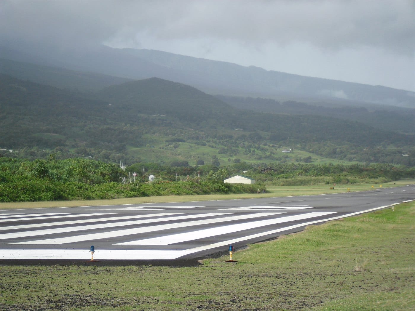
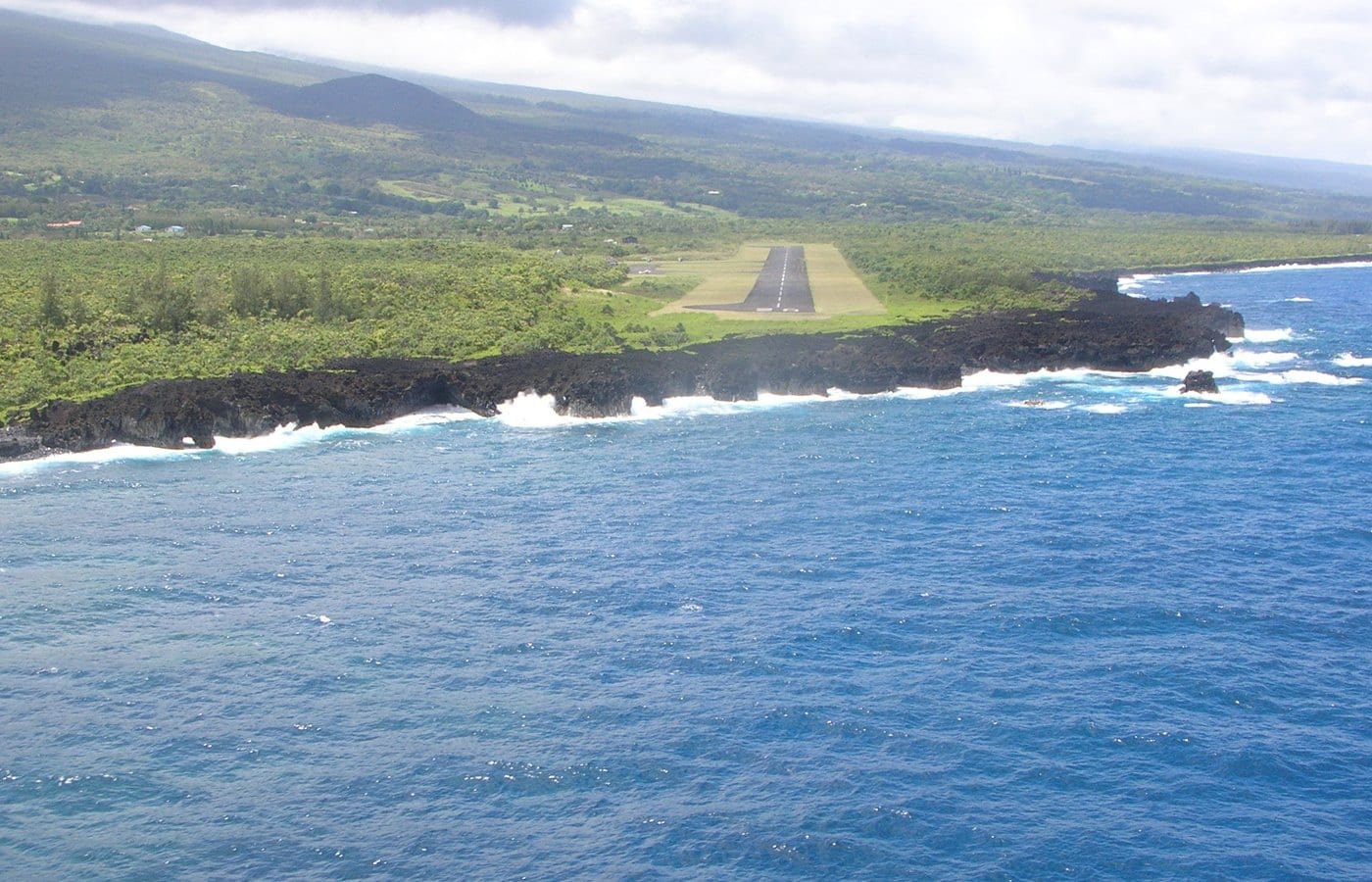
A 2008 state environmental assessment describes a 144-acre public airport about three miles northwest of Hāna. The July 2026 FAA Chart Supplement lists one paved runway measuring 3,606 by 100 feet and an untowered field, so pilots coordinate operations without an airport control tower.
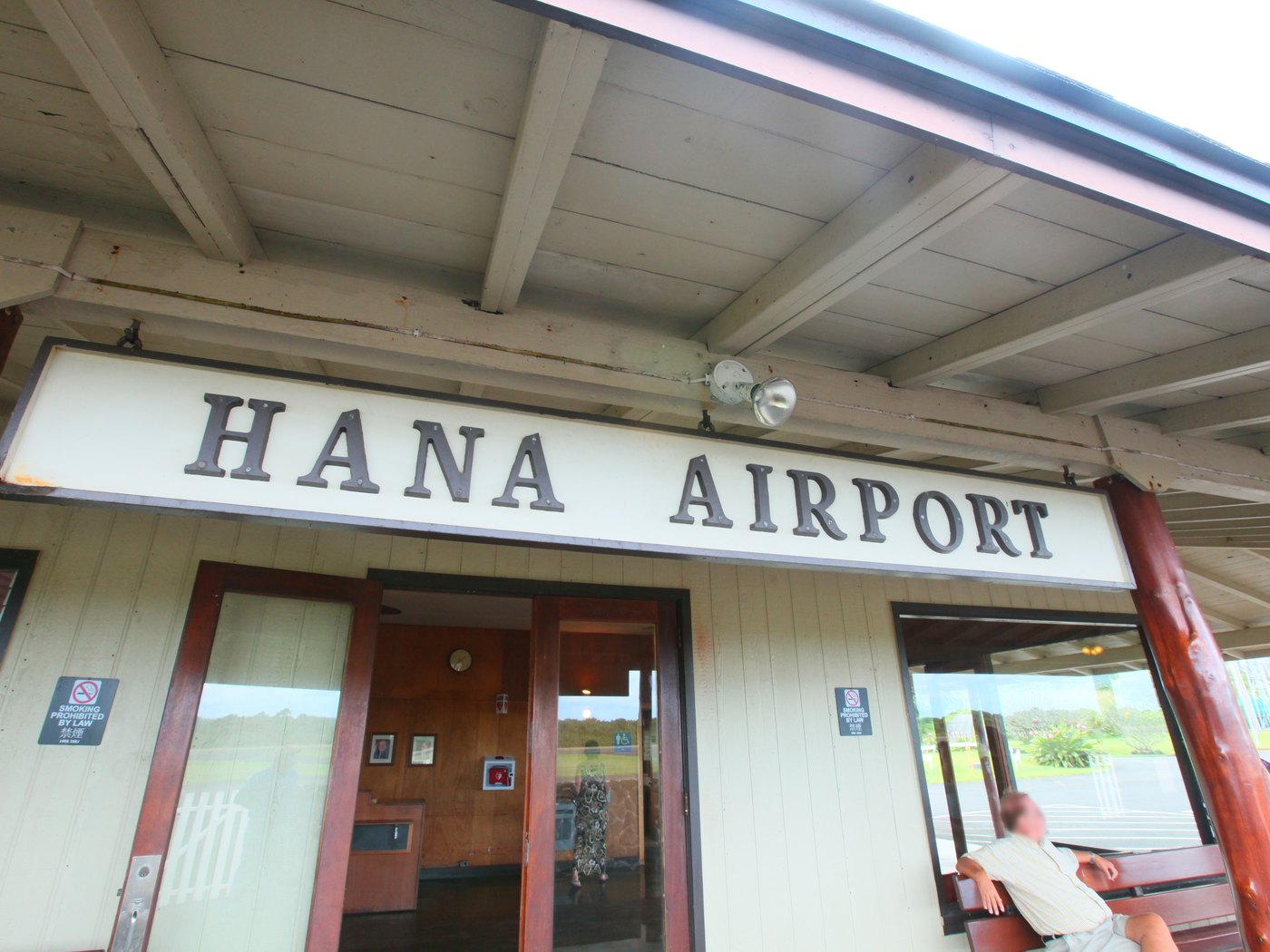
The passenger terminal is small. State accessibility information identifies accessible parking and restrooms, while food service is limited to vending. Those facts should be treated as a dated facility snapshot, not a promise that every amenity or flight is available on a future travel day.
-
1950s–70s
Interisland service evolves
Aircraft, carriers, and schedules change as Hāna tourism and mobility grow.
-
1978–79
Essential Air Service is established and Hāna’s level is defined
Congress establishes EAS in 1978; the Civil Aeronautics Board defines Hāna’s minimum service in 1979.
-
Today
A compact active airport
One paved runway and a small terminal continue to connect East Maui by air.
What guests can notice
Read the runway from legal public areas
The airfield’s geography tells most of the story. Observe only from normal passenger and public areas; never stop where it interferes with airport or highway operations.
- Runway and oceanThe paved strip sits close to a rough lava shoreline, showing why wind and weather are central operating conditions.
- Small terminalIts scale fits a remote community airport rather than a regional hub.
- No towerThe absence of a control tower distinguishes HNM from Kahului’s larger operation.
- Distance from townThe northwest coastal site reveals why planners abandoned the convenient but constrained Hāmoa field south of town.
Related Maui history & tours
Follow the connections
Continue with the places and experiences that share this chapter’s roads, water, communities, or working landscapes.
Continue the series
Follow Hāna by air, sea, and road
The harbor and belt road explain the other transportation choices that shaped this remote district.
Research notes
Sources & further reading
This chapter relies on official State of Hawaiʻi aviation histories and airport information checked August 20, 2026. State airports were reported open after Tropical Storm Lala, but every flight and ground-transport plan still requires direct confirmation. Historical source titles may omit Hawaiian diacritics; editorial text follows Hāna.
- State of Hawaiʻi Aviation: Hāna Airport history (opens in a new tab)
- State of Hawaiʻi Aviation: Hāmoa Airport history (opens in a new tab)
- State of Hawaiʻi Airports: current Hāna Airport information (opens in a new tab)
- State of Hawaiʻi: Hāna Airport improvements Final EA (PDF) (opens in a new tab)
- FAA: July 2026 Pacific Chart Supplement, Hāna Airport entry (PDF) (opens in a new tab)
- State of Hawaiʻi Airports: Hāna Airport accessibility information (opens in a new tab)
- State of Hawaiʻi Airports: Hāna Airport food and vending information (opens in a new tab)
- U.S. Department of Transportation: Essential Air Service program history (opens in a new tab)
- Hawaiʻi Department of Transportation: Tropical Storm Lala transportation updates (opens in a new tab)
- County of Maui: Hāna Community Plan (PDF) (opens in a new tab)
- Hawaiʻi Board on Geographic Names: official Maui spellings (PDF) (opens in a new tab)