
Maui History Series · Māʻalaea Harbor
Māʻalaea Harbor: From Canoe Landing to Ocean Gateway
At Maui’s isthmus, a traditional landing place became a wartime training shore, a postwar small-boat harbor, and a busy starting point for ocean journeys.
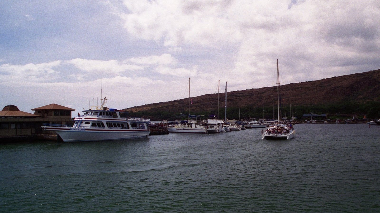
Begin at the landing placeMāʻalaea Harbor, October 1997. Photo: Brian Snelson source (opens in a new tab) · CC BY 2.0 license (opens in a new tab) · cropped and resized
Before the breakwaters
Māʻalaea was a place of arrival long before it was a harbor
A 2006 U.S. Coast Guard study describes Māʻalaea Bay as an important Hawaiian stopover and transit place. It identifies Kapoli Spring, near the harbor’s western end, as a canoe landing beside a small maritime settlement. Travelers arrived here by canoe or small boat and continued overland toward Waikapū, Wailuku, and ʻĪao.
The basin visitors see today is much newer. It was cut from this older shoreline after World War II, then expanded as recreational boating, fishing, passenger service, and Maui’s visitor economy grew around it.
Recent studies preserve an unresolved place-name distinction: earlier records map Kapoli Spring, while a 2023 cultural study records one consultee calling a spring by the ramp and restrooms Waikoli. The reports do not establish that the names identify the same spring.
Landing · Farming · Fishing · War
A shoreline at Maui’s crossroads
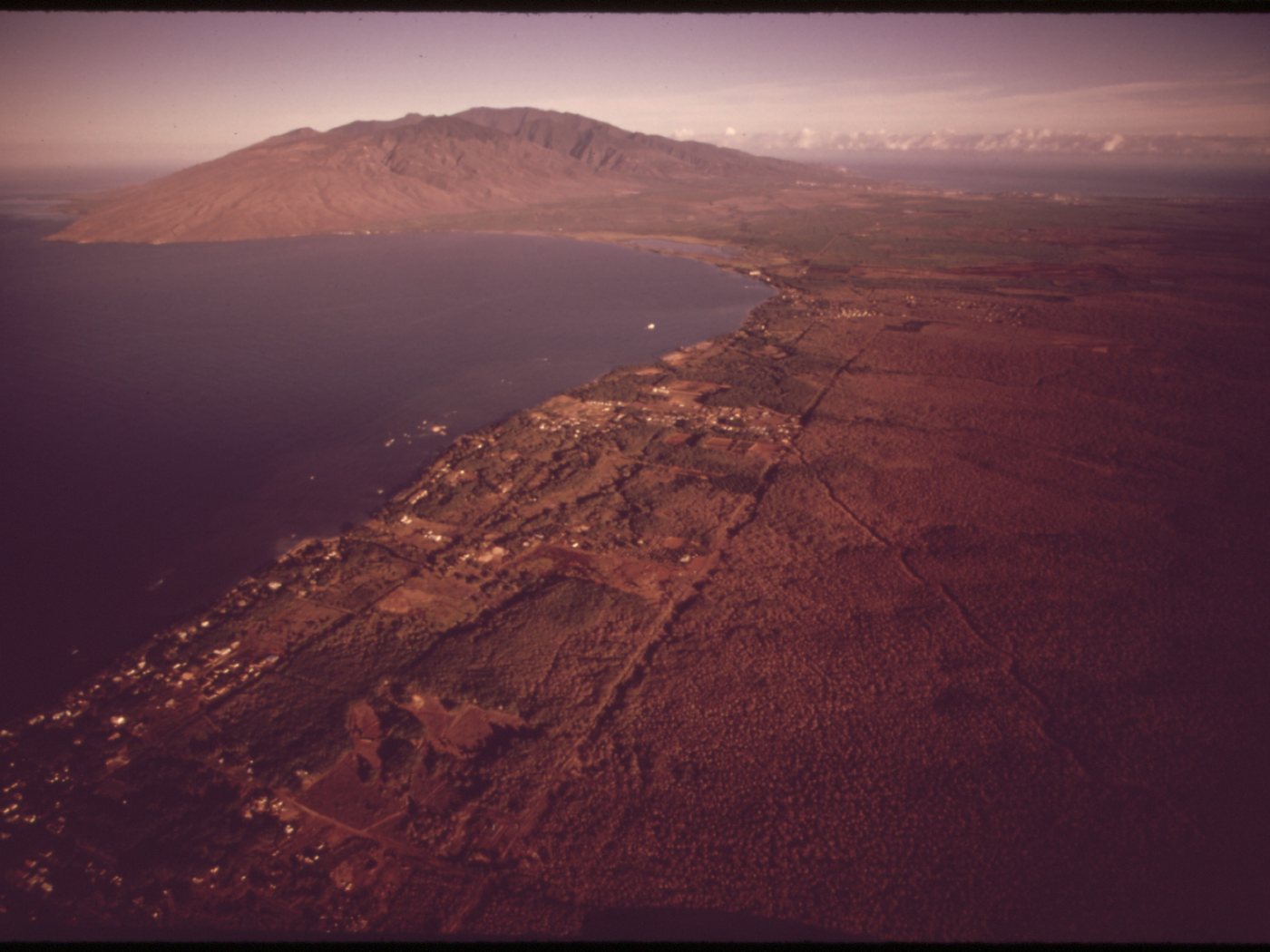
Long before the modern marina, Māʻalaea connected ocean routes with the overland paths crossing Maui’s central isthmus. Later maps and photographs record how settlement, agriculture, and transportation gathered around that natural junction.
From canoe landing to maritime settlement
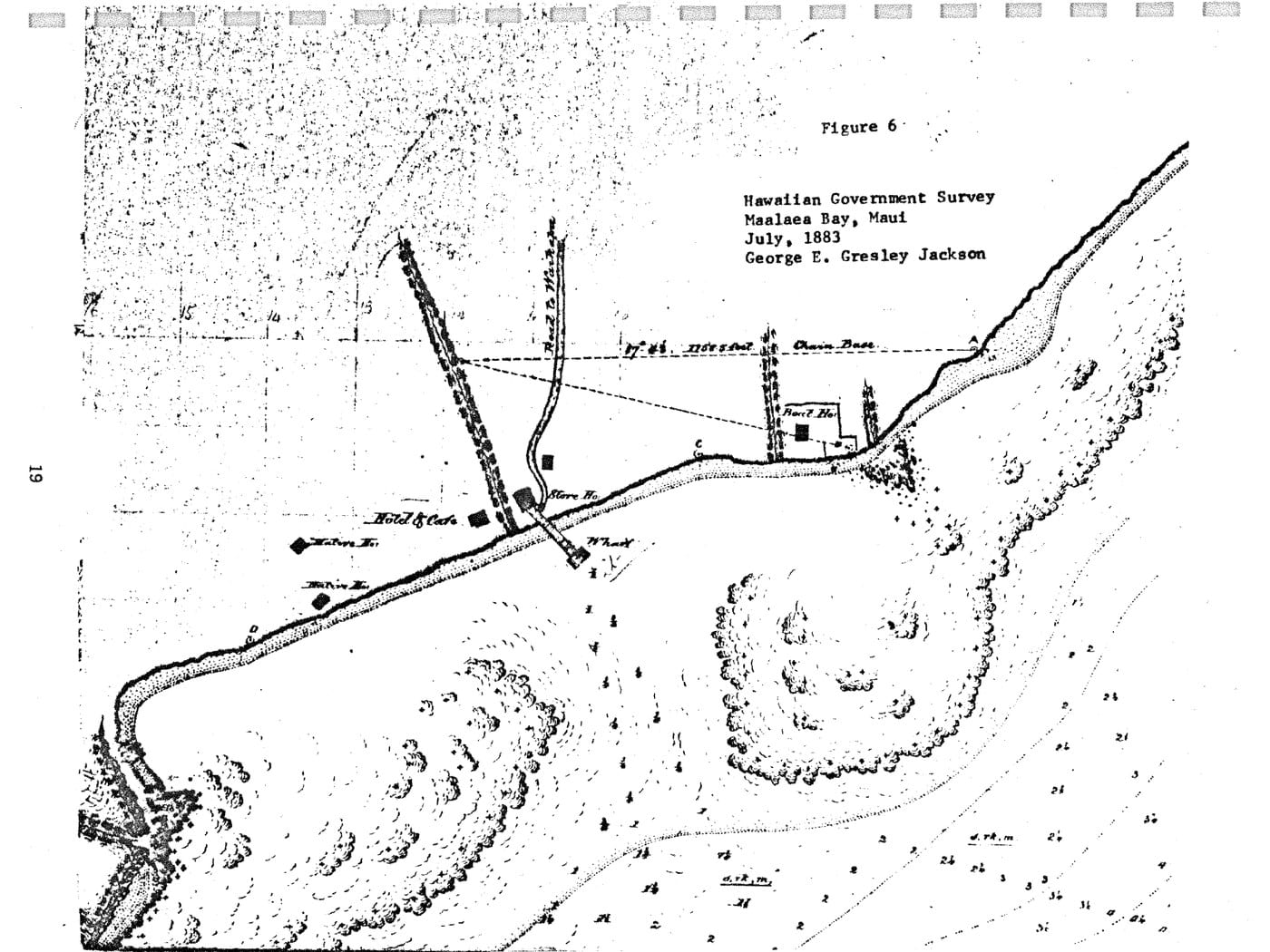
A recorded Hawaiian oral tradition summarized in government studies says high chiefs landed by canoe at Kapoli Spring in 1736 to take the remains of Maui ruler Kekaulike overland to Wailuku in ʻĪao Valley. Those studies also identify Kapoli as a major canoe landing and record house lots, a pier, a hotel, fishing families, and other signs of a small maritime settlement.
During the California Gold Rush, produce grown in Hawaiʻi—including potatoes, onions, pumpkins, oranges, coffee, and molasses—left through Māʻalaea for San Francisco and other West Coast ports. By the later nineteenth century, much of the surrounding Waikapū landscape had been converted to sugarcane. Māʻalaea’s shore linked farming country with ocean transport, but the present small-boat harbor had not yet been built.
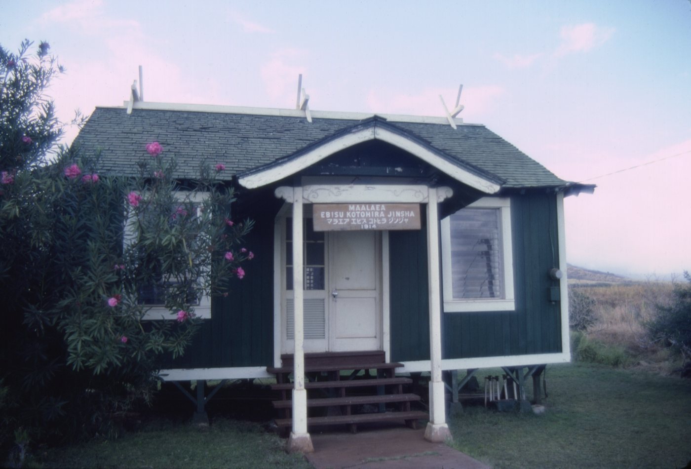
A Japanese fishing-community shrine, probably built in the first half of the twentieth century, adds another layer. Then World War II changed the bay’s purpose again: before the harbor existed, the 4th Marine Division trained here for Iwo Jima, and Māʻalaea Bay was used for amphibious landing practice.
-
Before the modern harbor
A place of transit and fishing
Hawaiian travelers arrive by canoe and continue across the isthmus; fishing and settlement connect people to the bay.
-
1848–1850
Produce moves toward California
Māʻalaea serves as an export point for Hawaiian-grown foods, coffee, and molasses during the Gold Rush.
-
1883
A wharf and shoreline buildings
A government survey maps the wharf, hotel, storehouse, roads, reefs, and soundings at Māʻalaea Bay.
-
Early 1900s
The old pier declines
A territorial report describes the pier as extremely deteriorated by 1902, and public works officials look elsewhere for a larger wharf.
-
1944–1945
The bay becomes a training ground
Marines conduct amphibious exercises at Māʻalaea before the battle of Iwo Jima.
Breakwaters · Tourism · Working harbor
Postwar engineering created an ocean gateway
The harbor’s history is not one construction date. It is a sequence of dredging, breakwaters, expansions, proposals, and repairs responding to an energetic bay and a changing Maui economy.
A harbor built in stages
Work began in 1952. The first breakwater and dredging were completed in 1953, when Māʻalaea Small Boat Harbor entered operation. The east breakwater followed in 1958, with further work in the 1960s. Oral interviews summarized in 2005 and 2006 official studies reported that pōhaku and other stones from a heiau upslope were taken for harbor-wall construction. This is an attributed oral account, not an independently verified archaeological conclusion.
Surge and navigation problems did not disappear. Congress authorized federal modifications in 1968, and later plans examined a longer breakwater, realigned channels, and many more slips. Those proposals triggered debate over cost, coral, surf, regulation, and community priorities. After decades of study, the State and Army Corps terminated the unbuilt project in 2012.
Meanwhile, Maui’s economy shifted toward tourism. SeaFlite hydrofoils used a terminal near the west breakwater from 1975 through 1977. Condominiums multiplied along the shore, charter and passenger boats expanded, and Māʻalaea became a departure point for Molokini, whale watching, fishing, and other ocean trips. The harbor remained a working public facility for recreational boats, commercial fishing, passenger operations, and the U.S. Coast Guard.
-
1952
Harbor construction begins
The Territory starts work to replace the older pier with a protected small-boat basin.
-
1953
The harbor enters operation
Dredging and the first breakwater are completed, creating the initial protected basin.
-
1958
The east breakwater follows
A second breakwater adds shelter, with additional improvements continuing in the 1960s.
-
1975–1977
Hydrofoils arrive
SeaFlite operates interisland passenger service from a terminal near the west breakwater.
-
2012
A major expansion is ended
The State and Army Corps terminate the long-studied federal navigation project without constructing it.
-
2011–2024
Piers, utilities, and seawalls
Modern projects replace the ferry pier and improve harbor infrastructure, parking, utilities, and shoreline protection.
What you are seeing
Four clues around the harbor
The basin can look like a simple marina. Its structures and surroundings reveal the longer shift from landing place to engineered harbor and visitor crossroads.
- The paired breakwatersThey mark the harbor’s 1950s construction stages and the continuing effort to manage swell and surge.
- The crowded slipsFishing boats, charters, passenger vessels, and recreational craft share a basin that was never expanded to the scale once proposed.
- The ferry pier and harbor buildingsThey record later investment in passenger service, utilities, safety, and public access.
- Condos, shops, and the Ocean CenterThey show how a small shoreline settlement became a tourism-oriented crossroads even as the resident community stayed small.
Related Maui history & tours
Follow the connections
Continue with the places and experiences that share this chapter’s roads, water, communities, or working landscapes.
Continue the story
Follow Maui’s changing shoreline
Compare Māʻalaea’s protected harbor with South Maui’s public launch, then continue on land with a private Maui tour built around your group.
Research notes
Sources & further reading
This account distinguishes Māʻalaea Bay from the postwar harbor, separates staged construction dates, and treats unbuilt federal expansion plans and oral histories with explicit attribution.
- U.S. Coast Guard: 2006 Station Māʻalaea Final EA (PDF) (opens in a new tab)
- U.S. Coast Guard: 2024 Station Māʻalaea Draft EA, including cultural studies (PDF) (opens in a new tab)
- Hawaiʻi DLNR: 2005 Māʻalaea Harbor Improvements Final EA (PDF) (opens in a new tab)
- U.S. Army Corps: 1980 Māʻalaea Harbor Light-Draft-Vessel FEIS (PDF) (opens in a new tab)
- Hawaiʻi DLNR: History of Recreational Boating in Hawaiʻi (opens in a new tab)
- U.S. Marine Corps: History of the 4th Marine Division (PDF) (opens in a new tab)
- U.S. Army Corps: 2012 navigation project termination (opens in a new tab)
- Hawaiʻi DLNR DOBOR: Current Māʻalaea Small Boat Harbor facilities (opens in a new tab)
- Hawaiʻi DLNR: 2015 ferry-pier replacement (opens in a new tab)
- Hawaiʻi DLNR: 2024 seawall repair (opens in a new tab)
- Hawaiʻi DLNR DAR: Molokini charter access and stewardship (opens in a new tab)
- U.S. Census Bureau: 2020 Māʻalaea CDP population and housing table (opens in a new tab)