
Maui History Series · East Maui
Hāna Harbor: Kaʻuiki, Sugar and the Wharf
A sheltered-looking bay carried Hawaiian voyaging, plantation freight, passengers, fuel, and fishing boats—but the historic pier and today’s launch facility are different layers of the story.
Follow the shoreline through timePhoto: Forest & Kim Starr source (opens in a new tab) · CC BY 3.0 US license (opens in a new tab) · cropped and resized
One bay, several facilities
The word “harbor” can hide an important distinction
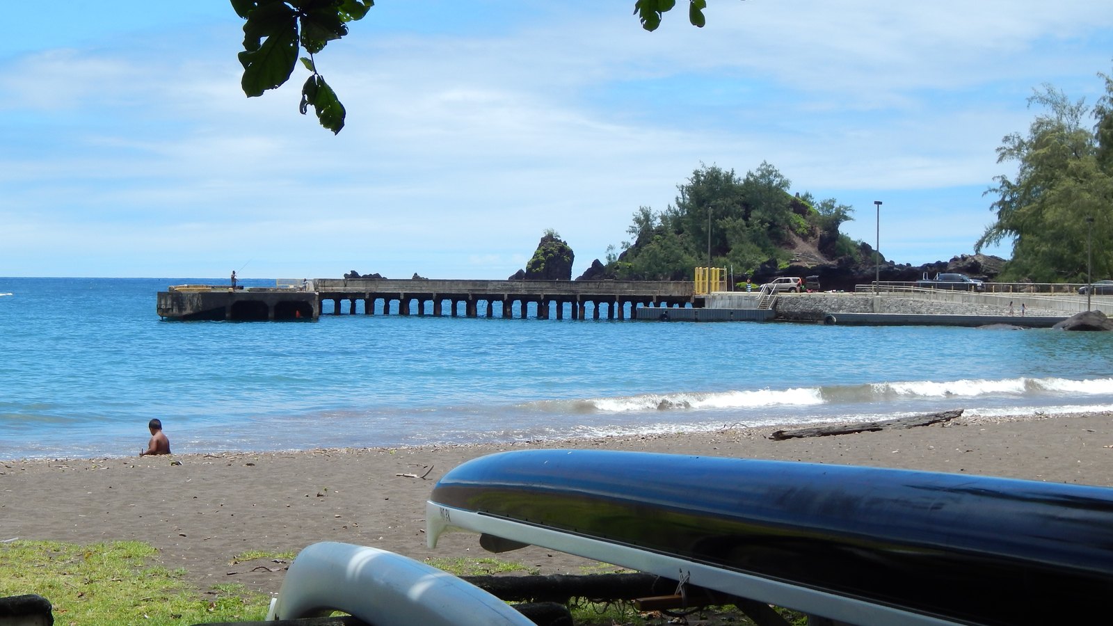
Hāna Bay—also identified in official place-name records as Kapueokahi Harbor—has long connected East Maui communities to the sea. The concrete structure extending from the shore is the historic Hāna Wharf or Hāna Pier, completed in 1921 for passengers and plantation freight.
The state boating facility listed today is a later launch area with a ramp and loading pier. It sits beside the older wharf, but it did not inherit every function, date, or engineering feature of that structure. Reading the two separately makes Hāna’s transition from maritime supply point to road-connected community much clearer.
Before the highway
A bay links Hāna to the rest of Hawaiʻi
Before a continuous road connected East Maui, landings and the wharf moved people, mail, equipment, food, sugar, and fuel between shore and interisland vessels.


A Hawaiian shoreline before a concrete wharf
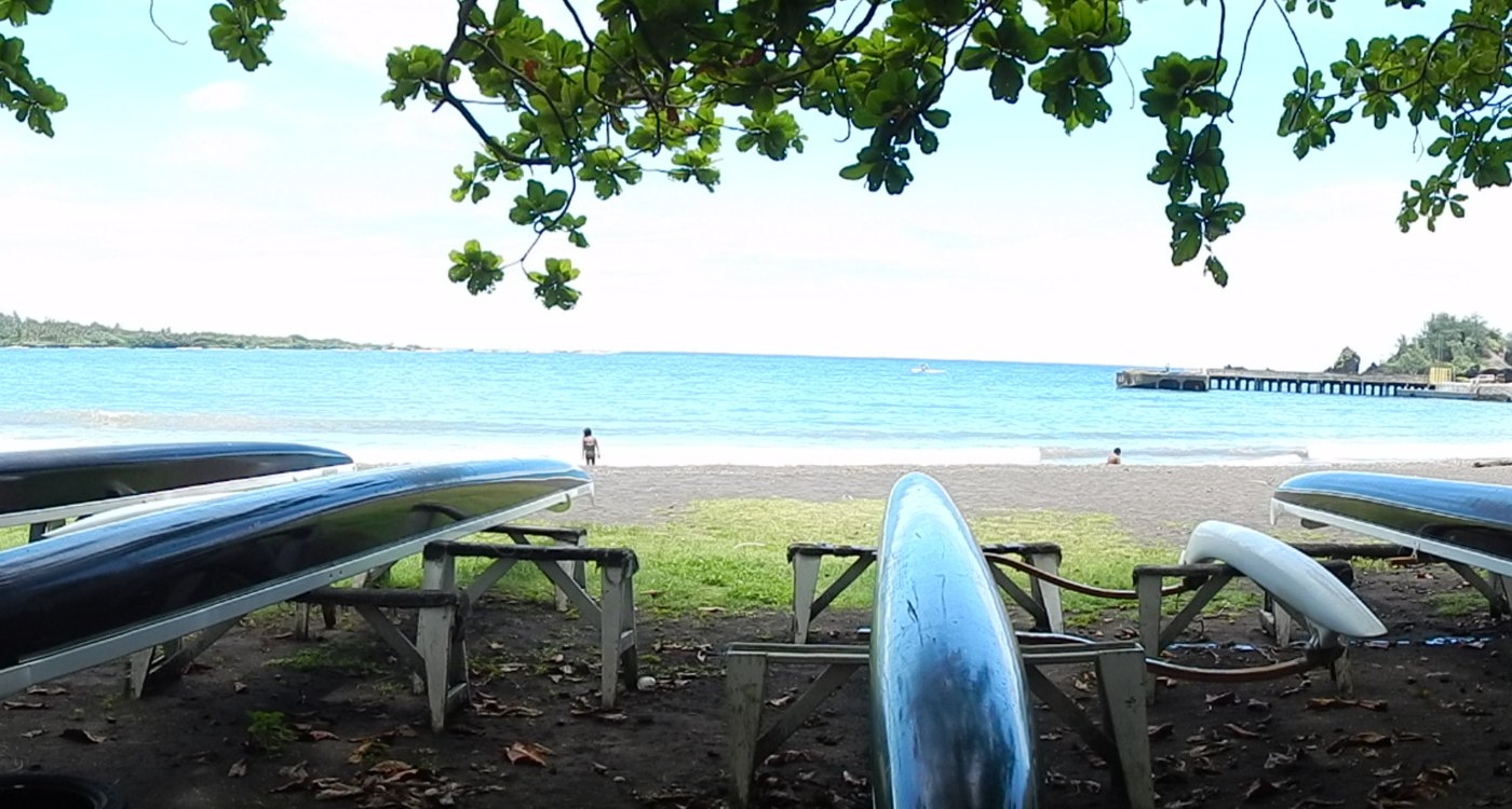
Hāna Bay belongs to a much older Hawaiian landscape of fishing, cultivation, canoe travel, chiefly history, and settlement centered around Hāna and Puʻu Kaʻuiki. The Hāna Pier environmental study’s cultural assessment records Puʻu Kaʻuiki as a place of continuing cultural importance connected with Hāna’s histories and practices. This page names that relationship as context, not as an invitation to seek out sensitive places.
The modern shoreline structures did not create Hāna’s relationship with the sea; they were laid over it. By the late nineteenth century, regular landings served a district increasingly tied to plantation agriculture. Freight still had to cross the surf between small boats and interisland vessels, making weather and water conditions part of every shipment.
A prison-labor wharf for a plantation economy
Territorial funding for a permanent wharf began in 1917. Construction started in 1919 and used a work camp of approximately sixty Territorial prisoners. The concrete Hāna Wharf was completed in 1921, creating a more direct transfer point for passengers, freight, and sugar.
Sugar shipped through the wharf from 1922 until the Hāna plantation ended operations in the mid-1940s. Later work lengthened the structure around 1940–41, while World War II kept interisland supply and fuel movement important even as the district’s economic base was changing.
The road changes the balance
Completion of the Hāna Belt Road connection in 1926 did not make the wharf irrelevant overnight, but it changed the district’s choices. Scheduled passenger service at the pier ended in 1929 as road travel became practical, while freight and fuel continued arriving by sea.
The 1946 tsunami struck an already shifting maritime system. In the postwar decades, trucking, aviation, and the closure of Hāna’s sugar operation reduced the old wharf’s regional role.
-
By 1882
Regular landings serve Hāna
Small boats connect the district with vessels standing offshore.
-
1919–21
The concrete wharf is built
Territorial construction creates a permanent passenger and freight pier.
-
1922–mid-1940s
Sugar moves by sea
Hāna plantation shipments use the wharf until the sugar operation closes.
-
1926–29
The road shifts passenger travel
The belt road reaches Hāna; scheduled passenger use of the wharf soon ends.
-
1940–41
The wharf is lengthened
Territorial work extends the structure during a period of continued freight use.
-
April 1, 1946
Tsunami strikes East Maui
Powerful waves damage coastal communities and infrastructure around Hāna.
Postwar shoreline
A working launch grows beside an aging pier
Recreational boating infrastructure arrived later, while the historic wharf deteriorated and eventually lost public access.
From freight pier to local launch
State records place construction of Hāna’s recreational ramp in the 1970s, with loading-dock improvements following in the late 1980s. These facilities served smaller local boats and should not be described as a conversion of the entire 1921 wharf.
Access to the old pier became increasingly restricted during the 1990s and early 2000s. In 2010, engineers condemned the structure and the state transferred jurisdiction from the harbor system. Environmental review later evaluated its removal, but the continuing physical structure means this page must not imply that demolition was completed.
A community waterfront, not an abandoned relic
DOBOR improved the active launch area again in 2021. Its current facility listing identifies one pier and one ramp, while County Hāna Beach Park information describes the adjoining public shoreline recreation area.
The bay continues to hold fishing, paddling, swimming, shoreline recreation, and small-boat activity. That living use is the endpoint of the story—not entry onto a condemned concrete structure.
-
1970s
A recreational ramp is built
A later small-boat facility develops beside the historic wharf.
-
Late 1980s
Loading docks improve
State boating infrastructure supports local launching and retrieval.
-
1990s–2002
Old-pier access tightens
Safety concerns progressively limit entry onto the aging wharf.
-
2010
The wharf is condemned
The historic structure is removed from normal public use.
-
2021
The active ramp is improved
DOBOR completes work on the separate small-boat facility.
What guests can notice
Read two maritime eras from public space
The strongest view is contextual: see how the exposed concrete pier, active launch, beach park, bay, and road each belong to a different transportation chapter.
- The long concrete wharfIts narrow deck and open pilings identify the 1921 passenger-and-freight structure. Stay behind every barrier.
- The launch areaRamp slopes and loading structures serve smaller boats and are later than the historic pier.
- Puʻu KaʻuikiThe prominent landform frames the bay and long predates every modern harbor structure.
- Road and shoreline togetherModern access makes visible the transportation shift that reduced reliance on interisland passenger service.
Related Maui history & tours
Follow the connections
Continue with the places and experiences that share this chapter’s roads, water, communities, or working landscapes.
Continue the series
Follow Hāna by sea, air, and road
Hāna Airport and the Hāna Belt Road complete the district’s transportation story.
Research notes
Sources & further reading
This chapter separates the historic Territorial wharf from the later state boating facility and dates current conditions to August 20, 2026. The facility listing is not live launch clearance; verify launch, surf, and park conditions again before relying on them.
- State of Hawaiʻi: Hāna Pier Deck Removal Final EIS and cultural assessment (PDF) (opens in a new tab)
- State of Hawaiʻi: Hāna Pier Deck Removal Draft EIS and historical chronology (PDF) (opens in a new tab)
- State of Hawaiʻi: Hāna Pier Deck Removal Final EIS acceptance and mitigation record (PDF) (opens in a new tab)
- State of Hawaiʻi: Hāna Pier Deck Removal EIS preparation notice and historical chronology (PDF) (opens in a new tab)
- DLNR Division of Boating and Ocean Recreation: Hāna Wharf and Ramp (opens in a new tab)
- DLNR Division of Boating and Ocean Recreation: current Maui facilities (opens in a new tab)
- DLNR: 2021 Hāna boat-ramp and wharf improvement notice (opens in a new tab)
- County of Maui: Hāna Bay Beach Park (opens in a new tab)
- County of Maui: Ocean Safety coverage information (opens in a new tab)
- County of Maui: Hāna Community Plan (PDF) (opens in a new tab)
- Hawaiʻi Board on Geographic Names: official Maui spellings (PDF) (opens in a new tab)
- Library of Congress HAER: Hāna Belt Road and Hāna Bay documentation (opens in a new tab)