
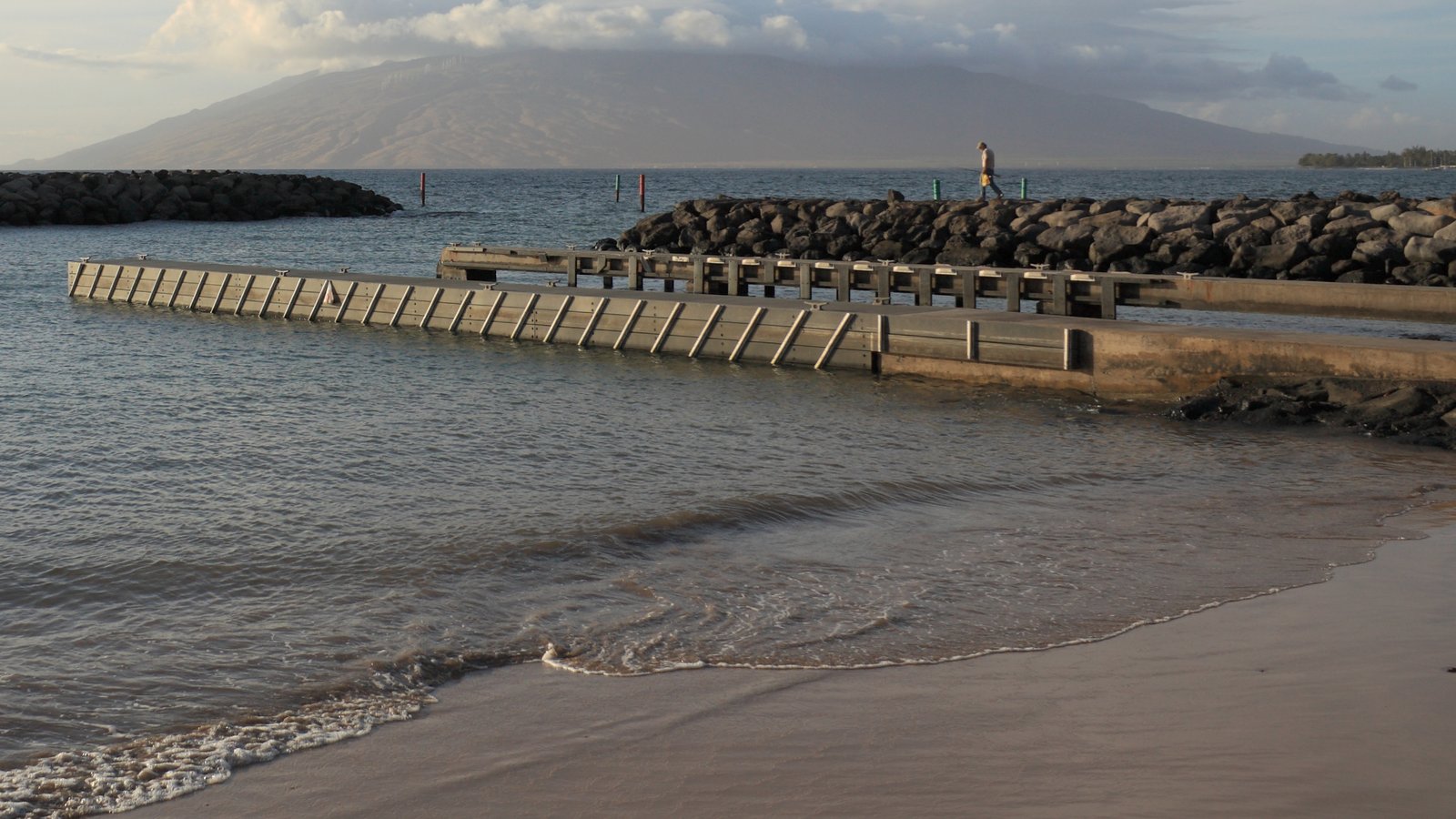
Maui History Series · Kīhei Boat Ramp
Kīhei Boat Ramp: A Public Launch on a Changing Shoreline
At Keawakapu, a public launch tells a larger story about Hawaiian coastal life, early landings, postwar boating, resort growth, and the effort to keep ocean access open.
Start at the shorelinePhoto: Viriditas source (opens in a new tab) · CC BY-SA 3.0 license (opens in a new tab) · cropped and resized
Before the trailer ramp
Keawakapu was part of a cultural coastline, not an empty construction site
Fishing villages, fishponds, shrines, heiau, shelters, and canoe travel connected South Maui communities to the sea for generations. Later landings supported interisland travel and the plantation economy. The modern launch is one recent layer in that much longer relationship with the coast.
The ramp visitors see now began as a specific Keawakapu project in the late 1970s. Earlier calls for a protected Kīhei small-boat harbor show that public boating access had been debated for decades, but they should not be confused with the initial launching facility completed here in 1983.
Fishing · Landings · Sugar
South Maui reached the sea long before trailered boats
Kīhei–Mākena’s older coastal network linked fishing grounds, settlements, agricultural land, and interisland shipping. The names and remnants along the shoreline still mark those connections.
From Hawaiian fishing coast to a network of landings
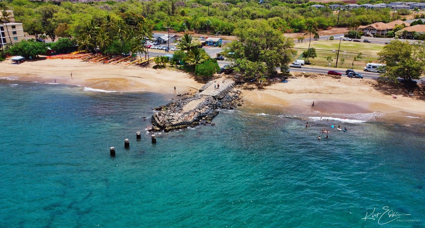
County planning records describe a Kīhei–Mākena coast shaped by fishing villages, fishponds, fishing shrines, heiau, shelters, and anchialine ponds. The 1979 ramp study also recorded archaeological features near the project area. Its construction footprint was only one part of a wider cultural landscape.
During the nineteenth century, South Maui landings moved agricultural goods and passengers. An early-twentieth-century government landing at Keawakapu joined older facilities at Kalepolepo, Kīhei, and Mākena. Kīhei Wharf served plantation shipping and helped anchor the community that grew around it, while the Keawakapu landing helped shift shipping away from Mākena.
After World War II, the demand changed. Rising leisure time and ownership of smaller fiberglass and trailerable boats transformed recreational boating across Hawaiʻi. By 1961, the state counted nearly 6,000 small boats, about 90 percent of them recreational. Kīhei’s exposed launches and limited parking were no longer enough.
-
Before modern landings
A Hawaiian coastal system
Fishing, gathering, settlement, fishponds, and canoe travel connect communities to the sea.
-
Early 1900s
Landings link the dry coast
Kīhei Wharf and a government landing at Keawakapu serve a changing agricultural and interisland economy.
-
1938
Boaters ask for protection
A petition to the Harbor Board records demand for a protected Kīhei mooring site.
-
1947
A harbor appropriation stalls
The legislature appropriates money for a Kīhei small-boat harbor, but dredging funds remain a barrier.
-
Postwar decades
Trailerable boats multiply
Recreational boating grows rapidly, increasing pressure for safer, more practical public launches.
Planning · Resorts · Population
The ramp arrived while South Maui was being remade
The Keawakapu launch was planned against a backdrop of extraordinary change. Resort construction, new homes, and a rising visitor economy made public shoreline access more valuable—and more contested.
A public facility in a fast-growing district
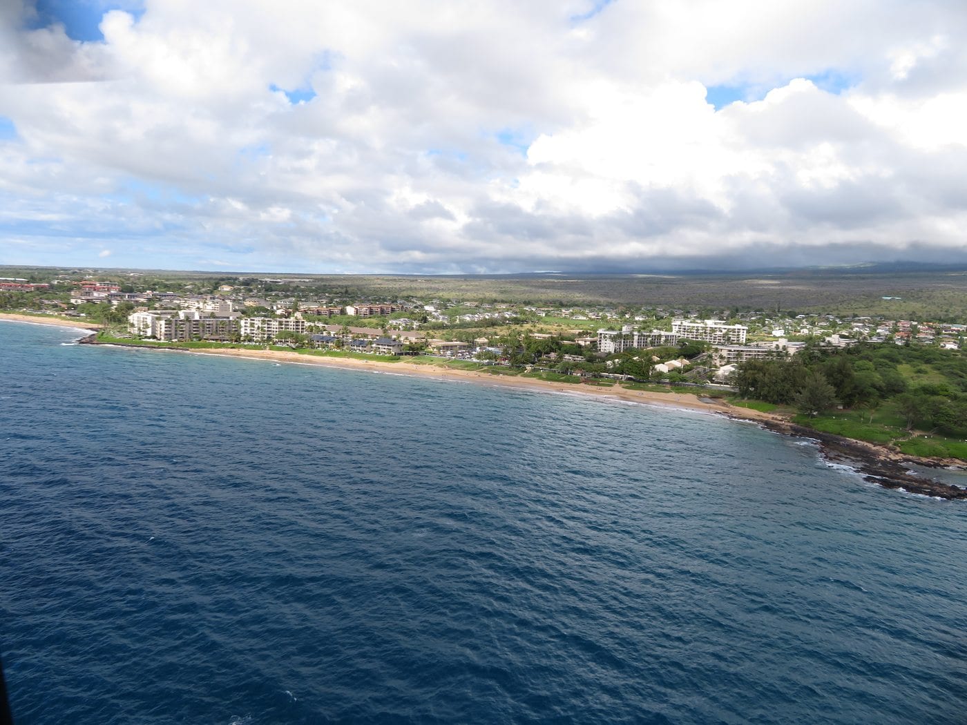
In 1970, the Kīhei district had 1,636 residents. The 1979 environmental statement said most year-round housing had been occupied only since 1968 and described “tremendous growth” as apartments and resort development spread around Kamaʻole. The County’s later community plan reports that the Kīhei–Mākena region reached 7,263 residents in 1980 and 15,365 in 1990.
The state’s 1979 plan proposed a double-lane ramp, loading docks, 39 car-and-trailer spaces, washdown and maneuvering areas, a protective breakwater and groin, utilities, and room for two future lanes. State property records date construction of the launching facilities to 1983.
The facility expanded into the three-ramp, two-dock launch DLNR lists today. Its infrastructure still needs care: a 2017 project rebuilt pavement, drainage, and washdown areas; in 2019, maintenance dredging removed about 4,500 cubic yards from the basin and entrance channel.
-
1970
A small district begins to surge
Kīhei has 1,636 residents as resort and apartment development accelerates.
-
1979
The final environmental statement is issued
A revised final environmental statement weighs launch demand, shoreline engineering, marine life, archaeology, and alternate sites.
-
1983
The initial launch facility is completed
State records list construction of the boat-launching facilities at a cost of $982,000.
-
2017–2019
Paving, drainage, and dredging
Major maintenance projects improve the ramp head, washdown system, access roads, and entrance channel.
-
Today
Ocean access amid a larger town
The Kīhei census-designated place had 21,423 residents in 2020, and the launch remains a working public connection to South Maui waters.
What you are seeing
Four clues at the water’s edge
The ramp looks practical because it is. Its details explain why this site was chosen, what engineers had to change, and how Kīhei grew around it.
- The protective structuresThe breakwater and groin create a sheltered entrance along a coast otherwise exposed to swell and surge.
- The three concrete lanesThey show how the current facility differs from the original double-lane proposal.
- The resort and neighborhood skylineIt records Kīhei’s change from a sparsely populated rural coast into a much larger community.
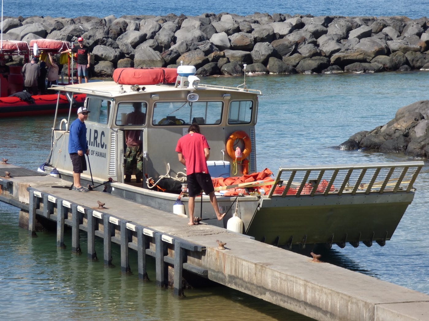
- The working mixFishing boats, commercial operators, recreational crews, and stewardship vessels all depend on the same limited space.
Related Maui history & tours
Follow the connections
Continue with the places and experiences that share this chapter’s roads, water, communities, or working landscapes.
Continue the story
Follow Maui’s working shoreline
Kīhei’s public ramp and Kahului’s commercial harbor answer very different needs. Together, they show how access to the sea shaped modern Maui.
Research notes
Sources & further reading
This account keeps the earlier Kīhei harbor proposals distinct from the present Keawakapu ramp and uses population figures only with their original geographic labels.
- Hawaiʻi DOT: 1979 Kīhei Boat Launching Ramp Final EIS (PDF) (opens in a new tab)
- Hawaiʻi DLNR: History of Recreational Boating in Hawaiʻi (opens in a new tab)
- Maui County: Kīhei–Mākena Community Plan (PDF) (opens in a new tab)
- Maui County: Maui Island Plan heritage resources (PDF) (opens in a new tab)
- Hawaiʻi DLNR DOBOR: State boating property inventory (PDF) (opens in a new tab)
- Hawaiʻi DLNR: 2017 paving and drainage improvements (opens in a new tab)
- Hawaiʻi DLNR: 2019 maintenance dredging (opens in a new tab)
- Hawaiʻi DLNR DOBOR: Current Kīhei Ramp facilities (opens in a new tab)
- U.S. Census Bureau QuickFacts: Kīhei CDP (opens in a new tab)