
Maui History Series · Honuaʻula
Keoneʻōʻio: The Hawaiian Bay Behind “La Pérouse”
Before French charts supplied another name, Keoneʻōʻio was a Hawaiian fishing and farming community. Its lava, road, ranch landing, and conservation boundaries record centuries of adaptation—not an empty wilderness.
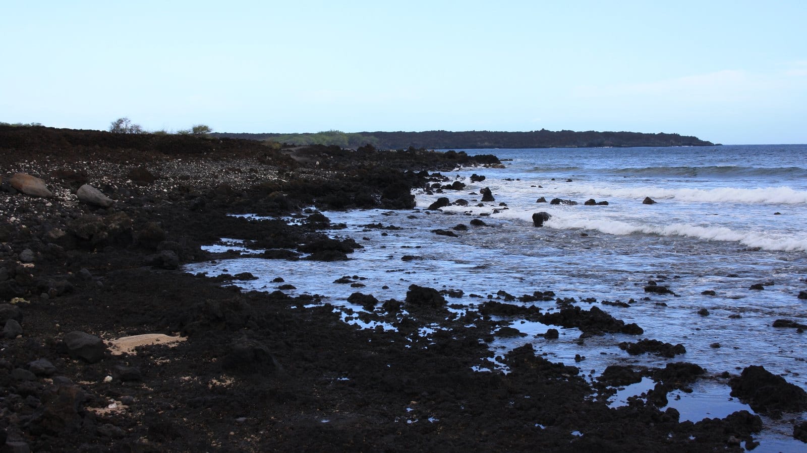
Follow the coast through timePhoto: Harrias source (opens in a new tab) · CC BY-SA 3.0 license (opens in a new tab) · cropped and resized; derivative shared under CC BY-SA 3.0
A Hawaiian place with a later foreign name
The story does not begin with La Pérouse
The map often labels this shore La Pérouse Bay, but its official Hawaiian name is Keoneʻōʻio. State cultural studies connect the name with ʻōʻio, the Hawaiian bonefish once associated with the bay. The place lies in Honuaʻula, one of Maui’s driest regions.
Archaeologists working for the State concluded that permanent settlement was probably established by about AD 1400, while seasonal use of the coast’s rich marine resources may have begun earlier. That conclusion partly draws on dated neighboring settlements, so it is a careful regional inference—not an exact founding date for one village.
Village, volcano and voyage
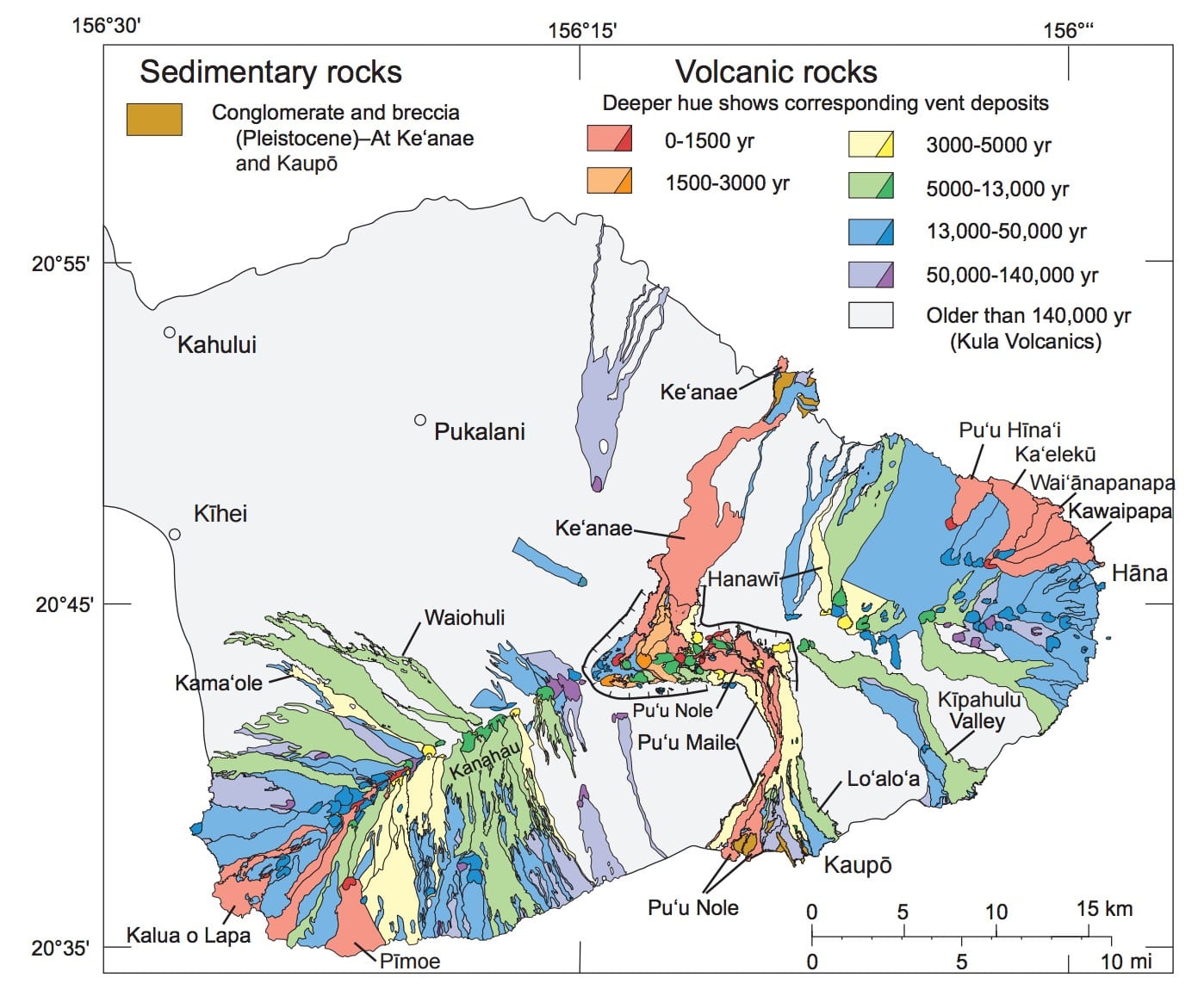
A community lives beside one of Haleakalā’s youngest lava flows
The black coast is young in geologic time, but neither the lava nor La Pérouse’s visit marks the beginning of human history here.

Marine abundance and scarce freshwater shape settlement
Keoneʻōʻio’s coast offered fish and other marine foods, while families cultivated ʻuala in pockets of older soil called kīpuka and connected with wetter planting lands upslope. Running water was absent along much of the shore. La Pérouse later described shallow wells yielding brackish water—evidence of adaptation to scarcity, not an uninhabitable landscape.
The State’s archaeological review identifies homes, paths, fishing areas, agricultural features, gathering places, and religious sites across the broader cultural landscape. Their locations do not belong in a visitor guide. The history is most respectful when it explains relationships rather than turning sites into a checklist.
The lava flow was not from 1790
For decades, guidebooks and signs repeated that the Kalua o Lapa eruption occurred around 1790. That date relied largely on comparing La Pérouse’s 1786 chart with George Vancouver’s 1793 chart. USGS later concluded that the maps were not accurate enough to establish an eruption between those voyages.
Radiocarbon evidence now places the flow between AD 1420 and 1620. USGS also emphasizes that nineteenth-century oral accounts suggesting a later eruption remain an important part of the record. The responsible conclusion is not that one kind of evidence erases another; it is that the current geologic age range is older than the familiar 1790 story.
What La Pérouse actually encountered
In 1786, the ships Boussole and Astrolabe anchored off Keoneʻōʻio. La Pérouse did not “discover” an unoccupied bay. Hawaiians brought hogs, ʻuala, bananas, taro, and kapa to the ships, and his account described four villages of roughly ten to twelve thatched houses each.
The value of the European account is that it provides one written snapshot of a Hawaiian community already present. “La Pérouse Bay” is a later foreign name layered onto Keoneʻōʻio—not the beginning of the place’s history.
-
By about AD 1400
Permanent settlement is considered likely
State archaeologists make a careful regional inference from neighboring dated sites and the Keoneʻōʻio landscape.
-
AD 1420–1620
Kalua o Lapa reaches the coast
The current USGS radiocarbon range replaces the old 1790 claim.
-
1786
La Pérouse anchors offshore
His written account records four Hawaiian villages and active exchange with the ships.
Road, ranch and reserve
Population change and new economies remake a remote working coast
A government road, ranch landing, wartime activity, tsunami, paved access, and conservation rules each left a different layer on Keoneʻōʻio.
A road follows a coast already crossed by trails
Between 1823 and 1840, a coastal government road was developed under Governor Hoapili to connect Honuaʻula with lands toward Kaupō. Portions of today’s Hoapili Trail and South Mākena road network may follow that alignment, but older Hawaiian paths, later road work, ranch trails, walls, and modern repairs overlap.
Honuaʻula’s recorded population fell sharply during the nineteenth century: early counts list 3,340 people in 1831 and 1,911 only five years later. State researchers caution that early census figures are imperfect, but disease, migration, and changing economic systems clearly transformed the district. A government school at Keoneʻōʻio in 1865 served children from fishing and ranch-laboring families.
A ranch landing gives the bay an industrial role
In 1901, Rose Ranch owner J. H. Raymond built a boat landing, slaughterhouse, and cold-storage facility at Keoneʻōʻio. The operation connected the remote coast with Maui’s cattle economy for nearly thirty years. Processing later shifted upslope and toward Kahului.
Stone walls, road alignments, and other visible features do not all belong to the same era. Some relate to Hawaiian settlement and travel; others record government construction, ranching, or twentieth-century work. No single label should be applied without evidence.
War, tsunami and severe weather expose the coast
During World War II, the military practiced amphibious landings around Mākena. Local informants quoted in an official archaeological study recalled two buildings and a concrete ramp at Keoneʻōʻio; the same study says those structures apparently did not survive the 1946 tsunami. Both details remain attributed recollections rather than independently confirmed site claims.
This dry landscape can still receive damaging rain in a short period. Heavy weather, surf, storm surge, hurricanes, and tsunamis can damage the narrow road and shoreline. County and State records also show a long-running division of maintenance responsibilities, so a road’s presence does not guarantee simple ownership, repair, or access.
Pavement brings visitors; conservation rules answer the pressure
ʻĀhihi-Kīnaʻu became Hawaiʻi’s first designated Natural Area Reserve in 1973. Paving the road in the 1990s transformed the coast into an easier drive-to destination. A State-cited 2001 count recorded as many as 805 people and 339 vehicles in one day.
Trampling, informal trails, off-road driving, and damage to cultural and natural resources followed. In 2008, most reserve land closed to general recreation. Modern parking, fees, signs, water rules, and closed areas are the latest historical layer—not an inconvenience separate from the story.
-
1823–40
A government road crosses the coast
Hoapili-era work adds a new transportation layer over older Hawaiian routes.
-
1831–65
Population and work change
Recorded population falls; a government school later serves fishing and ranch families.
-
1901–about 1930
Rose Ranch works from the landing
A boat landing, slaughterhouse, and cold storage connect cattle country to the sea.
-
1940s
War and tsunami alter the shore
Official study records local recollections of military-era features and their apparent loss in 1946.
-
1973
The natural-area reserve is established
ʻĀhihi-Kīnaʻu begins a new conservation chapter.
-
1990s–2008
Paving increases pressure
Easier road access precedes heavy use and broad land closures for protection.
What guests can notice
Read visible layers without leaving public routes
The coastline itself holds the strongest context. Never cross barriers, enter a closed area, or handle cultural or natural material to understand it.
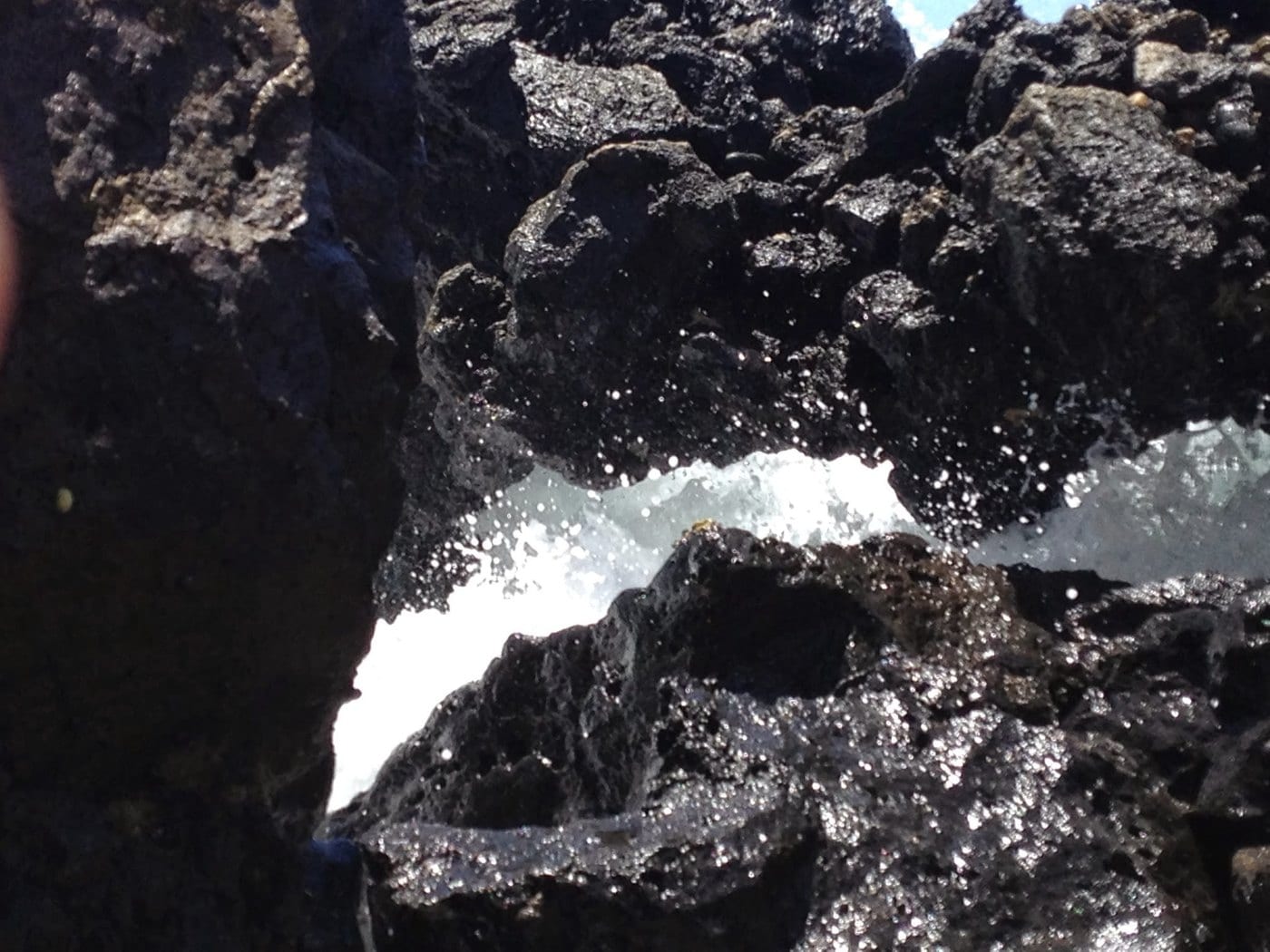
- Black ʻaʻāYoung geologically, but not from 1790. Use the USGS range of AD 1420–1620.
- Green kīpukaVegetated pockets can mark older surfaces or soil islands within younger lava, helping explain cultivation and grazing.
- A bay without a streamThe setting shows how communities combined marine abundance, brackish groundwater, dryland crops, and connections upslope.
- Roads and wallsOlder trails, government construction, ranch walls, and modern repairs overlap; not every stone alignment is from one era.
- Signs and closed areasModern boundaries record the conservation response to roads and mass visitation.
Related Maui history & tours
Follow the connections
Continue with the places and experiences that share this chapter’s roads, water, communities, or working landscapes.
Continue the series
Follow Honuaʻula from ranch slopes to public shore
Upcountry ranch history and Kīhei’s boat ramp show two other ways land, roads, and the ocean economy connect South Maui.
Research notes
Sources & further reading
The settlement and access story relies on State cultural and environmental studies; the lava date uses current USGS research. Conditions were checked August 20, 2026, when Hoapili and Ke Ala Loa O Maui/Piilani trails remained closed after Tropical Storm Lala.
- Hawaiʻi DLNR: ʻĀhihi-Kīnaʻu Natural Area Reserve Management Plan (PDF) (opens in a new tab)
- State of Hawaiʻi: ʻĀhihi-Kīnaʻu parking and cultural-history Draft EA (PDF) (opens in a new tab)
- U.S. Geological Survey: geology and history of Haleakalā (opens in a new tab)
- USGS Hawaiian Volcano Observatory: why the youngest East Maui flows predate 1790 (opens in a new tab)
- Hawaiʻi Board on Geographic Names: official Maui spellings (PDF) (opens in a new tab)
- Hawaiʻi DLNR: current ʻĀhihi-Kīnaʻu visitor information and activity map (opens in a new tab)
- Hawaiʻi DLNR Division of Aquatic Resources: reserve-water regulations (opens in a new tab)
- Hawaiʻi Trails: live State trail closures and notices (opens in a new tab)
- Nā Ala Hele: Hoapili Trail information sheet (PDF; fishing language may be outdated) (opens in a new tab)
- County of Maui: Keoneʻōʻio road-maintenance memorandum and report (opens in a new tab)
- Hawaiʻi DLNR: August 14, 2026 Tropical Storm Lala lands closure notice (opens in a new tab)
- County of Maui: current emergency road closures (opens in a new tab)