
Maui History Series · East Maui
Hāna Ranch: Sugar Fields, Cattle and a Working Landscape
The ranch story did not begin with an empty pasture. Hawaiian cultivation and community life, plantation sugar, a wartime sale, postwar tourism, and working cattle all shaped the land seen around Hāna today.
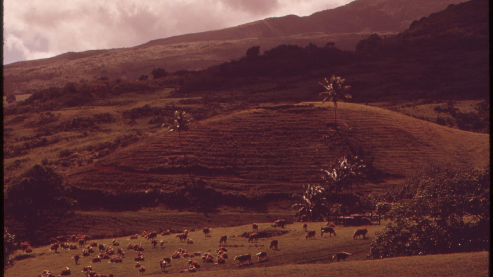
Trace the land through timePhoto: Charles O’Rear / U.S. EPA DOCUMERICA, National Archives source (opens in a new tab) · public domain U.S. federal work license (opens in a new tab) · cropped and resized
A ranch layered over older land histories
Hāna Ranch belongs to a living Hawaiian landscape
Long before a company used the Hāna Ranch name, East Maui families farmed, fished, gathered, traveled, and maintained relationships across ahupuaʻa. State cultural research at Wākiu records continuing family ties and food practices that survived major changes in land tenure and land use.
Sugar plantations reorganized much of the district during the nineteenth century. Paul Fagan’s 1944 purchase of roughly 14,000 plantation acres then shifted former cane land toward cattle and helped launch a postwar ranch-and-hotel economy. The present ranch is a smaller working property within that longer history, not the beginning or entirety of Hāna’s relationship with the land.
Hawaiian land use to plantation sugar
Fields, water and ownership change before cattle dominate the view
The open pasture seen today followed generations of Hawaiian food production and nearly a century of commercial sugar development.
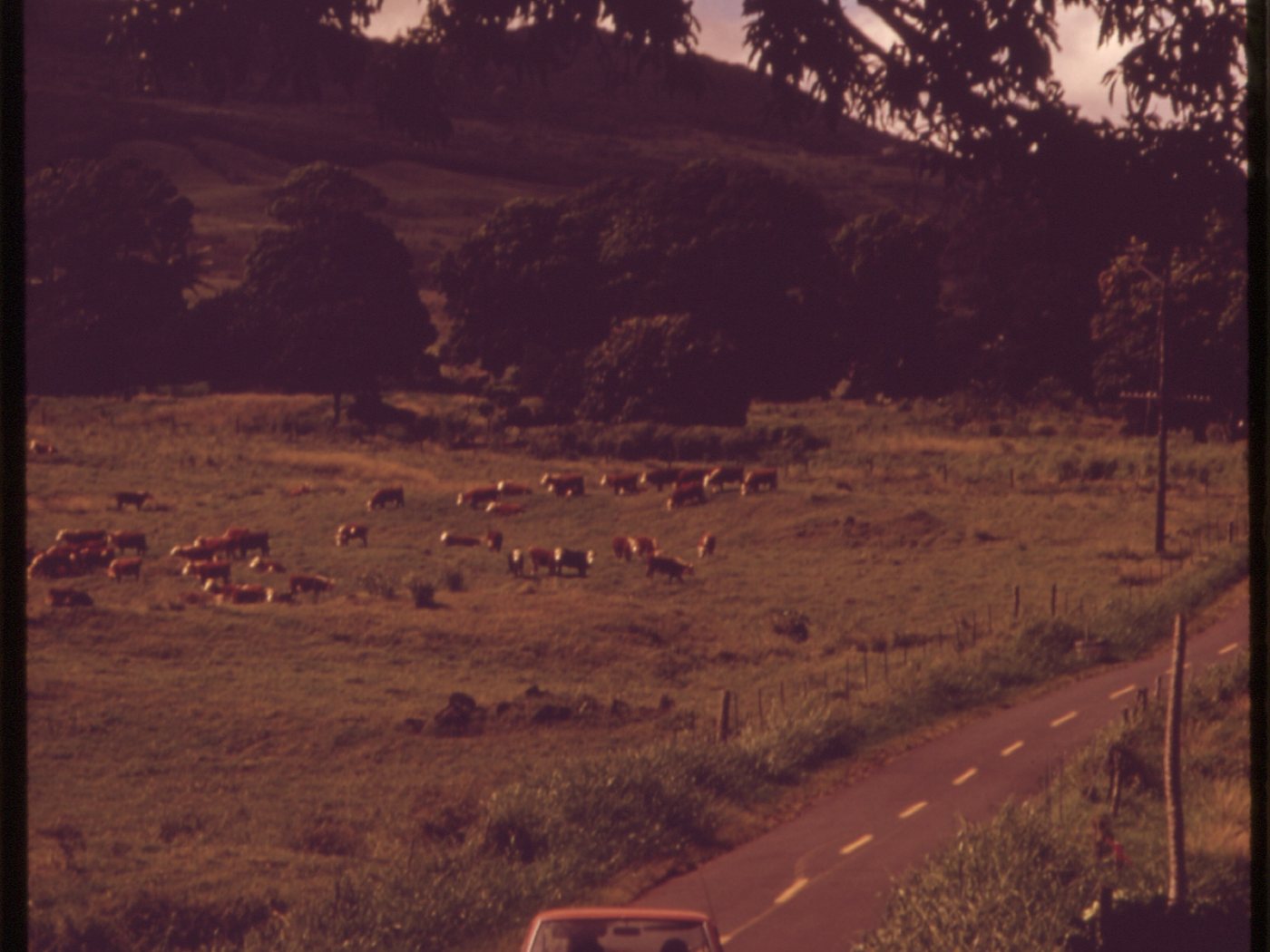
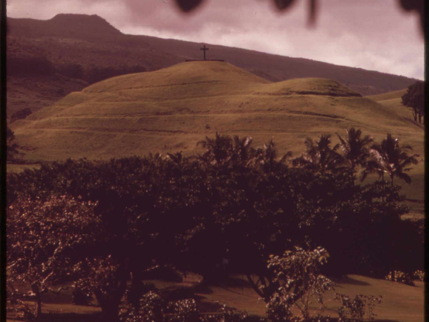

A cultivated Hawaiian landscape before plantation boundaries
Hāna’s wet climate supported kalo, ʻulu, maiʻa, ʻuala, and other foods within an economy tied to family, exchange, fishing, and seasonal knowledge. Cultural work for the Department of Hawaiian Home Lands at Wākiu documents Native Hawaiian families maintaining those relationships through plantation and ranch eras.
That continuity matters because later histories often begin with commercial acreage. Ranch roads and pasture fences sit within named ahupuaʻa and communities whose histories do not disappear when land use changes.
Sugar redraws the district
The first documented sugar mill in Hāna dates to 1849, and Hāna Plantation or Kaʻeleku Sugar Company followed in 1851. By 1883, six plantations operated in the district. Mills, irrigation, labor camps, land consolidation, and coastal shipping tied Hāna more tightly to a cash economy.
That growth also displaced and constrained Hawaiian agricultural and cultural landscapes. The concrete wharf completed in 1921 and the Hāna Belt Road connection completed in 1926 were transportation layers of the plantation era, even though the road eventually helped weaken the wharf’s passenger role.
A 1944 sale begins the modern ranch chapter
During World War II, California businessman Paul Fagan purchased roughly 14,000 acres of Hāna Plantation land. State environmental research and the ranch’s own history say he brought cattle from Molokaʻi and converted former cane fields into the beginnings of Hāna Ranch.
This is a wartime ownership and land-use transition, not evidence that the ranch itself was a military base. Cane land became initial pasture; later grass planting and clearing altered the visual landscape further.
-
Before plantations
Families cultivate and gather across Hāna
Food production, fishing, travel, and cultural responsibility organize the landscape.
-
1849–51
Commercial sugar takes hold
A first mill and then a plantation enterprise begin a major land-use shift.
-
By 1883
Six plantations operate
Commercial sugar, labor, water, and shipping reshape the district.
-
1921–26
Wharf and highway change transport
A concrete freight pier and the belt-road connection link Hāna in new ways.
-
1944
Fagan buys plantation acreage
A wartime sale starts the modern Hāna Ranch chapter on former cane land.
Postwar ranch, hotel and community
Sugar closes as cattle and tourism move forward together
Late 1945 through 1946 marks an unusually sharp economic turn: Kaʻelekū sugar ended while a new hotel opened and ranching expanded.
A postwar pivot, not a clean break
Kaʻelekū ceased sugar operations and liquidated in late 1945; some sources frame Hāna’s plantation era as ending by 1946. In 1946, Fagan opened Kaʻuiki Inn, later associated with Hotel Hāna-Maui, while the ranch grew as another major employer. Plantation skills, housing patterns, roads, and family histories did not vanish when cane production ended.
The 1947 Wākiu subdivision, created with twenty-nine roughly one-acre parcels, records one post-plantation housing response. At the same time, cattle, hotel work, small business, farming, fishing, and informal exchange helped diversify Hāna’s economy.
Tourism grows around a working district
The hotel and the increasingly famous road brought visitor spending, but they did not turn Hāna into a resort landscape without residents. County economic planning still describes a rural, geographically isolated community whose livelihoods include agriculture, visitor services, subsistence, and barter.
Ranch scenery became part of the visitor image of Hāna. That image can obscure labor, private property, and older Hawaiian relationships to the land unless those stories remain visible.
A smaller working ranch in the twenty-first century
In January 2014, Hāna Ranch Stewards LLC purchased the principal mauka ranch property, which the company describes as approximately 3,600 acres, together with cattle and water-utility interests. That is much smaller than the roughly 14,000 acres involved in the 1944 purchase.
The acreage difference is a reminder not to project one historic boundary onto every present field. Ownership, leases, subdivisions, conservation decisions, and community use have changed across time.
-
1945–46
Sugar ends and Kaʻuiki Inn opens
Hāna pivots toward ranch, hospitality, and a more diversified postwar economy.
-
1947
Wākiu lots create new housing
A twenty-nine-lot subdivision responds to post-plantation community change.
-
1960s
Pasture conversion continues
State research documents additional clearing and grass planting at Wākiu.
-
1973
Federal photographs record working land
DOCUMERICA frames cattle, roads, pasture, and community together.
-
January 2014
A 3,600-acre ranch changes hands
Hāna Ranch Stewards acquires the main mauka working property.
What guests can notice
Read working land without crossing its boundaries
From public roads and authorized stops, ordinary features reveal how Hawaiian cultivation, sugar, cattle, water, and tourism became layered across Hāna.
- Field shapes and gradesSome pasture follows land previously cleared or organized for cane, but not every open field has the same history.
- Fences, gates and cattleThese are active agricultural infrastructure and clear reminders that the landscape is private working land.
- Water and vegetationWet windward conditions support lush growth, while drainage, introduced grass, and water management shape pasture.
- Town, bay and pasture togetherThe ranch economy never existed apart from Hāna’s homes, shoreline, roads, businesses, and community labor.
Related Maui history & tours
Follow the connections
Continue with the places and experiences that share this chapter’s roads, water, communities, or working landscapes.
Continue the series
Follow Hāna from working land into town
Hāna Town shows how plantation closure, ranching, the road, and visitor travel became part of one living community.
Research notes
Sources & further reading
This chapter distinguishes the roughly 14,000-acre 1944 plantation purchase from the approximately 3,600-acre present ranch and dates its access snapshot to August 20, 2026. Acreage, road status, operations, and property rules can change; verify current information before relying on it.
- Hāna Ranch: official company history and current ranch description (opens in a new tab)
- Department of Hawaiian Home Lands: Wākiu Master Plan Final EA and cultural assessment (PDF) (opens in a new tab)
- Waiʻānapanapa State Park Master Plan appendices: Hāna cultural and plantation chronology (PDF) (opens in a new tab)
- State of Hawaiʻi: Hāna Airport improvements Final EA and plantation-liquidation chronology (PDF) (opens in a new tab)
- State of Hawaiʻi: Hāna Pier Final EIS, plantation and transportation history (PDF) (opens in a new tab)
- County of Maui: Hāna Community Plan (PDF) (opens in a new tab)
- Maui County Comprehensive Economic Development Strategy (PDF) (opens in a new tab)
- Library of Congress HAER: Hāna Belt Road and Hāna Bay documentation (opens in a new tab)
- National Archives: 1973 Hāna agricultural-land DOCUMERICA photograph (opens in a new tab)
- Hawaiʻi Board on Geographic Names: official Maui spellings (PDF) (opens in a new tab)
- Hawaiʻi Department of Transportation: current weather and road status (opens in a new tab)