

Maui History Series · Koʻolau, East Maui
Keʻanae: Kalo, Community, and a Peninsula Shaped by Water
Keʻanae is not simply a turnoff on the Road to Hāna. It is a living Hawaiian community whose loʻi, ʻauwai, church, school, shoreline, and family lands hold a much longer story.
Follow Keʻanae through timePhoto: Navin75 source (opens in a new tab) · CC BY-SA 2.0 license (opens in a new tab) · cropped and resized; derivative shared under CC BY-SA 2.0
A community, not a roadside attraction
The cultivated landscape is the history
Keʻanae and neighboring Wailuanui form one of East Maui’s best-known wetland kalo-growing landscapes. Streams descend from the wet Koʻolau slope, while generations of ʻauwai carry water through loʻi and back toward lower channels and the sea. The system is cultural infrastructure: it reflects labor, family continuity, food production, and relationships to wai that long predate the modern highway.
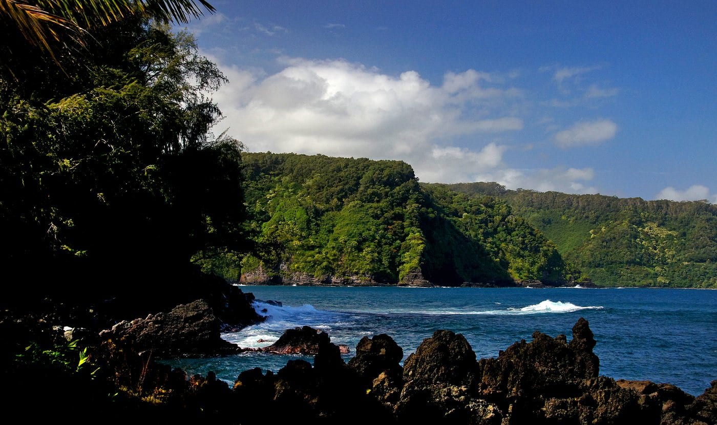
The peninsula also contains homes, farms, a church, a former school, a County park, and a rugged shoreline. Those uses overlap visually but not legally. A view from a public road or park does not make a loʻi, churchyard, driveway, or agricultural lane public access.
Wai, ʻāina, and community institutions
Loʻi connect the valley, peninsula, and sea
Keʻanae’s history is clearest when water, cultivation, family lands, worship, and education are read as parts of one community landscape.
Kalo cultivation is a present tense
County planning and cultural records describe Keʻanae and Wailuanui as important centers of wetland kalo cultivation. The loʻi are not surviving scenery from a vanished period: families continue to cultivate, repair ʻauwai, and pass knowledge between generations.
Water moves through a social system as well as a hydrologic one. Traditional and customary practices, domestic needs, stream habitat, downstream ecosystems, and offstream diversions all depend on the same rain-fed slope. That is why East Maui water decisions remain part of Keʻanae’s history rather than a separate modern issue.
Church and school become community anchors
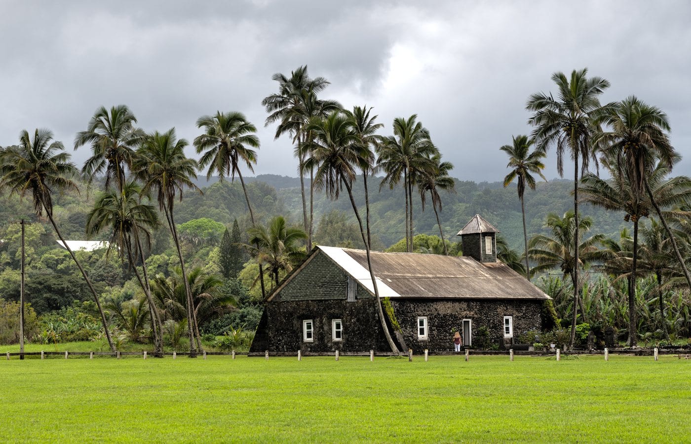
The stone Congregational church was completed in 1860 with local labor and materials. Its Hawaiian name and continued community role matter more than the familiar visitor shorthand “the church that survived.” The building belongs to a living congregation and cemetery landscape.
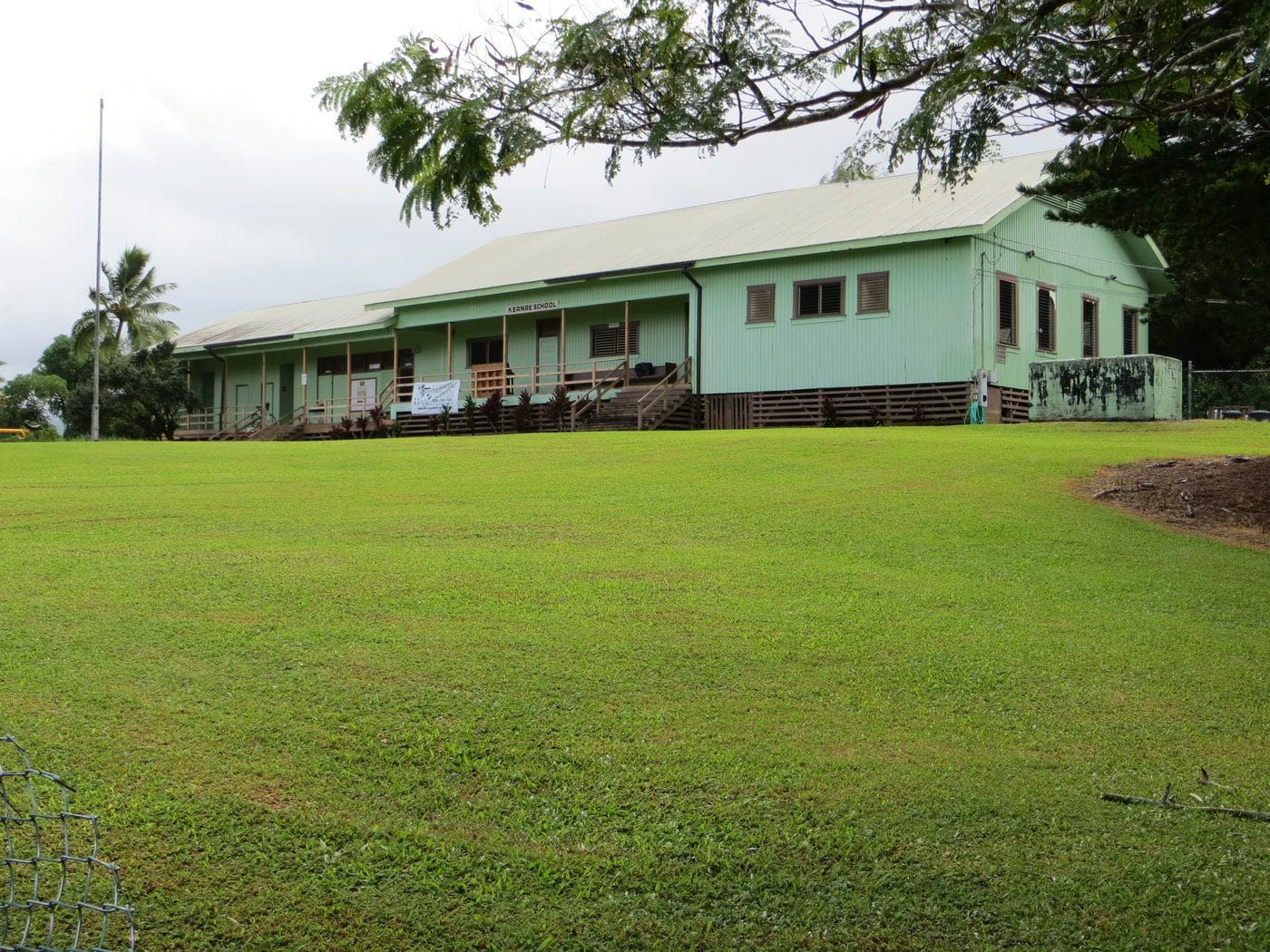
The small wooden Keʻanae School dates to the early twentieth century and is listed for its local educational and architectural significance. National Register records identify 1912–1950 as its formal period of significance, while a 2009 legislative resolution records continued use until the remaining pupils left in fall 2005. Sources differ over whether to call its final arrangement one-room or its historic form two-room, so this chapter uses the accurate broader description: a small rural vernacular school.
Plantation water reaches farther than plantation fields
Unlike districts dominated by large sugar fields, much of Koʻolau retained small landholdings and wetland kalo. Plantation-era change nevertheless reached Keʻanae through ditch construction and the export of stream water toward Central Maui and Upcountry.
That distinction is important: Keʻanae does not need an invented sugar mill or plantation camp to fit Maui’s plantation storyline. Its history shows how the plantation economy could reshape a community through water infrastructure even where family cultivation endured.
-
Before Western contact
Communities cultivate with stream water
Loʻi and ʻauwai connect food production, family labor, and the wider ahupuaʻa.
-
Mid-1800s
Land tenure and mission life change
New property systems and Congregational institutions enter an established Hawaiian community.
-
1860
The stone church is completed
Lanakila ʻIhiʻihi o Iēhowa Ona Kaua becomes a lasting community landmark.
-
1912
The historic school period begins
A small vernacular school serves children and community life along the future highway corridor.
-
1926
The belt road links the district
Road travel changes movement between Keʻanae, Hāna, and Central Maui.
-
April 1, 1946
A tsunami devastates the peninsula
The disaster destroys homes and reshapes the community; the stone church remains standing.
After the tsunami
Rebuilding carries memory into the present
The modern chapter is not a story of replacement. It is one of families rebuilding, maintaining cultivation, caring for institutions, and negotiating heavier visitor traffic.
The 1946 disaster cannot be reduced to one surviving building
The April 1, 1946 Aleutian tsunami struck Hawaiʻi without today’s warning system and caused severe damage along exposed north and east shores. Official Maui records confirm major effects at Keʻanae. This chapter does not repeat a precise local death toll because published accounts conflict over whether their totals refer to the peninsula, a wider district, or all of East Maui.
The church’s survival is visually powerful, but the more important story is what followed: families recovered, homes and farms were rebuilt, cultivation continued, and community memory remained attached to the whole peninsula.
A historic school closes, but community history continues
Keʻanae School entered the Hawaiʻi Register in 1992 and the National Register in 2000. Its remaining students left in fall 2005, ending nearly a century of classroom use documented by the Legislature.
The old school’s significance is local rather than monumental. It records what education looked like in a geographically isolated community and why one small building could also function as a meeting place and rallying point.
Restoring ʻauwai is future work as well as preservation
In January 2026, the County’s East Maui Water Authority selected a Nā Moku ʻAupuni ʻO Koʻolau Hui project to restore loʻi and ʻauwai in Keʻanae. The grant describes food sovereignty, cultural continuity, and ecological health as connected outcomes.
That project offers the right endpoint for this history: Keʻanae is not frozen in 1860, 1926, or 1946. Its cultural landscape remains active because people keep doing the work.
-
1992
The school enters the Hawaiʻi Register
The small rural building gains state historic recognition.
-
2000
National Register listing follows
Federal documentation recognizes its local educational and architectural significance.
-
Fall 2005
Classroom use ends
The remaining pupils leave, while the building’s community meaning continues.
-
2026
Loʻi and ʻauwai restoration advances
A County-supported project connects water infrastructure, cultural continuity, ecology, and food.
What guests can notice respectfully
Let public viewpoints explain the place
Keʻanae’s strongest story does not require entry onto family land. Its relationships can be understood from the County park and public roads.
- Water below the roadChannels and loʻi show how gravity carries stream water through cultivated ground.
- Compact settlementHomes, fields, church, school, road, and shore sit close together because the usable peninsula is limited.
- Stone churchIts mass and materials help explain survival, but respect worship and cemetery space.
- Exposed shorelineJagged lava and breaking waves explain both the beauty of the peninsula and its tsunami and surf risk.
Related Maui history & tours
Follow the connections
Continue with the places and experiences that share this chapter’s roads, water, communities, or working landscapes.
Continue the series
Follow water and transportation across East Maui
Twin Falls introduces the Hoʻolawa watershed, while Hāna Harbor shows how a remote district connected to interisland travel and plantation freight.
Research notes
Sources & further reading
This chapter treats Keʻanae as a living community, not a scenic relic. Current park details were checked August 20, 2026. Historical sources conflict on the exact 1946 local casualty count and on one-room versus two-room descriptions of the school, so neither disputed detail is presented as settled fact.
- County of Maui: Hāna Community Plan and Keʻanae kalo landscape (PDF) (opens in a new tab)
- County of Maui / Kumu Pono Associates: Maui Hikina cultural research (PDF) (opens in a new tab)
- County of Maui / Kumu Pono Associates: East Maui oral histories (PDF) (opens in a new tab)
- Commission on Water Resource Management: Keʻanae landscape, church, landing, and water context (PDF) (opens in a new tab)
- State of Hawaiʻi: Kolea Reservoir Removal Final Environmental Assessment—1946 tsunami and church survival (PDF) (opens in a new tab)
- United Church of Christ: current Keanae Congregational UCC directory (opens in a new tab)
- County of Maui: current Keanae County cemetery listing (opens in a new tab)
- National Park Service: Keanae School National Register record (PDF) (opens in a new tab)
- Hawaiʻi Legislature: Keanae School history and 2005 closure (opens in a new tab)
- County of Maui Cultural Resources Commission: Keʻanae and the 1946 tsunami (meeting record) (opens in a new tab)
- Hawaiʻi Emergency Management Agency: tsunami history and safety (opens in a new tab)
- County of Maui: current Keʻanae Park hours, amenities, and shoreline guidance (opens in a new tab)
- County of Maui East Maui Water Authority: 2026 Keʻanae loʻi and ʻauwai restoration grant (opens in a new tab)
- Hawaiʻi Board on Geographic Names: official Maui spellings (PDF) (opens in a new tab)