
Maui History Series · North Shore
Pāʻia Town: Water, Sugar and a Main Street That Endured
Pāʻia became a plantation mill town through East Maui water, rail and harbor connections—then survived the mill by carrying its community life into a different economy.
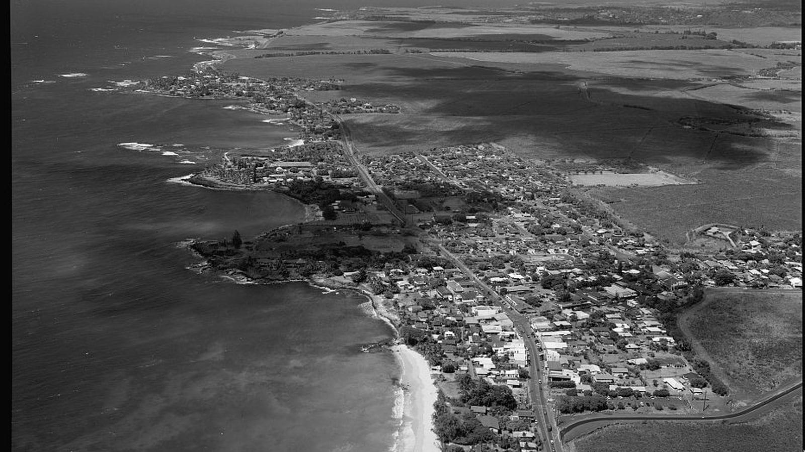
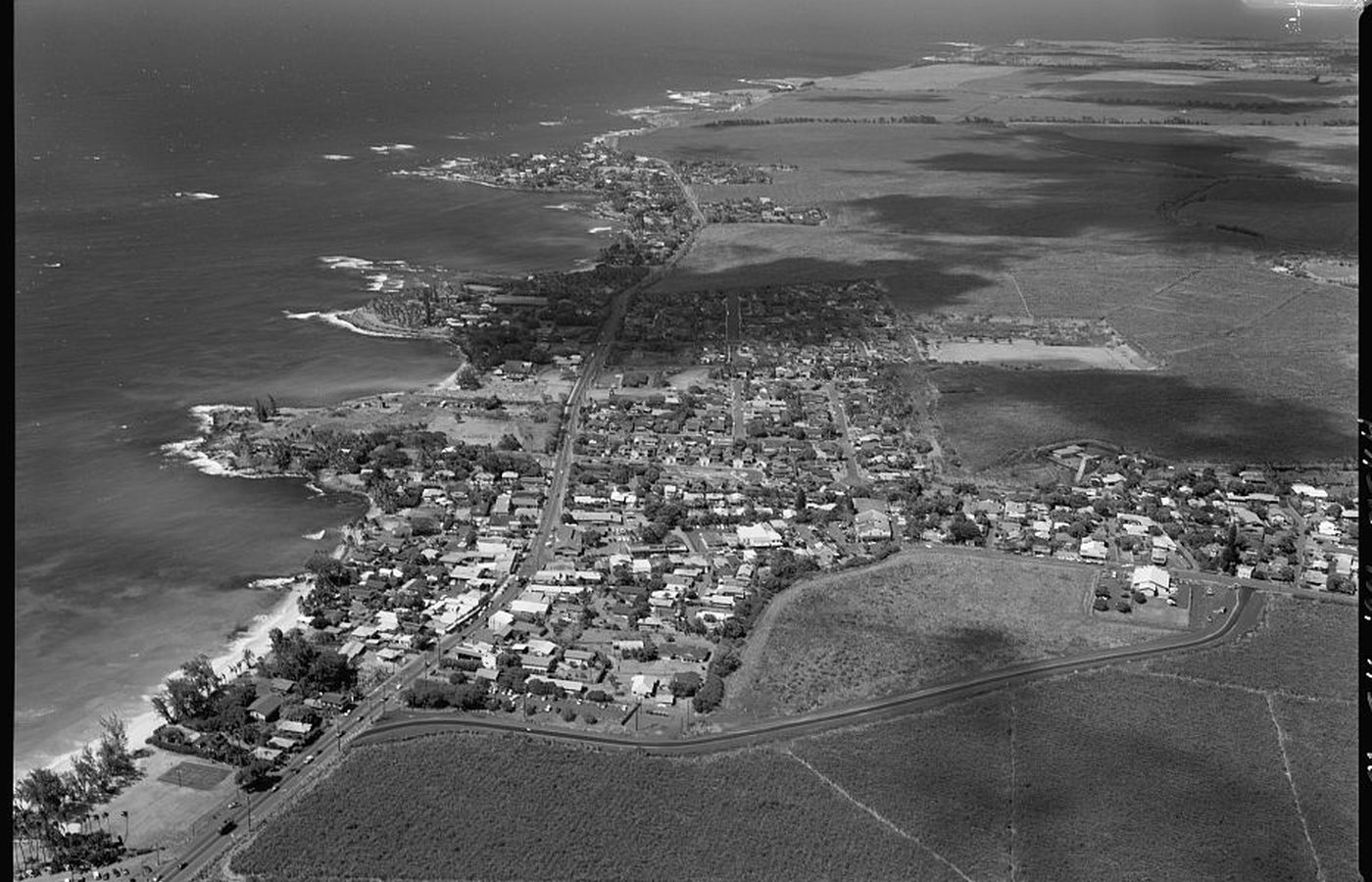
Follow the town uphill through timePhoto: Jet Lowe / Historic American Engineering Record, Library of Congress source (opens in a new tab) · public domain U.S. federal work license (opens in a new tab) · film border removed; cropped, resized and converted
A town where systems meet
The storefronts are only the visible edge of the story
Pāʻia is a Hawaiian place before it is a plantation story. Its shoreline, winds, water, and place names long predate the nineteenth-century companies that built a mill district above the coast. The industrial era did not create the place; it reorganized land, water, work, and transportation around it.
What now feels like a compact North Shore town once connected a much larger machine: East Maui streams and engineered ditches, sugar fields and a mill, plantation camps, rail lines, and the port at Kahului. Hāna Highway later became Pāʻia’s main street, placing local life and through traffic in the same narrow corridor.
Land, water and industry
A plantation town grows around a mill
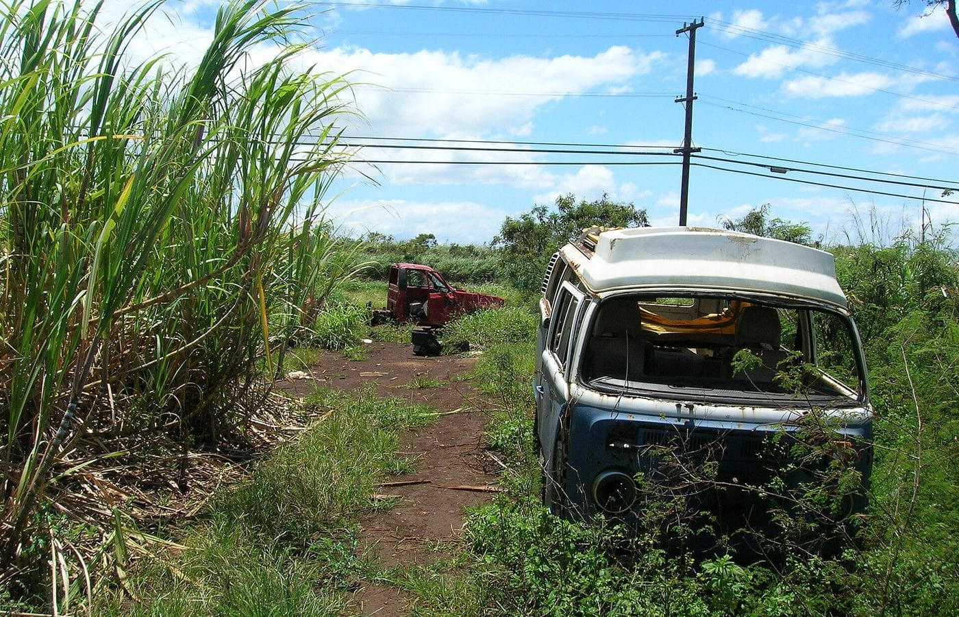
Pāʻia’s sugar economy depended on far more than cane. Water had to cross watersheds, machinery had to process the crop, and rail and harbor facilities had to move the result.
The place precedes the plantation
Pāʻia’s plantation chronology begins with a much older landscape already named, used, and connected to neighboring ahupuaʻa. The surviving business records describe corporate expansion clearly, but they should not be mistaken for the beginning of human history here.
Beginning in 1869, Samuel Alexander and Henry Baldwin accumulated land above Pāʻia. Their Alexander & Baldwin Plantation took shape in 1872, and by 1883 it had consolidated with neighboring operations as the Pāʻia Plantation Company. Those dates mark a new industrial land system, not the origin of Pāʻia itself.
East Maui water makes large-scale sugar possible
Sugar expanded after the 1875 Reciprocity Treaty increased access to the United States market. In 1876, Alexander and Baldwin began the Old Hāmākua Ditch, which became operational in 1878 and carried windward water toward plantations in drier Central Maui.
That plantation conveyance system was different from both the natural streams it intercepted and the smaller Hawaiian ʻauwai that supported communities and loʻi kalo. Pāʻia’s growth therefore belongs inside the larger East Maui water story, including the consequences of moving water away from its source watersheds.
Mill, railroad and harbor work as one system
Maui Agricultural Company was organized in 1903, and milling for Pāʻia Plantation and Haʻikū Sugar was centralized at Pāʻia in 1905. The rail connection to the mill carried sugar toward Kahului Harbor while also moving machinery, fuel, supplies, and people through the plantation district.
Maui Agricultural incorporated and absorbed its constituent plantations in 1921. In 1948 it was absorbed into Hawaiian Commercial & Sugar Company. The names changed, but the town remained tied to an integrated water, field, mill, rail, and harbor economy.
-
1869
Land accumulation begins
Alexander and Baldwin begin assembling plantation lands above Pāʻia.
-
1872
A&B Plantation takes shape
The partners formalize the sugar operation that anchors their Maui business.
-
1876–78
Old Hāmākua Ditch opens
Engineered conveyance begins moving windward water toward plantation lands.
-
1883
Pāʻia Plantation Company forms
The operation consolidates with neighboring plantations.
-
1903–05
Maui Agricultural centralizes milling
A new company structure and Pāʻia mill connect production more tightly to rail and harbor.
-
1921–48
Companies consolidate again
Maui Agricultural incorporates, then becomes part of HC&S after World War II.
Workers, memory and reinvention
The town becomes larger than the company
Plantation management shaped Pāʻia’s built environment, but generations of residents turned that framework into a community whose story continued after industrial sugar processing ended.
Camps and institutions become community
Workers lived in plantation camps organized around the mill and fields. The company’s demand for labor brought families from different countries and islands into close proximity, while residents built social, religious, educational, and mutual-support networks that did not belong solely to the employer.
A state planning study describes Upper and Lower Pāʻia as having more than 5,000 residents at the town’s 1930s–1940s peak. That population helps explain why the surviving street grid, schools, halls, and worship spaces carry histories far larger than today’s storefront district suggests.
Pāʻia sends a national legislator into history
Patsy Matsu Takemoto Mink was born in Pāʻia on December 6, 1927 and graduated from Maui High School in 1944. In 1965 she entered the U.S. House of Representatives as the first woman of color elected to Congress.
Mink helped build support for Title IX and pursued early-childhood education, social welfare, and gender equity. Her life connects a Maui plantation town to national civil-rights and education policy without reducing her achievement to a single piece of legislation.
The mill closes, but the town does not
Postwar housing and employment in Kahului drew population away from plantation Pāʻia. The Pāʻia Sugar Mill finally closed in September 2000, and HC&S consolidated processing at Puʻunēnē. State environmental records show that the former industrial site retained structures as well as contamination questions—another reason it should not be treated as a casual exploration area.
Pāʻia’s later economy emphasized small businesses, dining, arts, beach access, and its position at the threshold of the Hāna corridor. County planning has repeatedly framed the challenge as preserving small-town scale and community character while managing traffic, parking, coastal change, and development pressure.
-
1927
Patsy Takemoto Mink is born
A future national legislator begins life in plantation-era Pāʻia.
-
1930s–40s
The town reaches its population peak
Upper and Lower Pāʻia together hold more than 5,000 residents in a planning-study estimate.
-
1948
Maui Agricultural joins HC&S
Postwar corporate consolidation changes the mill’s ownership structure.
-
1950s
Kahului draws residents away
New opportunities for homeownership help shift Maui’s population center.
-
1965
Mink enters Congress
The Pāʻia-born legislator becomes the first woman of color elected to the U.S. House.
-
September 2000
The Pāʻia mill closes
Sugar processing consolidates at Puʻunēnē, ending the town’s operating-mill era.
What guests can notice
Read the town from public space
Pāʻia’s history is visible in relationships between road, slope, shoreline, town grid, and former industrial land—not through trespassing into private structures.
- Hāna Highway as main streetA regional through-route narrows into the town’s commercial and pedestrian core.
- Baldwin Avenue climbing inlandThe street points from the coast toward the former mill district and plantation landscape.
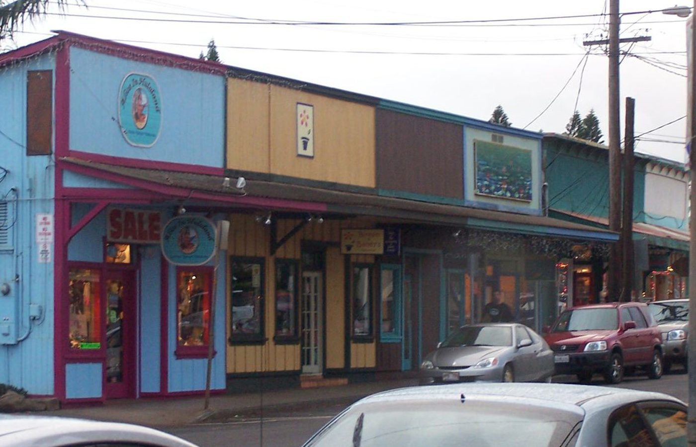
- Small storefront parcelsCompact street frontage preserves a town scale very different from later Central Maui shopping districts.
- Coast beside townSurf, dunes, erosion work, parks, and limited parking show that Pāʻia’s coastal setting is active infrastructure, not a static backdrop.
Related Maui history & tours
Follow the connections
Continue with the places and experiences that share this chapter’s roads, water, communities, or working landscapes.
Continue the series
Follow Pāʻia’s water and shipping connections
The East Maui conveyance system and Kahului Harbor explain how a small coastal town became part of a plantation network spanning much of the island.
Research notes
Sources & further reading
This chapter uses public agency, federal historical, and government planning records and dates current park and traffic conditions to August 20, 2026. It avoids treating corporate plantation records as the beginning of Pāʻia’s human history.
- Library of Congress HAER HI-147: A&B, Pāʻia Plantation, Maui Agricultural, rail and harbor history (PDF) (opens in a new tab)
- Library of Congress HAER HI-75: Hāna Belt Road and Pāʻia aerial documentation (opens in a new tab)
- State of Hawaiʻi Environmental Review Program: Heritage Hall Pāʻia historical study (PDF) (opens in a new tab)
- State of Hawaiʻi Environmental Review Program: Pāʻia Trade Center historical and cultural context (PDF) (opens in a new tab)
- Hawaiʻi Department of Health HEER: Pāʻia Sugar Mill closure and site history (PDF) (opens in a new tab)
- U.S. EPA: Pāʻia Sugar Mill site profile (opens in a new tab)
- County of Maui: Pāʻia-Haʻikū Community Plan (PDF) (opens in a new tab)
- County of Maui: Pāʻia-Haʻikū Country Town Design Guidelines (PDF) (opens in a new tab)
- Hawaiʻi Board on Geographic Names: official Maui spellings (PDF) (opens in a new tab)
- U.S. House of Representatives: Patsy Takemoto Mink biography (opens in a new tab)
- HDOT: July 2026 Pāʻia Hāna Highway speed-table safety project (opens in a new tab)
- County of Maui: Lower Pāʻia Park current facility and parking notice (opens in a new tab)
- County of Maui: Lower Pāʻia parking-lot repair project (opens in a new tab)
- County of Maui: 2026 Kapukaʻulua (Baldwin Beach Park) dune-restoration access notice (opens in a new tab)