
Maui History Series · Lahaina Harbor
Lahaina Harbor: From Royal Shore to a Recovering Waterfront
The small basin is only the newest layer of a shoreline shaped by Hawaiian royalty, ocean travel, whaling, sugar, tourism, loss, and a community-led recovery.
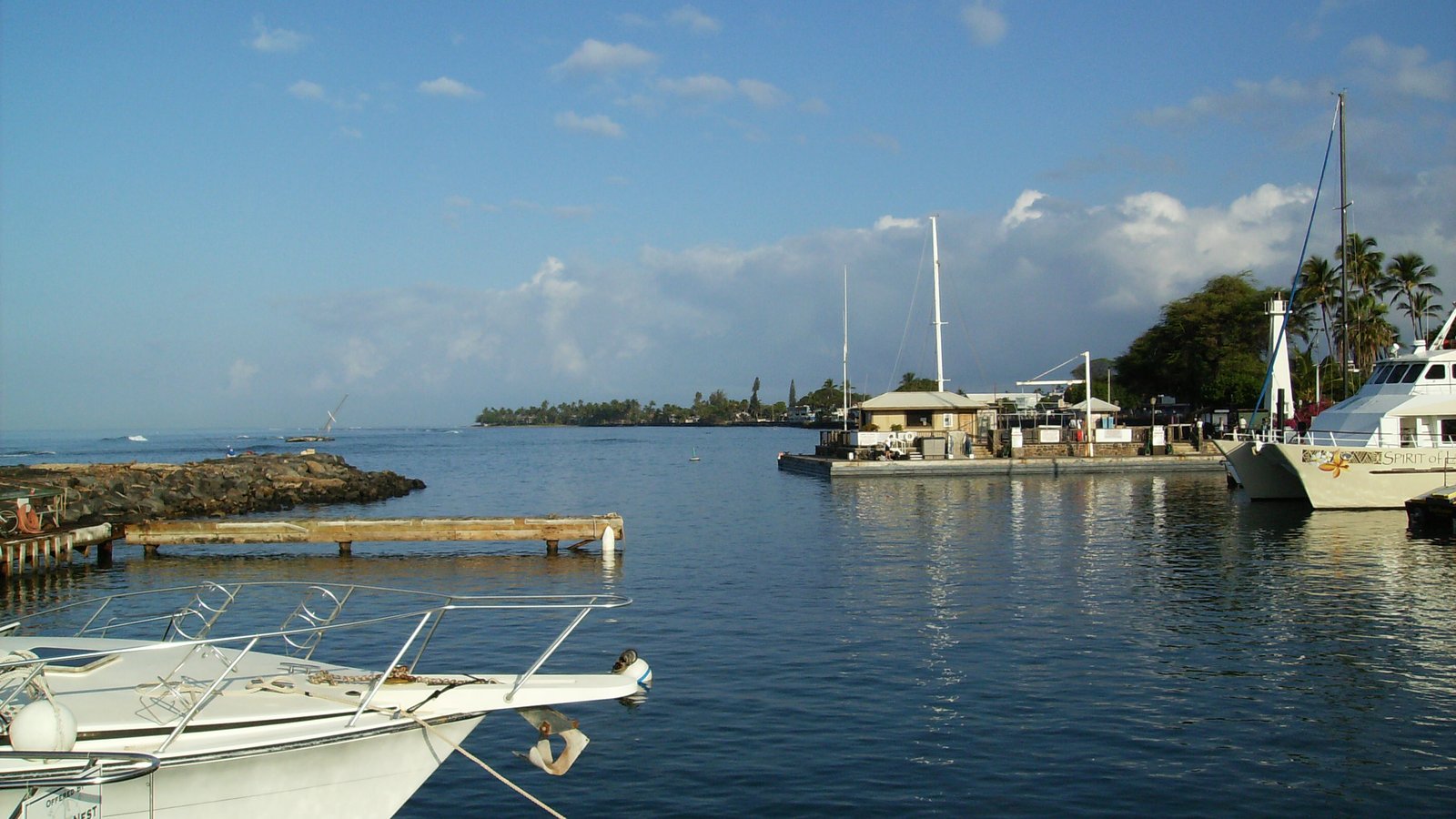
Begin with the royal shorelineLahaina Harbor, January 2008. Photo: Nukemlee source (opens in a new tab) · public domain status (opens in a new tab) · cropped and resized
Before the roadstead and basin
Lahaina was a chiefly, agricultural, and spiritual center
Long before the modern harbor, freshwater, fishponds, cultivated lands, chiefly residence, and ceremony shaped this shore. The traditional phrase Malu ʻUlu o Lele recalls Lele’s shaded breadfruit grove. Kamehameha I established a royal residence here, and Lahaina served as the capital of the Hawaiian Kingdom from 1820 to 1845.
At Mokuʻula, an island within Loko o Mokuhinia, Kauikeaouli—Kamehameha III—maintained a royal residential and sacred center. The wider Lahaina Royal Complex also includes Luaʻehu, Pākalā, and Loko o Nālehu. Its restoration is being guided by residents, cultural practitioners, people with ancestral kuleana, and public agencies.
That cultural landscape is not interchangeable with the small-boat harbor. Nineteenth-century ships anchored in the open roadstead offshore; the protected basin visitors recognize today was engineered much later.
Royal center · Roadstead · Sugar
Ocean travel transformed a royal shoreline
For generations, Lahaina’s freshwater and productive lands sustained Hawaiian communities, agriculture, ceremony, and chiefly governance. Its offshore roadstead later drew foreign seafarers, merchants, and missionaries, and plantation interests then reshaped land and water. The Native Hawaiian cultural landscape continues through these histories.


Royal center and Pacific roadstead
The National Park Service records Lahaina as a royal residence and the capital of the Hawaiian Kingdom from 1820 to 1845. The historic district extends into the ocean because the maritime story unfolded offshore as well as on land.
The first American whaling ships arrived in 1819. By 1824, about 100 ships a year visited; at the 1850s peak, more than 400 whaling ships a year made port. Those vessels anchored in the Lahaina roadstead, while smaller boats carried people and goods between ship and shore. Hawaiian mariners also joined the Pacific whaling fleet, linking Lahaina with ports far beyond Maui.
When the capital moved to Honolulu in 1845 and whaling declined in the 1860s, sugar reshaped West Maui. Pioneer Mill began in 1861, plantation camps expanded, and water was redirected toward cane. The waterfront served a growing plantation town and, later, a visitor economy—but the open anchorage and shore landings still came before the engineered basin.
-
Before foreign ships
A chiefly and cultivated landscape
Freshwater, fishponds, breadfruit cultivation, ceremony, and chiefly residence shape the landscape remembered in the phrase Malu ʻUlu o Lele.
-
1819
American whaling ships arrive
American whaling ships begin using the offshore roadstead, changing the town’s economy and social life.
-
1820–1845
Capital of the Hawaiian Kingdom
Lahaina serves as a center of royal government while maritime traffic grows offshore.
-
1850s
The whaling roadstead peaks
More than 400 ships a year visit at the height of Lahaina’s whaling-era traffic.
-
1861 onward
Sugar becomes the dominant industry
Pioneer Mill and plantation development reshape land, labor, water, housing, and the waterfront economy.
World War II · Postwar boating · Tourism · Recovery
The modern harbor grew—and then had to be rebuilt
Before the protected basin, Lahaina Roads had a wartime role offshore. Postwar boating and tourism then produced a small-boat harbor crowded with local vessels, charters, ferry passengers, and cruise tenders. The 2023 fire changed that working waterfront in a single day, and recovery remains unfinished.
Lahaina Roads in World War II
The modern small-boat basin did not yet exist, but the offshore anchorage remained strategically important. Before the Pearl Harbor attack on December 7, 1941, a Japanese reconnaissance floatplane checked Lahaina Roads and found no major fleet anchored there; Lahaina itself was not attacked. In early 1944, U.S. Navy transports staged at Lahaina Roads for Operation Flintlock in the Marshall Islands.
From small-boat basin to visitor gateway
After World War II, recreational boating expanded across Hawaiʻi. In the postwar 1950s, a breakwater was constructed so a protected small-boat harbor could be developed. A much larger replacement harbor was authorized in 1965 and studied through 1971, but the existing harbor remained in use and the replacement was never built. State records identify 1966 as the last main-basin dredging before the 2026 project.
Tourism then transformed West Maui. Lahaina’s 2020 census population reached 12,702, up from 11,704 in 2010, while the harbor carried local fishers, recreational craft, commercial tours, ferry passengers, and cruise-ship tenders. In 2021, the State began an $18.4 million ferry-pier and harbor-office improvement project.
On August 8, 2023, a wind-driven fire killed 102 people and devastated much of Lahaina. Many historic buildings burned, including all three main buildings on Waiola Church’s sacred land; the congregation continues to gather and rebuild. The harbor lost vessels and infrastructure. A 2024 ACHP/NPS review found that Mokuʻula and Loko o Mokuhinia, the historic Waineʻe (Waiola) Cemetery, Pōhakuohauola (Hauola Stone), and many Native Hawaiian archaeological and subsurface resources were not significantly affected and continue to convey cultural significance.
Limited commercial harbor operations resumed on December 15, 2025. Maintenance dredging began June 1, 2026, with completion estimated for December. State schedules place additional pier, wharf, office, and ferry work into 2027 and 2028, subject to funding and permits. That is a rebuilding timeline—not a promise that the entire harbor is open.
-
1941–1944
The offshore anchorage enters the war
A Japanese scout plane checks Lahaina Roads on December 7, 1941; later, U.S. Navy transports stage there for the Marshall Islands campaign.
-
1950s
A breakwater begins the small-boat era
Postwar harbor work creates a protected basin for fishing and recreational boating.
-
1965–1971
A larger replacement is studied
A federally authorized 380-craft harbor north of the existing basin is proposed but never constructed.
-
1966
The main basin is dredged
State records identify this as the last main-basin dredging before the 2026 project.
-
2021
A new ferry-pier project begins
The State starts a major pier, gangway, pavement, bollard, and harbor-office improvement program.
-
August 8, 2023
Fire devastates Lahaina
The fire kills 102 people and destroys or damages homes, businesses, historic buildings, vessels, and harbor infrastructure.
-
2025–2028
Limited reopening and phased rebuilding
Commercial activity resumes in late 2025; dredging and reconstruction continue on estimates that remain subject to change.
What the waterfront can teach
Four layers to understand—not a sightseeing checklist
Some places are visible from public areas; others are sacred, closed, damaged, or under restoration. Context matters more than collecting photographs.
- The ocean beyond the breakwaterThat open roadstead—not the small basin—held the nineteenth-century whaling fleet.
- Pōhakuohauola (Hauola Stone)This culturally significant sacred birthing stone remains a living sacred place. Follow all barriers; never touch or sit on it, and do not cross barriers to get closer.
- Work boats, dredges, and barriersThey are evidence of an active recovery, not an inconvenience to work around.
- The Lahaina Royal ComplexMokuʻula and Loko o Mokuhinia remain a sacred cultural landscape whose restoration is community-led and multiyear.
Related Maui history & tours
Follow the connections
Continue with the places and experiences that share this chapter’s roads, water, communities, or working landscapes.
Continue learning
Keep Maui’s shoreline stories connected
Compare Lahaina’s roadstead and recovering basin with the postwar harbor at Māʻalaea, or return to the History hub for every published chapter.
Research notes
Sources & current guidance
This account distinguishes the offshore roadstead from the modern basin, centers Native Hawaiian and royal history before whaling, and dates every recovery statement to an official August 2026 snapshot.
- National Park Service: Lahaina Historic District (opens in a new tab)
- National Park Service: Lahaina National Historic Landmark documentation (PDF) (opens in a new tab)
- National Park Service: Native Hawaiian mariners in the whaling fleet (opens in a new tab)
- U.S. Naval History Division: Lahaina Roads reconnaissance on December 7, 1941 (opens in a new tab)
- U.S. Navy: Beans, Bullets, and Black Oil—Operation Flintlock staging at Lahaina Roads (opens in a new tab)
- County of Maui: Lahaina Long-Term Recovery Plan (PDF) (opens in a new tab)
- County of Maui: Lahaina Royal Complex community planning (opens in a new tab)
- ACHP and National Park Service: 2024 Lahaina Section 213 Report (PDF) (opens in a new tab)
- Hawaiʻi DLNR: History of Recreational Boating in Hawaiʻi (opens in a new tab)
- State of Hawaiʻi: 2008 Lahaina Small Boat Harbor ferry-pier DEIS (PDF) (opens in a new tab)
- U.S. Army Corps: Proposed Lahaina Harbor enlargement study (PDF) (opens in a new tab)
- State of Hawaiʻi: 1990 Lahaina Boat Harbor facilities assessment (PDF) (opens in a new tab)
- Hawaiʻi DLNR: 2021 ferry-pier improvements (opens in a new tab)
- Hawaiʻi DLNR: Pōhakuohauola protection and cultural context (opens in a new tab)
- State of Hawaiʻi Department of Human Services: Maui wildfire loss and recovery report (opens in a new tab)
- Waiola Church: congregation rebuilding after the fire (opens in a new tab)
- Hawaiʻi DLNR: December 2025 limited harbor reopening (opens in a new tab)
- Hawaiʻi DLNR: 2026 harbor dredging (opens in a new tab)
- Hawaiʻi DLNR: August 2026 Lahaina Harbor rebuild schedule (PDF) (opens in a new tab)
- Hawaiʻi DLNR: Lahaina boating and harbor recovery updates (opens in a new tab)
- County of Maui: July 17, 2026 notice for August 1 Front Street and recovery-zone access (opens in a new tab)
- GoHawaii: current respectful-visitor guidance for Lahaina (opens in a new tab)
- Hawaiʻi Board on Geographic Names: official Maui place-name register (PDF) (opens in a new tab)
- U.S. Census Bureau: Lahaina CDP population, 2010 and 2020 (opens in a new tab)