
Maui History Series · East Maui Waterfalls
Road to Hana Waterfalls: A History and Visitor Guide
Follow the major named waterfalls from Twin Falls in the Hoʻolawa watershed and Puohokamoa to Wailua and Waimoku, with the history, access limits, and water systems that shaped what travelers see today.
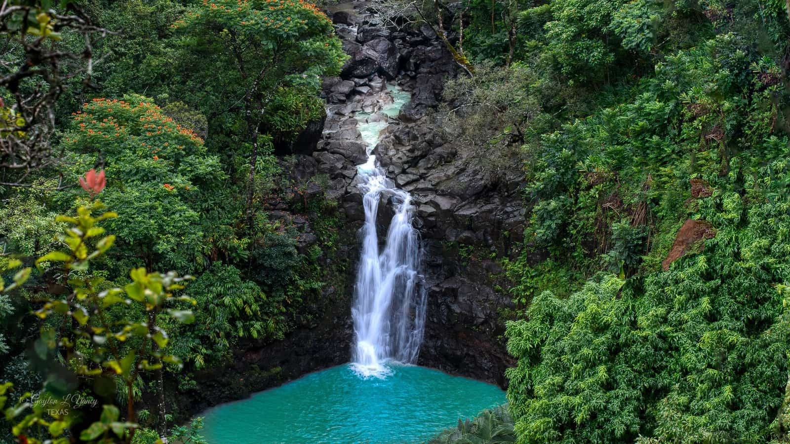
Explore the waterfalls in driving orderPhoto: G. Lamar source (opens in a new tab) · CC BY 2.0 license (opens in a new tab) · cropped, resized and converted
A route, not a fixed checklist
The falls change with rain, season, access, and place
The phrase Road to Hana waterfalls does not describe a fixed number of attractions. East Maui has named falls, locally used names, seasonal ribbons, hidden upper drops, and countless unnamed cascades that appear after rain. This guide follows the major named or commonly referenced waterfall areas a responsible traveler can understand from the highway, a managed property, or an authorized park trail.
The route begins in the Hoʻolawa watershed near Twin Falls, crosses a succession of windward streams before Hāna, and continues into Kīpahulu for Wailua, Makahiku, and Waimoku Falls. Some places are managed stops, some are passenger views, and some require a hike. A waterfall visible from a bridge is not automatically public, parkable, swimmable, or safe.
Route at a glance
Road to Hana waterfalls in driving order
Select a waterfall to jump to its history and current access context. These categories describe the usual visitor experience, but signs, closures, weather, and land-manager directions always control.
Rain, lava, people, and road
Why East Maui has so many waterfalls—and why their history matters
Each cascade is a moment in a larger stream system connecting Haleakalā’s wet windward slope with farms, communities, native habitat, historic bridges, and the sea.
Windward Haleakalā turns moving air into moving water
Moist trade winds rise over East Maui, cool, and release rain across a steep volcanic landscape. Water reaches stream channels as storm runoff, shallow subsurface flow, and groundwater discharge. Resistant lava layers, softer material, narrow valleys, and abrupt changes in elevation turn that flow into chutes, pools, and waterfalls.
The result is dynamic rather than permanent. A stream can shrink to a thread during a dry spell and rise dangerously after rain falling far upslope. Diversions can also alter how much water remains in a channel. One photograph—or even clear sky at the coast—cannot predict the next hour’s conditions.
Wai connected an inhabited landscape long before tourism
Hawaiʻi DLNR describes fresh water, or wai, and streams as sacred resources connecting an ahupuaʻa from mountain to sea. East Maui streams supported native aquatic life and supplied ʻauwai that carried water to loʻi kalo and other community uses. Waterfalls were therefore not isolated scenery; they belonged to watersheds that sustained people, food systems, and downstream ecosystems.
At Keʻanae and Wailuanui, cultural records describe extensive wet-taro landscapes. They also preserve oral traditions about carrying soil to create loʻi on the Keʻanae peninsula. Those histories help explain why respecting local land, working fields, water infrastructure, and posted boundaries matters as much as finding a view.
Bridges made the waterfall sequence visible to motorists
The Hāna Belt Road followed earlier routes and took modern form progressively during the early twentieth century. Its unusually concentrated group of concrete bridges carries travelers across the gulches and streams that cut East Maui. The road’s historic alignment and engineering were listed on the National Register of Historic Places in 2001.
That engineering created famous windshield views, not parking at every bridge. Many approaches are narrow, and HDOT applies enhanced penalties in signed no-parking areas including Waikamoi, Twin Falls, Waikani, Puaʻa Kaʻa, and Hanawī. A passenger view may be the only responsible way to experience a fall.
Plantation-era ditches changed stream flow across East Maui
Beginning in 1876, plantation companies constructed a regional network of intakes, open ditches, tunnels, pipes, flumes, and siphons to move windward water toward sugar lands. Principal components of the East Maui Irrigation system were completed by 1923. The system crossed many watersheds along the modern Road to Hāna and changed where water flowed.
Those plantation works are not the same as Hawaiian ʻauwai. Their scale, purpose, governance, and cross-watershed reach were different. Modern stream-flow decisions seek to balance ecological, cultural, community, agricultural, and municipal needs stream by stream. A roadside fall can therefore reflect rainfall, geology, groundwater, and a complicated human water history at the same time.
Pāʻia toward Keʻanae
The first Road to Hana waterfalls: Hoʻolawa, Waikamoi, Puohokamoa, and Haipuaʻena
The western half of the highway introduces the route’s essential distinction: a familiar name does not tell you whether a place is public, private, or safe to stop at today.
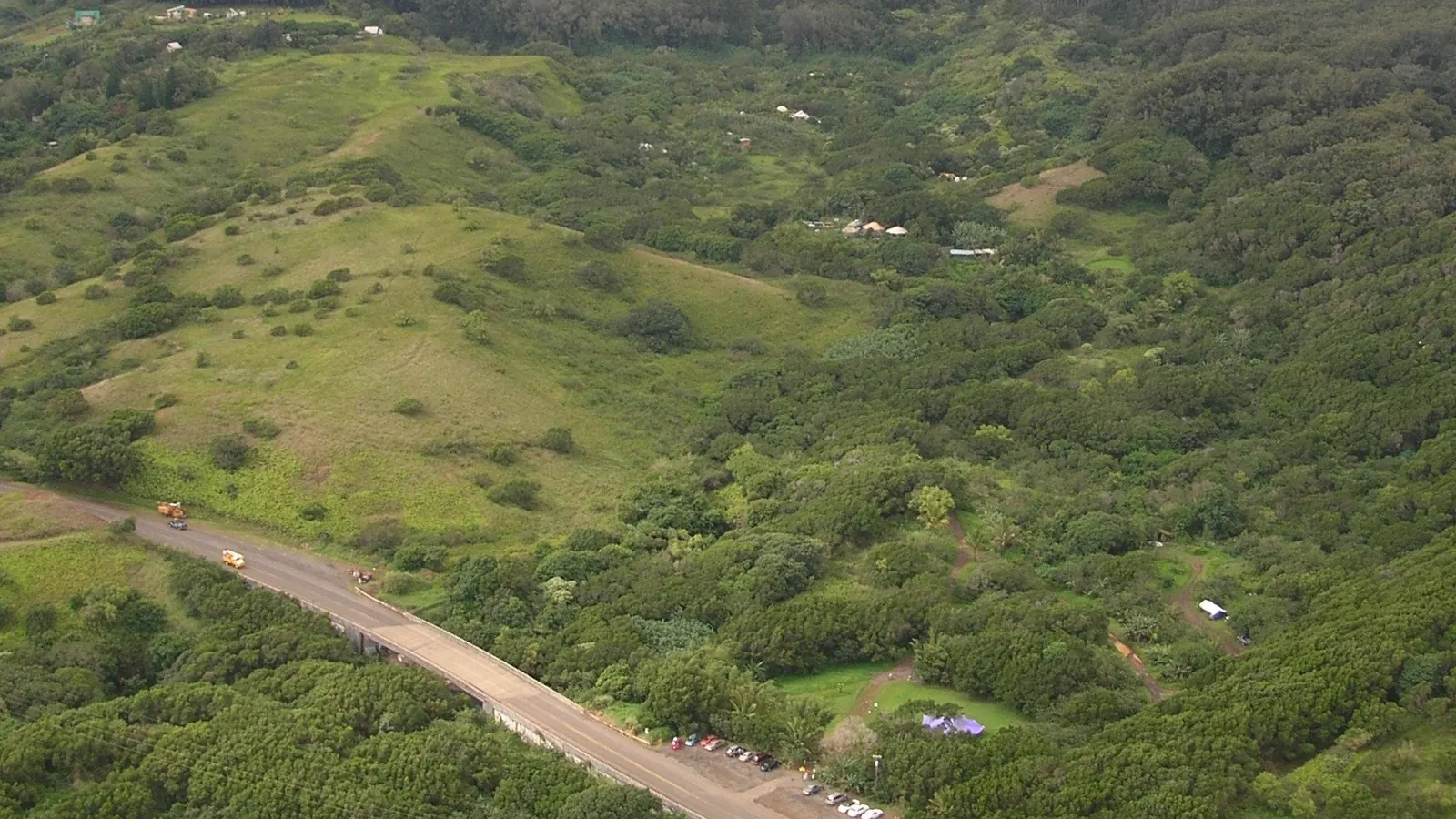

Twin Falls and Hoʻolawa Stream
Access type: privately managed farm entrance. Twin Falls is the familiar visitor name for cascades reached through Wailele Farm in the Hoʻolawa watershed. The operator—not the State or County—sets parking, admission, trail, weather, and capacity rules. Check the farm’s live status before stopping and use only its designated entrance and trails.
The wider history belongs to Hoʻolawa: a windward watershed affected by rainfall, agricultural use, plantation diversion, modern flow standards, and community stewardship. Read the full Twin Falls and Hoʻolawa history for that deeper story.
Waikamoi Stream crossing
Access type: passenger view; no highway parking. Rain can create attractive cascades around the Waikamoi crossing, but “Waikamoi Falls” is often used loosely online for different water features. HDOT specifically identifies the Waikamoi Stream Bridge area for no-parking enforcement. Do not stop on the bridge or shoulder, and do not follow an unofficial path.
Puohokamoa Falls
Access type: private attraction viewpoint. Puohokamoa is a substantial fall, but the dependable managed view is inside the privately operated Garden of Eden Arboretum. Standard garden admission provides a viewpoint only and does not include stream or swimming access. Admission, hours, and any closure are controlled by the operator.
This is a good example of why a paid viewpoint can be the responsible option: the photo is possible without improvising parking or crossing private land near a narrow highway.
Haipuaʻena Stream and falls
Access type: roadway context only unless a current land manager authorizes otherwise. Haipuaʻena is a documented East Maui stream and diversion watershed. Online guides often promote a pool or short path near the highway, but no authoritative managed public access was verified for this guide. Treat it as stream-and-waterfall context seen from legal public space, not an invitation to enter.
Keʻanae toward Hāna
Waterfalls in driving order: Waikani, Wailuaiki, Puaʻa Kaʻa, Hanawī, and Makapipi
This stretch has some of the highway’s most photographed falls—and some of its clearest no-parking limits.


Upper Waikani Falls, often called Three Bears
Access type: passenger view. Upper Waikani is one of the route’s most recognizable multi-stream falls. “Three Bears” is an informal visitor nickname, not the official stream name. HDOT identifies the Waikani Bridge area as a no-parking zone, so a clear view does not create a legal stop.
Wailuaiki and Kopiliʻula stream crossings
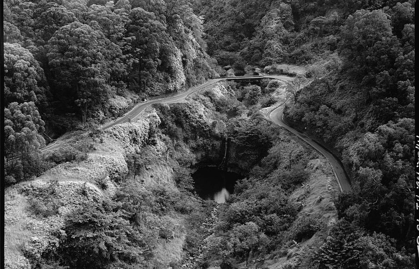
Access type: road and bridge views only where legal. The highway crosses several named streams and historic bridges near Keʻanae and Wailua. Wailuaiki and Kopiliʻula are documented names; generic online labels can shift among pools, roadside drops, and upper cascades. The Historic American Engineering Record photograph above shows how closely road, bridge, pool, and waterfall meet without establishing public entry.
Do not confuse this Wailua landscape near Keʻanae with the famous Wailua Falls beside the highway in Kīpahulu, farther beyond Hāna.
Puaʻa Kaʻa State Wayside
Access type: state-managed daylight wayside. DLNR describes Puaʻa Kaʻa as a five-acre roadside rest and picnic area with small scenic falls and pools. Parking, facilities, water access, and closures depend on current conditions. Use the established area only and check the official park page before relying on it as a stop.
Official records vary between the spaced wayside name “Puaʻa Kaʻa” and the joined geographic form “Puaʻakaʻa.” A literal gloss is sometimes offered, but no reliable inherited waterfall-name story was verified, so this guide does not invent one.
Hanawī Stream and the falls seen near its bridge
Access type: passenger view; no bridge parking. Hanawī Stream is an official name, while “Hanawi Falls” is the common visitor label for cascades seen around the highway crossing. HDOT identifies Hanawī Bridge for no-parking enforcement. Photograph it only from a genuinely legal and safe location, never by blocking traffic or walking onto the bridge.
Makapipi Falls
Access type: unusual above-the-fall passenger view. Makapipi drops immediately below the highway, so travelers may look down toward the water rather than across at a cliff. State water records describe the stream as intermittent, and the fall can be dry or reduced to a trickle. Its visibility depends on recent weather; the bridge is not a place to stop in traffic.
Hāna toward Kīpahulu
Beyond Hāna: Wailua, ʻOheʻo, Makahiku, and Waimoku Falls
Several of the route’s best-known waterfall landscapes are southeast of Hāna town. Reaching them requires additional road time, and the park falls require trail time too.
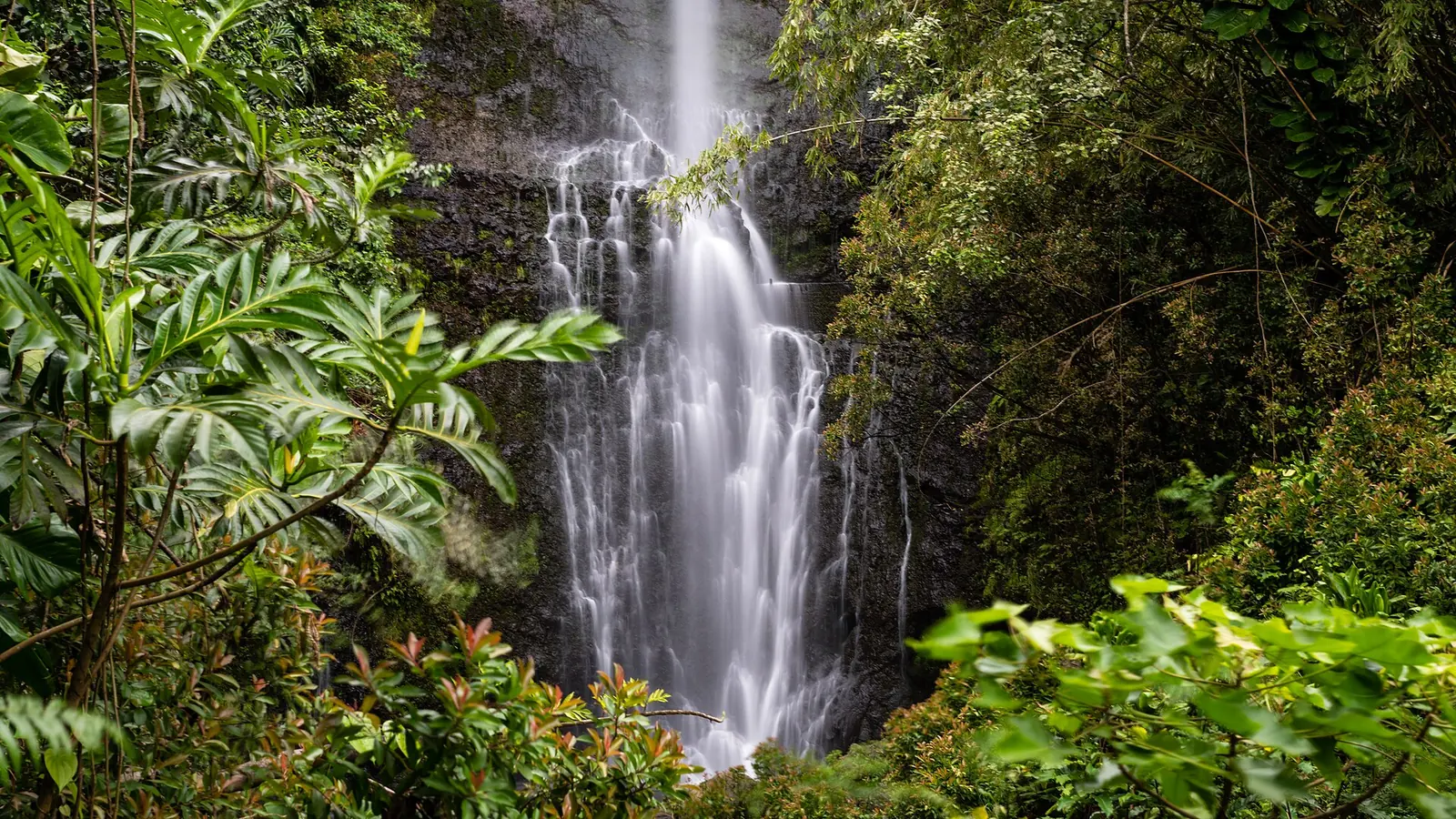

Wailua Falls in Kīpahulu
Access type: roadside view only when a legal space is available. This tall, narrow fall immediately beside the road is the Wailua Falls most visitors mean. Some modern sources call it Honolewa or South Wailua Falls to distinguish it from other Wailua names. The location is a known visitor-pressure area, so current signs, traffic, community impacts, and safe road behavior determine whether any pause is appropriate.
Nearby Alaʻalaula and Paihi stream crossings can reveal seasonal cascades, but a visible ribbon does not guarantee a pullout or public path. This guide does not promote improvised access.
Pools of ʻOheʻo
Access type: National Park Service view. ʻOheʻo Gulch carries a succession of cascades and pools toward the sea in Haleakalā National Park’s Kīpahulu District. “Seven Sacred Pools” is a tourism-era English label without documented traditional provenance; the National Park Service uses Pools of ʻOheʻo.
The pools are currently not accessible for swimming. NPS directs visitors to view them from the Kūloa Point Trail and warns that flash floods and rockfall can occur. Park alerts and ranger instructions control access.
Makahiku Falls overlook
Access type: authorized park trail. NPS places the Makahiku Falls overlook about one-half mile along the Pīpīwai Trail. It offers a meaningful waterfall destination for visitors who do not continue the full route, but trail, weather, daylight, and personal ability still matter.
Waimoku Falls
Access type: authorized park hike. NPS describes Waimoku as a 400-foot waterfall at the end of the two-mile Pīpīwai Trail. The full outing is roughly four miles round trip with about 800 feet of elevation gain, passing a banyan tree, Makahiku overlook, and bamboo forest before reaching the viewing area.
Do not approach the cliff base or cross a closure. Falling rock, sudden water, slippery surfaces, fatigue, heat, and the long drive back all belong in the day’s plan. Our private Waimoku Falls tour explains the route and current trip considerations, while the Haleakalā National Park history places Kīpahulu inside its larger cultural and conservation story.
Access, rain, and respect
A waterfall is never a promise of parking, swimming, or safe entry
The most useful waterfall plan is flexible enough to skip a place when the road, land manager, weather, or water says no.
Rain can arrive upstream before it reaches you
Flash floods can travel through a gulch from rain falling out of sight. Rising or discolored water, debris, thunder, a flood watch, or a closure is a reason to stay out. Never assume a pool is safe because other people are in it, because a photograph shows swimmers, or because the sky overhead looks clear.
The shoulder is part of the highway, not a viewing platform
Historic bridges and tight curves often provide little recovery space. Obey every no-parking sign, keep wheels fully out of the travel lane only in a lawful pullout, and never reverse or walk into traffic for a photograph. If a legal space is full, continue.
Private land and working water infrastructure are not shortcuts
A stream can border farms, homes, cultural places, diversion works, or conservation land. Do not cross gates, move barriers, enter ditches or tunnels, follow social-media paths, or treat a tour booking elsewhere as permission. Use managed entrances and current instructions from the responsible landowner or agency.
A guide helps because conditions—not a checklist—shape the day
A private guide cannot guarantee rain, flow, parking, swimming, or access. The value is local route judgment: matching the day to current conditions, explaining what you are seeing, and choosing alternatives without pressuring a closed or unsafe location. That usually creates a better experience than racing between online pins.
What to notice along the route
Read each waterfall as part of a living watershed
The best views become more meaningful when you notice the relationships around them.
- FlowCompare a thin ribbon with a rain-fed torrent without treating either moment as permanent.
- BridgeNotice how early concrete engineering crosses the gulch while leaving almost no stopping space.
- Land useLook for farms, loʻi, forest, homes, and water infrastructure—not just an isolated cascade.
- BoundaryTreat signs, gates, and closures as information about stewardship, safety, and community life.
Plan with clear expectations
Road to Hana Waterfalls FAQ
These answers separate route planning from real-time access decisions.
How many waterfalls are on the Road to Hana?
There is no accurate fixed total. The route crosses many named streams, but seasonal and unnamed cascades appear or disappear with rainfall. This guide covers the major named or commonly referenced waterfall areas that can be understood responsibly from the highway, managed property, or authorized trail.
Which Road to Hana waterfalls have managed visitor access?
Twin Falls uses a private farm entrance; Puohokamoa has a viewpoint inside the private Garden of Eden; Puaʻa Kaʻa is a state wayside; and ʻOheʻo, Makahiku, and Waimoku are within Haleakalā National Park. Each manager can change access, hours, capacity, fees, or closures.
Can you swim at Road to Hana waterfalls?
Do not assume so. Swimming depends on legal access, a land manager’s rules, water quality, recent and upstream rain, currents, debris, rockfall, and the ability to exit safely. The Pools of ʻOheʻo are currently not accessible for swimming, and a guide or photograph cannot override a closure.
Are Wailua and Waimoku Falls before or after Hana?
Both are beyond Hāna town when traveling the usual clockwise Road to Hāna route. Wailua Falls is roadside in Kīpahulu; Waimoku requires the Pīpīwai Trail in Haleakalā National Park’s Kīpahulu District.
Do Road to Hana waterfalls flow year-round?
Some streams receive base flow between storms, while others are strongly seasonal or intermittent. Rainfall, groundwater, diversions, and dry periods all affect what is visible. Makapipi, for example, can be dry or only a trickle.
Can I park at Waikani, Hanawi, or Waikamoi Falls?
Do not rely on roadside blogs that say yes. HDOT identifies bridge areas including Waikani, Hanawī, and Waikamoi for enhanced no-parking enforcement. Obey current signs and never stop in a travel lane or narrow shoulder.
Is a private Road to Hana tour helpful for seeing waterfalls?
A private guide can adjust for weather, traffic, trip timing, managed access, and your group’s interests while explaining the landscape. No ethical operator can guarantee waterfall flow, a swim, a parking space, or entry when a place is closed.
Related Maui history & tours
Follow the connections
Continue with the places and experiences that share this chapter’s roads, water, communities, or working landscapes.
Continue the Maui History Series
Follow the waterfalls into community and park history
Explore one managed watershed at Twin Falls, the living loʻi landscape of Keʻanae, and Kīpahulu within Haleakalā National Park.
Research notes
Sources & further reading
This guide favors agency records, official land-manager information, historic documentation, and clearly labeled first-party access rules. It avoids unsupported waterfall heights, invented name translations, and unofficial entry directions. Access notes were reviewed September 2, 2026; check every linked manager again before travel.
- Hawaiʻi DLNR: cultural importance of streams, wai, ʻauwai, and loʻi (opens in a new tab)
- Library of Congress HAER: Hāna Belt Road history and engineering (PDF) (opens in a new tab)
- Hawaiʻi DOT: enhanced no-parking enforcement on Hāna Highway (opens in a new tab)
- Twin Falls Maui / Wailele Farm: current private access information (first-party) (opens in a new tab)
- Garden of Eden Arboretum: current Puohokamoa viewpoint and access FAQ (first-party) (opens in a new tab)
- Hawaiʻi DLNR: Puaʻa Kaʻa State Wayside and current notices (opens in a new tab)
- Commission on Water Resource Management: East Maui stream and Makapipi hydrology (PDF) (opens in a new tab)
- National Park Service: Kīpahulu District, ʻOheʻo, Pīpīwai, and Waimoku (opens in a new tab)
- National Park Service: Pīpīwai Trail distance, elevation, and Makahiku overlook (opens in a new tab)
- National Park Service: current Haleakalā conditions and closures (opens in a new tab)
- National Park Service: Pools of ʻOheʻo access and flash-flood safety (opens in a new tab)
- Hawaiʻi Board on Geographic Names: ʻOheʻo and “Seven Sacred Pools” case record (PDF) (opens in a new tab)
- Hawaiʻi Department of Agriculture: East Maui irrigation-system history (PDF) (opens in a new tab)
- Hawaiʻi Tourism Authority: East Maui visitor-impact management, including Honolewa (PDF) (opens in a new tab)
- County of Maui: Hāna Bridges Historic Preservation Plan and South Wailua / Honolewa naming (PDF) (opens in a new tab)